Transcript:
John Gilroy: Welcome to Constellations, the podcast from Kratos. My name is John Gilroy, and I’ll be your moderator.
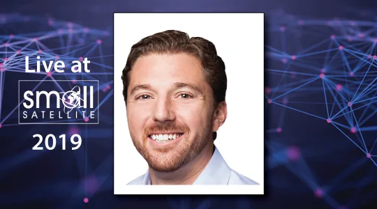
John Gilroy: Our guest today is Nick Merski. He’s Vice President, Space Operations, at Spaceflight Industries. We’re broadcasting from the floor of Small Sat Conference. We’ve got all kinds of people walking by us.
John Gilroy: Today’s podcast is about leveraging small satellite constellation capabilities to fuse data with high-resolution imagery. We will talk about satellite imaging as a service, and a new rating scale, the temporal imagery interpretability rating scale, that will help others define and classify data and imagery being collected in new space.
John Gilroy: To discuss this, we’ve invited Nick Merski, who is the vice president of Space Operations at Spaceflight Industries where he oversees BlackSky Global, a subsidiary of Spaceflight, which aims to have a complete small satellite constellation orbit here in 2019.
John Gilroy: Well, Nick, we’re going to jump right in here. You know, this is a small satellite conference. There are a lot of new small satellite constellations out there. What is unique about BlackSky’s imaging constellation?
Nick Merski: Yeah, John. So, I guess the first thing that I’d say is where there’s been huge expansion in the space industry and the amount of space-based data sources that are out there, I think there’s still a real set of needs and gaps in coverage and capabilities.
Nick Merski: For example, have you ever seen an image of the Super Bowl? No, because there are still fundamental limitations of when and where you can get access to space data. We’re really trying to address that need with an interactive geospatial monitoring service that can provide users unique insights about a business need on a real timely basis.
John Gilroy: When you say interactive, you have to worry about latency, and communications, and availability. So it’s a lot more complex than just tossing a word like that out, isn’t it?
Nick Merski: That’s right.
John Gilroy: So, let’s say we have a commercial customer and he signs up for high resolution imaging services. So, how quickly can they see the Super Bowl, or the football game, or what they’re looking at?
Nick Merski: I think the key point in there is really the service grade experience. Our goal is to really have predictable delivery timelines that are measured in minutes, not like it is currently in terms of hours, and even days, which still frankly occurs worldwide.
Nick Merski: So, where we want to be in the next year is consistent, inner hour service across all world markets. So, 20, 30 minutes from collection to delivery.
John Gilroy: So, give me a typical customer. Would it be a federal customer? Government customer? Military? Would it be commercial? Give me a ‘for instance’.
Nick Merski: Yeah. I think all the ones that you mentioned above, people that are really data- driven people. You know, risk managers, people that are looking to speculate or track assets in a number of remote locations. All of those people need timely access to information and the ability to understand what’s going on around them, as well as use the domain of space to see from above.
John Gilroy: Would agriculture be an application? Something like that?
Nick Merski: Sure. Agriculture could be and it’s certainly one of the traditional markets. You know, our system is really focused on monitoring locations and we’ve really focused on the temporal resolution of that. So, we will have some agricultural applications, but we’ve also really focused on seeing one place on the globe many, many times. So, there are different value propositions there.
John Gilroy: So, you don’t have to name any specific companies. So, what is the latency today? What’s the typical latency that most people encounter today?
Nick Merski: So, your typical latency today, and what’s innovative in the market, is less than 12 hours.
John Gilroy: 12 hours? Well a lot can change can’t it?
Nick Merski: So, there’s a lot to disrupt there still.
John Gilroy: For your images, the BlackSky images, is either the latency of the resolution limited by technology, or by regulations? So, where’s your bottleneck?
Nick Merski: First off, the regulations really don’t limit us either in the technology that we’re trying to deliver or how fast we can deliver it. We have handling and storage requirements that are dictated by our license, but we don’t have any hold back times that we need to adhere to. There are some regulations in terms of the resolution that we can provide data at, but our value proposition is well below that threshold, and our offerings are at around one meter image resolution.
John Gilroy: So, can you leverage cloud computing? It’s a buzzword a lot of people are using, a lot of power there. Can you leverage it for your infrastructure like image processing, analytics, ground systems?
Nick Merski: In fact we’ve been a cloud-first company since we got started, and that’s really helped us. Our cloud, our user platform is in the cloud, our command and control systems, and our image processing pipeline, and in various parts of the cloud with various different types of security and information assurance controls.
Nick Merski: So, we can really take advantage of the accessibility of the cloud, and then also the ability to really secure it into kind of a closed network environment if you need to.
John Gilroy: So, Spaceflight’s been in business since around 2000, and BlackSky’s just more recent than that. Maybe 2017, 2018?
Nick Merski: So, we’ve really started with our financing in 2014. So, we’ve been around about five years.
John Gilroy: You can claim that you started off in the cloud too because that’s when it got popular isn’t it?
Nick Merski: That’s right.
John Gilroy: Yeah. So are you taking advantage of any new commercial ground providers to get some growth in new business?
Nick Merski: Yeah, we’re really excited about the growth that’s occurred in the ground provider part of the market. Our ground architecture allows us to leverage different ground station architectures. So, the emergence of those providers gives us both optionality and different ways to procure services, which is exciting for us, and really kind of helps us in our goal to increase that level of service and product quality for our consumers.
Nick Merski: An example of that would be how we leverage different antenna assets and being able to spin them up on demand with some of the emerging service models. It really presents nice opportunities and scalability of some of the business models.
John Gilroy: You know, when you said that ‘spin up demand’, I remember eight years ago I’d ask a system administrator to spin up a hard drive for me, it could take three days. It was like we would have to give him a pizza or something and maybe it would take two days.
John Gilroy: So, you’ve got some innovation in imaging, you’ve got some innovation in handling your ground station. So, where does the data go that you collect?
Nick Merski: Yeah, so as I mentioned we’re a cloud-first company, so our image archive is located in the cloud. So, as we collect it from space, we route it to the image processing portion of our system, it really does all the image processing, quality assurance, archival and data, and then that’s connected to our user platform, which sends notifications to our customers that the data’s ready to either be delivered, or if there’s a more systematic delivery mechanism that we have, like let’s say to an EC2 instance or something like that, it will just happen.
John Gilroy: Yeah. And the people who talk EC2 are the Amazon Web Services people of course. And they would say ‘compute’. They wouldn’t say ‘process’, they say ‘compute’. It’s kind of a different vocabulary than it was years ago. It’s just changing so quickly. It’s hard to go.
John Gilroy: You know Nick, thousands of people from all over the world are listening to this podcast. We’ve had people walk up to us from all kinds of different countries and get pictures and try to subscribe, and if you are listening to this and you would like to get email alerts when the new episodes are available, go to Google and type in Constellations Podcast, it’ll come right up on the Kratos podcast. Give us your email and off you go. We’ll let you know when other great guests like Nick come on board and we’ll talk about all kinds of exciting things.
John Gilroy: If you take a look at the satellite business, maybe since 2014 when you started, it seems like a lot of organizations are offering data from a third party platform for a fee. And I guess this is your strike zone, isn’t it?
Nick Merski: You know, when we think about our product at BlackSky, our product isn’t our satellites. Our product is the unique insights that our satellites and satellite infrastructure provide, combined with a lot of structured information about the world going on around us. So, the platform is really the hub where that all kind of occurs and comes together in product form.
John Gilroy: You know, I taught English for a year so now we get to delve in the world of acronyms and abbreviations and hard things to say. So we’re going to talk about NIIRS and TIIRS here. So if you’re listening, be very, very careful about this. One is N-I-I-R-S and one is T-I-I-R-S. So, NIIRS and TIIRS.
John Gilroy: So, back in the 1970’s way before you were born I’ll bet, in the 70’s image interpretability rating scale was developed. It was called NIIRS. N-I-I-R-S. And it defined different levels of image quality and interpretability based on types of tasks an analyst could perform with images. The higher the rating, the higher the quality imagery. I think 0 to 9, or 0 to 10.
John Gilroy: The NIIRS scale has become well known and widely used tool to characterize the interpretability of satellite images and it has provided imagery analysts and consumers of satellite imagery a simple, easy to use, and powerful tool to describe and share satellite imagery.
John Gilroy: So, you’re going to turn that upside down here, aren’t you? You’re going to come up with something called TIIRS, T-I-I-R-S. This is the temporal imagery interpretability rating scale. So, can you explain this?
Nick Merski: Yeah. Maybe I’d start by talking quickly about why is NIIRS widely useful. When I think about it simply, it provides tactile examples of what types of applications can be performed with a given image of a given resolution. And so if you think about that and then you extend it to temporally, the time and the persistence components of the data really add a new dimension of that in how the data could be evaluated, or applied, or used contextually.
Nick Merski: So, I kind of think about the TIIRS scale and I say it could be used a couple different ways. The first one would be defining what are the rates that you need to sample a given scene or area to draw meaningful conclusions about a thing. Or, another way that you could really use a scale like this is used in conjunction with NIIRS to understand how those NIIRS levels might change if you had a different sampling rate. Because the time component does give you a different aspect of information that can change interpretability.
John Gilroy: And speaking of time, if the NIIRS was developed in 1973, I mean mobile phones, you needed a pickup truck to carry a mobile phone in the 1970’s, so technology has changed drastically. It would make sense in other aspects that the technology would keep up as well doesn’t it?
Nick Merski: Yeah, absolutely.
John Gilroy: When it comes to standards, I think of standards emanating from the NIST building up North of Washington D.C. You know, all those PhD’s in physics, talking about standards, and I also think about nonprofit organizations, maybe associations coming up with standards. And so, your company, you’re just going to boldly go forth and say, “Hey, this is the new standard.” Are you working with other organizations? Maybe public/private organizations?
Nick Merski: I think that we’re just really not trying to be the proponent or the owner of a standard. What we’re really trying to do is think about different ways that people can consume and talk about a really different type of data with different attributes and have a kind of common language to communicate.
John Gilroy: I think there is an observation service called a Global Risk Dashboard, and it’s tailored for some very specific interests. Tell us more about these specific interests.
Nick Merski: I mentioned that our user platform is the hub that brings everything together, and really the Global Risk Dashboard is one way of viewing our user platform. And really what we have is a very capable user platform that really can take unstructured information about a place in the world, and a geography, and events going on at a time and contextualize that and geo locate that. And connecting that with a very capable, taskable satellite network allows people who are interested in understanding the world around them, and the data that’s flowing around them through a connected world of devices, and then immediately connecting that with the view from space allows people to do a different type of risk management and have a different view of assets that they track. And really that’s what that product’s all about.
John Gilroy: You know, I was thinking that there’s some case studies now with healthcare organizations relying on social media to project out different infection rates in different types of diseases and where they originate, which you could only do it on a chalkboard a few years back, but now you can almost visualize it and say, “Well look, this is exactly where it’s trending.” And they have some accuracy with these predictions, don’t they?
Nick Merski: Absolutely.
John Gilroy: So news, social media. How else does your platform include anything else besides those?
Nick Merski: So, another one is just the world of connected devices. So I’d offer one, thinking about weather and natural disasters, we have a very extensive set of connected networks throughout the world that help us sense and understand when something is going to happen. And so that, when you overlay systems like that with news and social media, with geospatial resources, you can really get a full spectrum picture of what’s going on at a place very rapidly.
John Gilroy: There are people who are worrying about space debris, we know that. There are also people worrying about plastic entering the oceans. And I’m thinking about sensors in the ocean. So, your imaging service could provide environmentalist information about Earth because of the advantage you have in space. It’s kind of like one’s following the other.
Nick Merski: Working back and forth and queuing from those types of resources is exactly the type of architecture that we’ve built.
John Gilroy: Well, in the last few years we’ve had waves with cloud computing, we’ve had waves with IOT, and cybersecurity challenges, and all kinds of things going on here. So, from your perspective, if you try to look out the next five or 10 years, what kind of challenges do you see in the satellite industry?
Nick Merski: I think there are still big challenges in terms of normalizing transportation, getting there, being there sustainably, and really maintaining the services that we’re trying to provide and to leverage space really effectively, and in an enduring fashion. But I think there’s also a ton of opportunities. I look at emerging companies with different ideas of how to leverage either the viewpoint from space, or the access that space can provide, and I’m pretty sure that we’re going to solve this, and that we’re going to be continuing to exploit space pretty rapidly over the next 10 years in a number of different ways than we are right now.
John Gilroy: Well, all the youngsters are talking about going to Mars. Maybe your kids will wind up on Mars. I don’t know. My kids are getting too old for that. So, what about projecting way out beyond 10 years? I mean, is there going to be so much debris in space your kids may not get to go to Mars because of that?
Nick Merski: No, I think that we’ll have learned how to kind of manage and live in that environment just like we have in very densely populated cities throughout the world. I think we will. I think interplanetary exploration is certainly going to be there, and really what we consider space in the domain is really going to grow over that time.
John Gilroy: When it comes to public/private partnerships I think of, you know, I’m in the Washington D.C. area, I’ve interviewed many generals, and a lot of military types, and if you bring up the concept of ride sharing and an innovative use of technology, they kind of pull back a little. I think what companies like yours are doing is you’re so innovative you’re showing them new ways to accomplish things more effectively and it’s pushing that barrier, and pushing, and pushing with new public/private partnerships.
Nick Merski: I think innovation in the business model is as important as innovation in the technology itself. And I think we’ve had the real opportunity to work both sides of that over the last several years and had some success with that already.
John Gilroy: Well, Nick, unfortunately we are running out of time. I’d like to thank our guest, Nick Merski, Vice President, Space Operations, Spaceflight Industries.