Transcript:
John Gilroy: Welcome to Constellations, a podcast from Kratos. My name is John Gilroy, and I’ll be your moderator. Our guest today is Chris Tucker, Principal, Yale House Ventures. Today on the Constellations podcast, we will discuss how the advancements in earth observation satellites have impacted the geospatial industry.
John Gilroy: Also, we will explore how micro satellites have changed the industry. We’ll learn about very high resolution satellites, changes in R&D, and keep listening, remote sensor technology, and perhaps at the end, gain insight into the geospatial intelligence segment of the community here.
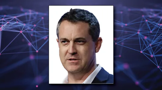
John Gilroy: Our guest today is Chris Tucker. He’s the principal at a company called Yale House Ventures, where he manages a portfolio of technology startups and social ventures. Chris is a businessman and social entrepreneur active in the geospatial industry and the U.S. National Security Community. And he’s also, here’s an added bonus, just published a book.
Chris Tucker: I have.
John Gilroy: Let’s hear the name of the book.
Chris Tucker: Oh, the book’s entitled A Planet of Three Billion.
John Gilroy: Wow.
Chris Tucker: And my extremely long subtitle is Mapping Humanity’s Long History of Ecological Destruction. Turns out we’re really good at that.
John Gilroy: Well, let’s get to this later on in the interview, but I think our listeners, in this community, really interested in satellites and that 20, 30 years’ experience they have in this whole community. It’s great. The goals of earth observation satellite missions are having maximum number of images with high quality and maximum orbital performance, such as maximum coverage. How do you think the explosion of micro satellites has impacted these goals?
Chris Tucker: Well, that’s a great question. It really depends on which satellite’s, putting together which constellation for which purpose. You take a company like Planet Labs, and their strategy, at least for their going in position into the market, was to image the entire earth once a day.
Chris Tucker: So they had to do all that complicated math with all the orbital mechanics on particular orbits, with the characteristics of the sensors, with what their field of view might be, to come up with that kind of min-max analysis of how do we image the entire earth once a day but minimize the size of the satellite itself in order to reduce the weight of the payload?
Chris Tucker: Because the actual weight of the payload drives the cost of launch. So if you want to have the most coverage of the earth with the lowest cost and the lowest capitalization, you have to do a bunch of that math. So Planet, I think, has done a really fantastic job of changing the game, saying we can image the entire earth once a day.
Chris Tucker: But inside that, you have to look at what each of the, let’s say, 175 satellites doing to kind of parse out that workload, to achieve that global coverage. But every constellation’s kind of going after a different business strategy to service a different piece of the mission and a different piece of these industry segments that are out there.
Chris Tucker: So I think we’d have to go through each one of these small sat companies, all of which are doing fascinating approaches to this problem in unique ways.
John Gilroy: Well, Chris, you do have a PhD from Columbia University, so I thought use a fancy phrase like temporal cadence. This is what the smart guys say, isn’t it? Temporal cadence, once a day.
Chris Tucker: I think that’s big, right? We often talk about the spatial resolution, but what is the temporal resolution? What is the cadence? What is the revisit rate? So, for a long time, it was amazing that you could even take an image from space, right? When you’re trying to get the highest resolution image you could get over the broadest possible area for the infrequent moment when you could actually take a look at something.
Chris Tucker: But once we were able to kind of image more and more of the earth with that high resolution, I think the new entrants in the market said, “Well, why aren’t we doing it once a day? Why aren’t we able to image a target once an hour?” And that requires fundamentally different kinds of constellations. So yes, spatial resolution, temporal resolution, radiometric resolution.
Chris Tucker: There’s all these different resolutions that you can’t fit everything into the same box for the same price at the same size. Right? So everybody’s got to take their engineering know-how, all their business acumen, and try to put together something that goes after a mission value or business value in a unique way.
John Gilroy: Chris, earth observation companies that are launching micro satellite constellations have piqued the interest of venture capitalists. Do you think the segment is getting too crowded, or do you think there are still opportunities that these companies can take advantage of?
Chris Tucker: Well, that’s a great question. Too crowded. I think if everybody tried to do exactly the same thing, yeah, it would definitely be too crowded. But I think a bunch of, I’d say, a new generation of folks came out, say, “Hey, small sat, I know how to do this. I’ve got a unique view on the world and I can provide unique value.”
Chris Tucker: And they went out with their perspectives, tried to raise money. In the meantime, somebody else raised money, and maybe got stuff on orbit. So you’ve seen people pivot their strategies a couple of times, which I think is fine. Perfectly natural kind of business behavior.
Chris Tucker: And so, people are out there with a thesis, and they may pivot their thesis a couple of times, but I’ll say people I don’t know, and I know a lot of people, got a pretty good Rolodex in this space, people I don’t know are coming out of left field with really novel approaches to business problems I was kind of unfamiliar with, and they have at least plausible business plans that show how they’re going to be able to mine the gold in that industry. Right?
Chris Tucker: And deliver a return to their shareholders. So, every once in a while, I do look at it and say, “Why did you think that’s a good idea after the last three companies did that?” But then I see other entrants coming in doing something fundamentally new that I wasn’t anticipating coming into the market.
John Gilroy: You just mentioned the term radiometric, kind of a satellite, space kind of term. There’s also a company called VHR, but not what normal people think. VHR is very high resolution satellites. So how has this technology changed over the years? And, for example, when you first started the industry?
Chris Tucker: Well, if we talk about the spy satellite industry, the value you provide is getting high resolution, very high resolution. And we don’t talk about how high resolution it is, and what they’re look angles are, because that’s classified.
Chris Tucker: But we do know, right, that we know what the ultimate highest possible resolution is. And we’ve watched industry kind of march further up to that limit, and ask NOAA, the regulatory body for commercial remote sensing licenses, asking them for licenses to say, “Can I image at this resolution?”
Chris Tucker: And we’ve seen relaxation of those imaging rules. So I think that industry still has a ways to go, right, to have infinitely high resolution approved by the government. But then the question is, how much resolution is too much resolution? There’s still a lot of the airborne market, right?
Chris Tucker: We strap sensors on airplanes, and we fly them around the world. Why? To get higher resolution than is legally allowable for unclassified commercial imagery. And there’s still a market there. So I think it’s one of those conversations we always have at the bar after the conference, going, well, hey, if we relax all of the regulatory rules on resolution, would that wipe out the airborne market?
Chris Tucker: And I think, truth, I do a lot of airborne work also over the years, man, there’s a thing called weather, and sometimes, you need to fly under the weather to get your imaging, and space has to look through it. But there’s all these phenomenologies out there, sorry to throw out a big GRE word there for you, but like synthetic aperture radar, right? Which, radar can see through clouds. Radar can see through trees.
Chris Tucker: And you have companies like Capella Space, MDA has radar, all these radar companies that offer really unique things that can see through all of these, whether it’s weather or canopy. And I think you’re seeing shifts in the market based upon the introduction of new phenomenologies coming in at higher resolutions than anybody’s ever seen the technology deliver at before. So yeah, I think there’s still a lot of room for innovation and disruption in the market.
John Gilroy: Chris, back in August, we were out in Utah, and recorded a whole bunch of podcasts from the floor of the small sat show. All kinds of innovation, research and development just oozing from the floor of that show there. So, with the increased affordability and accessibility of satellites nowadays, that’s must have drastically changed R&D for geospatial too, isn’t it?
Chris Tucker: Yeah. Right. So, the commoditization of the componentry, and things like 3D printing, have made it so that lots of kids, smart kids, can come in and say, “Hey, I’ve got an idea.” Maybe a bad idea, right, but that’s kind of the evolutionary process of innovation, where they come in with something new, try it out at a really low cost, because it doesn’t weigh much.
Chris Tucker: The launch isn’t that expensive. And NASA and even DOD and other agencies around the world have been subsidizing that innovation. I want to see what these kids can do. So yeah, you’re seeing this explosion. I think it’s great. It’s really healthy. It might be leading to a whole bunch of space junk that we have to figure out how to clean up later, but whatever. But it doesn’t require a billion dollar R&D strategy, a billion dollar R&D budget anymore in order to break new ground in space.
John Gilroy: When it comes to remote sensors, what are some of the most interesting advancements, and can you give us maybe some use cases?
Chris Tucker: Well, synthetic aperture radar, it’s been around a long time. It’s one of those things that, actually, I think, interestingly, used to be classified, that we had it and we declassified that, ultimately. And you saw a growth in the American SAR market. But when it was classified here and we didn’t allow it into space under a U.S. license, you actually saw other countries doing it commercially.
Chris Tucker: So I think SAR’s been around, but you’re starting to see new approaches to a SAR constellation with much smaller satellites with much higher resolution like what Capella is planning on doing, etc. So that’s fascinating and interesting. So that’s innovation. I’d say High Spec Q, they’re not on orbit yet, but they’re actually going after the hyper spectral market, so for everybody, right, you’ve got the spectrum, and everybody chops off what they want to do.
Chris Tucker: Electro, optical, or near IR, et cetera. So the hyper spectral are going into all the visible, all the non-visible, and chopping it up into these tiny little slices so they can do material characterization on the ground and know all these interesting things.
Chris Tucker: And again, I hate to say it, hyper spectral’s been in the textbooks probably since the 70s, and NASA had Hyperion on orbit, God, 15 years ago, doing amazing things, but they were big, and the resolutions were a bit more coarse grain. So there’s a lot of innovation in saying, “Hey, I’m going to launch a constellation of smaller, lower cost satellites that’s going to get better revisit and higher resolution.”
Chris Tucker: And we’ve also learned over the past, let’s say, 20 years of using hyper spectral and probably longer in airborne, we’ve built databases for materials characterization. If you see this part of the spectrum, what is it? Right? And now that we have those databases, I think that knowledge is probably going to help unleash a lot of commercial value and mission value with these new sets of constellations.
John Gilroy: Chris, thousands of people from all over the world have listened to this podcast. If you’re listening and would like to get alerts when new episodes are available, go to Google and type in Constellations Podcast. Click on Kratos and sign up.
John Gilroy: Let’s talk a little about your book, and tell us why you wrote it. You have this great background, and what’s this book all about, and what does it mean for our listeners?
Chris Tucker: Well, people talk about climate, the carbon footprint that we all have, how do we reduce it? But there’s the larger human footprint that we actually have. And interestingly, we really started learning more and more about the human footprint when remote sensing came out and the satellites gave us that God’s eye view from space where we could actually understand how the human footprint is changing year after year so rapidly.
Chris Tucker: So I guess, partially my own academic background and my life, but in this industry, it forces you to ask the big questions about, there’s so much change on the planet. At what point are we undermining our planet’s ability to support us? How many people can the earth support, which is actually the title to an old book from the mid 1990s, from a gentleman named Professor Joel Cohen.
Chris Tucker: And honestly, he asked the question, but didn’t give an answer. And my book is what I think is the answer. Interestingly, I’ll say, just today, the IPCC, the climate change, intergovernmental panel on climate change, just released another report where they actually finally called out the link between population and climate.
Chris Tucker: Maybe they read my book, I don’t know. If they haven’t, they should. But I think that is the adult conversation that we all need to be having. And remote sensing data plays an enormous role in helping us navigate an uncertain future.
John Gilroy: Speaking of adult conversations, you began your career with a three-letter organization in town here. And so I got to ask these questions. Don’t want to get you in any trouble or anything, but how have advancements in satellite technology impacted the geospatial intelligence segment?
Chris Tucker: Well, I’d say unfortunately not enough yet. There’s a lot of attention being paid. I’m on the board of the U.S. Geospatial Intelligence Foundation. I’m very proud of the work that we’ve done in establishing a small sat working group. We have, it’s member driven, and it’s enormous.
Chris Tucker: If you get on that USGIF small sat working group email list, it’s the who’s who in the industry, from all the different companies, all the different agencies, nonprofits, universities, and it’s everybody coming together, asking these big questions about where are things going, networking. There’s a lot of supply chain engagement on, how do I build my next thing?
Chris Tucker: But I will say, as the commercial remote sensing acquisition in the DOD has shifted from NGA to NRO, there have been some, that’s the National Reconnaissance Office, there have been some recent awards. You can Google them on the public web, and Planet and High Spec Q and Black Sky. These companies are being funded to do some advance studies, maybe get some things on orbit, etc.
Chris Tucker: So I think that’s good. Where, in the intelligence community, unfortunately, I think we’ve often placed more value on a satellite’s imagery if the imagery is TS SCI classified, right? The higher the classification, the more or better it is. And to some extent, that might be true. But also, when you have this explosion in coverage around our planet in new and unique phenomenologies, at great temporal resolutions and spatial resolutions, radiometrics spectral resolutions, why not use them?
Chris Tucker: And I think DOD takes a little while to get the gears rolling, but once the gears really start moving, I think you’re going to see a real uptake in the geospatial community over the next 10 years.
John Gilroy: You know what, with Planet’s advances and this open source distribution of geo- intelligence, it’s got to cause people at the CIA to wonder “So, what is classified, what isn’t? And who has access, who doesn’t?” It gets to be a very difficult area to draw a line between, doesn’t it?
Chris Tucker: Well, I think there’s several philosophies on that, right? Yeah. I’d say there’s an old guard that wanted to maintain their asymmetric advantage, and the commercials, in a way, were giving away advantage to the adversary. I think we’ve gotten over that mindset, and we understand that this is a revolution in commercial industry globally.
Chris Tucker: It’s not something any one nation can actually put back into Pandora’s box. And it’s something that you need to engage industry on, and engage them early, and figure out how to use it to advance your country’s national security agenda. So, yeah, there’s always issues of how is it classified, how is it distributed, how is it disseminated?
Chris Tucker: But I’d say the high speed kids in the class and the intelligence community know exactly what to do with the classified and exactly what to do with the unclassified. There might be some folks that are a little behind the education curve, and I would encourage them to move up the education curve, and maybe engage the community a little bit better, because a lot of these things are known.
Chris Tucker: And so I think I would not want anybody to advance that false choice of does it need to be classified or unclassified, because a robust national remote sensing strategy will allow you to leverage all of them.
John Gilroy: Well, I’m going to ask the obvious question. I introduced you as a principle for Yale House Ventures. He went to Columbia. Well, what’s going on here? Why not Columbia House Ventures?
Chris Tucker: I’m not telling you. Look, so, Yale House Ventures, I had commercial success after setting up the CIA’s Venture-Capital fund. I had my own company with some partners, and we did well. Since then, I’ve done a lot of early stage tech investment, and that includes space and geospatial and sensors and social media and energy, and a lot of wide range of things that I just enjoy doing.
Chris Tucker: So what is Yale House Ventures is what I feel like investing in, and the companies that I feel like giving a boost. And I just love working mostly with my friends who are doing fascinating things. I like to consider myself a unicorn collector, so I may not be good at anything myself, but I have a lot of friends that are really good at very specific things.
John Gilroy: So hashtag GON, hashtag earth observation, are there certain areas that you focus in on?
Chris Tucker: Yeah, sure. GON is something that I will always be engaged in. I’ve been on the board of the U.S. Geospatial Intelligence Foundation for 15 years, adviser to NGA, et cetera. I think once you do that in your life, you caught the bug. So I’ll be doing it for a very long time.
Chris Tucker: So I love talking to young, innovative companies that are doing fascinating things anywhere in the GON space. And I think the important thing to understand about GON is it is a space that is continuously redefining itself and remote sensing, space remote sensing isn’t the only thing that defines it.
John Gilroy: I touched on Planet and an open source earlier. Tell us about this open geospatial consortium, and what exactly does it do, and what’s your role with them?
Chris Tucker: Right. So it’s another place I’ve been on the board of for a very long time, actually. It was kind of a government sponsor in my role with CIA, with In-Q-Tel, a long time ago. It is the international standards body for geospatial technology stuff. The word stuff is probably the operative part.
Chris Tucker: It covers everything from how do you manage satellite imagery, airborne imagery? How do you manage internet of things, data, geospatial data coming out of the internet of things? How do you provide with interoperability and contacts of your battle space or smart cities, or conservation? A wide range of applications.
Chris Tucker: But it turns out the one, what I always like to say, right, is the one truth is that all things on the planet earth, by definition, happen in space and time. So that means information about them properly managed is geospatial. It is spatiotemporal. And if you’re going to exchange data between all these systems, you have to have interoperability, and that’s what the open geospatial consortium is there to provide.
John Gilroy: Findable, accessible, interoperable, and reusable, huh?
Chris Tucker: Absolutely.
John Gilroy: There’s the motto.
Chris Tucker: Yeah.
John Gilroy: Well, Chris, I’d like to continue this conversation, but we’re running out of time here. I’d like to thank our guest, Chris Tucker, principal of Yale House Ventures.