Transcript:
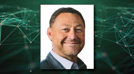
John Gilroy: Welcome to Constellations, the podcast from Kratos. My name is John Gilroy, and I will be your moderator. Our guest today is Michael Martinez, Vice President of Space Engineering for Maxar. Today, we’re going to talk about the changes taking place with ground systems, especially the technology that now leverages virtualization and cloud enablement. Maxar has the world’s most sophisticated commercial satellite imaging constellations. When Maxar’s newest satellites called, WorldView Legion, are in orbit, the company will be able to capture images of one location up to 15 times a day. This is creating a huge amount of data, a huge amount of imagery. How do you manage that? It seems with those numbers, you have to have artificial intelligence or something to manage that database. Michael, there must be something like Alexa or something, maybe like, “Max, show me Colorado.” Or something like that?
Michael Martinez: Yes, it is a lot of data. We capture today about 3.2 million to 3.5 million square kilometers a day. And with Legion, that’s going to increase three to four times. And automation, AI and machine learning are a big part of our ground systems and processing. The other differentiator here is that the imagery is very high resolution, 30 centimeter information that gives you a lot of detail and the accuracies are super important for providing mapping data. So artificial intelligence, machine learning are really key for the data extraction pieces.
John Gilroy: Yes, we talked to someone in the agriculture industry about that. And 30 centimeters! That is really important for agriculture. It’s important for so many aspects of imagery, isn’t it?
Michael Martinez: It is. It allows the end user to really define and map what they’re looking for, or even just data extraction. It may not be a mapping solution, but it’s really analytics that they want the answer, not necessarily images.
John Gilroy: Michael, I went to your LinkedIn profile and I saw quite a lot of experience there. It looks like you’ve been involved in the satellite business since about the mid 1980s. And I know you’ve seen a lot of changes since that time. So from your perspective, what do you think has been the biggest game changer in earth observation?
Michael Martinez: Yeah, I would say it’s commercialized space. In the mid ’90s, early ’90s, when this industry was formed, and has really grown, it was a game changer in terms of enabling lower costs, faster schedulings, from getting from a build out of a satellite to getting it into orbit. And with that, it’s enabled a whole set of new information that the world can use.
John Gilroy: There are startups all over Colorado. There are startups here in Washington, DC that are involved in commercial space. And even going back 10 years, this would’ve been a stretch of the imagination to imagine small startup companies even considering getting involved in commercial space, there were always way bigger companies back then. I mean, that really is a change for the last 10, 15 years, isn’t it?
Michael Martinez: It is. And there used to be a very large barrier of entry, which was the cost, to get into space. That barrier of entry has dropped significantly, allowing startups, even universities to get into space with their observation experiments.
John Gilroy: I’ve been out to Utah and talked to students out there. Smaller components, lower cost of launch, it’s all impacting them as well. And in my world, the world of software development, it seems to be software defined, everything is having a tremendous impact on the business, isn’t it?
Michael Martinez: It is. That’s another barrier that’s lowering costs that is helping enable this industry to grow.
John Gilroy: Can you tell us how the ability to virtualize satellite communication process and functions have affected the industry?
Michael Martinez: Well, virtualizing allows you to scan instances for communication and gives you diversity and business continuity that spans around the globe. It’s the ability to stand up a ground station or the infrastructure almost instantly, where in the past it was years to enable a ground system.
John Gilroy: Yeah, if I took a look at your first statement, you talked about quadrupling the number of square kilometers that you cover. I mean, right now in a virtual environment that allows that type of a scale, but think about 10, 15 years ago, you’d be out buying servers, you’d be up all night long plugging them into the server room and worrying about hard drive size. It changes the game, doesn’t it?
Michael Martinez: Yes, quite significantly. We had announced moving into the cloud and basically moving off of the on-prem data centers because of the cost involved in storage and compute. And now with cloud, we’re able to expand, scale up and scale to what you need, not necessarily build out a system for the one-off large compute cases.
John Gilroy: Yeah. I keep thinking of organizations like FEMA that may only have necessary requirements certain times of the year maybe, hurricane season or something, and they don’t need that capacity year round, but maybe two or three months a year. And so companies like Maxar can respond to that need by having flexible systems for storage. Is that right?
Michael Martinez: Yes. It’s allowed us to be able to scale compute, such that we can grow when we need to, and then scale back down and save money.
John Gilroy: And from the Washington DC perspective, from a compliance perspective, if the base system complies it can scale up and down and it overcomes a lot of concerns that they had in the past about scaling and unexpected situations. So Michael, tell us, how has the ability to utilize advanced cloud processing technologies taken a bigger role in satellite communications?
Michael Martinez: Well, the cloud compute has done a lot for us. It’s enabled advanced computing and enabled the ability for extracting insight. A lot of our customers in the past were interested in imagery because they were looking at doing analytics of the imagery themselves. Today with the advanced compute, we’re able to do extraction and provide insight and the answers to the customers, without them having to wait through all the imagery and perform the analytics themselves.
John Gilroy: And I would imagine there’s a time component here where their situations, like with FEMA again, if a storm is approaching, if you can respond quickly, it’s not a matter of waiting three or four days for something to be analyzed?
Michael Martinez: Yeah, in the FEMA example we’ll have imagery from pre-storm to post-storm and that really helps the emergency crews and teams to get in and understand where bridges may be out, where they can set up ahead of time when they know, for instance, if a hurricane’s coming through, where the high ground is, and then plan ahead of time to move in their headquarters and their operations to places where they know that they can actually operate and not be damaged.
John Gilroy: And this sounds like ivory tower, academic type thing, but it’s going on right now in fires in California, isn’t it? This is going on right now.
Michael Martinez: That is correct. On our WorldView free satellite, we have an instrument that is shortwave infrared, allowing us to see through the smoke and actually see the fire lines in the hotspots. That helps enable fire crews to know where the fire is at the time, and hopefully get in front of it.
John Gilroy: I had the pleasure of interviewing one of the founders of Pixar. And it used to be that movie makers would record images and put them on hard drives and FedEx them to a place that had a powerful enough computer to do it. Think about how that’s changed over the years. It gives you so much more flexibility to provide important information for your customers.
John Gilroy: Michael, thousands of people from all over the world have listened to this podcast. If you’re listening now, you can go to Google and type in Constellations Podcast to get to our show notes page. Here you get transcripts for all 82 interviews. Also, you can sign up for free email notifications for future podcasts, like this one here with Michael Martinez.
John Gilroy: There are people who are listening to this that may be familiar with the lingo in the industry and some people that don’t. I’m going to use a specialized phrase here and maybe you can explain it to our listeners. It’s called TT&C. I think that impacts the business satellites today. And so why is TT&C important? Maybe you can define it for our listeners.
Michael Martinez: TT&C is an acronym that stands for telemetry, tracking and control. It’s essentially the communication between the ground systems and the satellites themselves, so the ability to task the satellites, to maneuver them for collision avoidance with debris and keep the space environment safe.
John Gilroy: Maxar has been working on a virtual TT&C ground string for your newest satellites, the WorldView Legion, which can be deployed in any virtual environment or cloud. As you transition from more traditional ground systems to cloud enabled, service oriented architecture, do you see this moving your capabilities forward?
Michael Martinez: Well, absolutely. It is a system that we’ve developed and it has been online now. We’re flying our satellites through it. It allows us, as I indicated earlier, the ability to stand up ground infrastructure and then bring it back down, so you can stand it up and then turn it off, allowing us to be scalable across not just a small constellation, but a large constellation without costs involved. Large costs, I should say.
John Gilroy: So, does this capability to manage TT&C or a wideband payload in a cloud environment, does that enable Maxar to do things differently?
Michael Martinez: It does. It allows us to move data around to our end users and our customers faster. It allows us to, and enables us, to do analytics a lot faster and get the answers out to our customers. In our current environment, our current world data, latency is not tolerated for long durations. So reducing that latency and moving faster to answers is really where we’re going.
John Gilroy: We talked about groups of satellites initially. So what you mean is your system can support multiple satellites and that gives you a distinct advantage, doesn’t it?
Michael Martinez: It does. It allows us to do operations around multiple satellites without growing your teams or your ground infrastructure, to a point where it’s not tolerable with costs.
John Gilroy: Well, years ago, I first heard of software-defined networks and I thought it would be limited just to the network itself. There’s software defined everything now. Today there’s software-defined radios. So how are the capabilities offered by software-defined radios helping you and your customers?
Michael Martinez: You know, it goes back to that same aspect around standing up ground infrastructure and then bringing it back down, so you can bring it up and then take it offline. There’s a security aspect to that. And then also the ability that allows us to scale for capacity when needed. So if there’s a certain region of the world that there’s a lot of interest in suddenly, you can scale up the capacity with ground infrastructure for that time period, and then scale it back down as needed.
John Gilroy: The phrase is, “Unexpected consequences, unexpected events.” Because no one can really plan when you’re going to need imagery from different parts of the world. So this really gives you an ability to interact quickly and scale things up, scale things down and respond better to the needs of your customers, doesn’t it?
Michael Martinez: Yes, it does.
John Gilroy: Crystal ball time here. So how do you see the role of space and earth observation in our national defense changing in the next few years?
Michael Martinez: I see that earth observation is a critical component to our U.S. government, it’s critical to our allies, and it’s really about getting information quickly that’s very accurate with high resolution. And in that, allowing them to make decisions faster.
John Gilroy: And artificial intelligence probably streamlines that too because you can isolate and see the most important aspects of that imaging before you make that decision. So we know that’s true for the national defense group. So what do you think in general about the satellite industry in the next decade? So put on your thinking hat here and say what kind of challenges do you think are going to be faced by the industry in the next decade?
Michael Martinez: Yeah, I think that the hardest challenges are the reduction of latency and moving faster, getting the answers as quickly as possible. We’re in a world where information is at our fingertips, smart information is at our fingertips, and earth observation is no different from that. So key points are around enabling our end users and our customers to have that data and their answers to the information and answers to questions that they have as quickly as possible.
John Gilroy: Yeah. And they can make a decision. It’ll save time and save money for everyone, won’t it?
Michael Martinez: Correct.
John Gilroy: Michael. I really appreciate you helping our audience gain a better understanding of virtualization and cloud enablement.
John Gilroy: I’d like to thank our guest Michael Martinez, Vice President of Space Engineering for Maxar. Thank you, Michael.