Transcript:
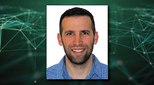
John Gilroy: Welcome to Constellations, the podcast from Kratos, my name is John Gilroy and I’ll be your moderator. Our guest today is Jeff Guido, Director of Special Projects at Planet. In today’s interview, we’re going to talk about satellite constellations, Norway and push brooms. Jeff, I didn’t know you’re an expert on push brooms, is that right?
Jeff Guido: Yes. Thanks for having me on John but yeah, the push brooms that we’re talking about are a little bit different type. The ones that capture light instead of dust, but it all works the same way and that’s why it’s a good discussion to start with.
John Gilroy: Well, give us a little thumbnail sketch briefly about Planet, what it does and some of the activities that you folks do.
Jeff Guido: Of course. At Planet, we’re a company that was founded in 2010 by three NASA scientists in a garage in Silicon Valley. You’ve heard these stories a couple of times, some big companies have come out of those sorts of humble beginnings. But Planet designs, builds and operates the largest Earth imaging constellation, largest Earth imaging fleet of satellites that’s ever been in existence. Our mission is to image the entire Earth every day and make that global change visible, accessible, and actionable. And in our nine year history, we’ve successfully deployed over 400 satellites, we’ve tripled our constellation imaging capacity, we’ve developed vertically integrated and cloud-based imaging platform that delivers satellite imagery most often on the day it was captured, and we serve hundreds of customers all over the world. We have two complimentary mission lines, we have our medium resolution, which most people know of as our Doves and our high resolution line also referred to as our SkySats. These satellites plus our recently retired RapidEye fleet gives us a deep data set that dates back all the way to 2009. And in our stories of the company, November of 2017 stands out in particular to me because it’s when we really achieved our founding mission or what we also call Mission 1. Which is to image the Earth’s entire land mass every day and that’s no small feat, that’s 150 million square kilometers at three meter resolution every single day. And in addition to creating such a unique data set of near daily satellite imagery, Planet is revolutionizing the way that our users process, analyze and access that data. We’re making that data available, nearly instantly via web API to just deliver our imagery over the internet. And we serve customers all over the world and industries such as agriculture, energy, defense, we serve domestic and international governments. We do mapping and we also provide insights to finance and business intelligence markets. Finally, in addition to our large government and enterprise contracts, Planet is working with various NGOs on specific humanitarian projects and have provided open data in support of disaster relief efforts all over the world.
John Gilroy: I know it’s a good story, the garage in Cupertino but these were like three ex- NASA scientists. These aren’t like three guys that randomly come out of the 7- Eleven, these guys have a pretty good startup here. I want to talk about one of them, his name is Robbie Schingler, he is your chief strategy officer now and he took the stage at your latest user conference to discuss three major trends impacting the remote sensing in geospatial industries. Number one, that digital transformation, the business of the environment sustainability and finally truth and transparency. Now Jeff, can you talk about the digital transformation piece of all of this and what’s happening in that area that would impact remote sensing?
Jeff Guido: Certainly. So digital transformation, it’s a pretty sweeping term that it’s touching all aspects of our modern lives in some way. I think this is probably a topic that you can do an entire thesis or it could be its own field of study all by itself. And what Robbie was talking about was how the digital transformation is enabling the evolution of organizations by equipping them with tools to extract insights much more rapidly than they have been able to do in the past. To me, in the context of remote sensing this means that an organization doesn’t have to stand up their own space program to get access to information. If they want to optimize their business operations, they can go and get that data through the internet from us. We deliver that data and insights like I already said rapidly and frequently over the internet. So that everyone from the smallest farmer to the largest governments can have access to that same data and then help them manage their scarce resources in the most effective way possible. I think you can make the argument that many governments will still elect to stand up their own space programs and they should, there are many good reasons to do so. But we are demonstrating that you can get most to all of the benefits of certain types of data without all the upfront cost and effort required to build your own space program. So this is how we see digital transformation at Planet and it’s really making an impact and allowing users to get to their insights quickly and effectively.
John Gilroy: I know you work with companies and governments all over the world. Can you discuss the agreement with Norway’s Ministry of Climate and Environment? I think this is a partnership where countries from all over the world are coming together for the first time to protect the world’s tropical forests and provide sustainable pathways to economic development.
Jeff Guido: Yeah. John, I’m glad you asked this question because this is something that I think extends and really delivers on some of the core missions of Planet. This digital transformation piece that we just talked about, because what it is, it’s where we are showing that you can go get the benefit of this data without needing to establish your own infrastructure, space program satellites and so on. But what the program itself is, we’re really honored at Planet to partner with Airbus to bring the access to a high resolution data set of the tropics to the world. And this is a public private partnership or a coalition of three geospatial organizations that I just mentioned deliver monthly Basemaps. So there are 64 tropical nations… And the purpose is to protect the world’s tropical forest and provide sustainable pathways for economic development. We’ve been seeing a lot of, or noticing or we can measure it with our imagery, that there’s this way that the rainforests are being cut down, that isn’t sustainable and releases a lot of forest carbon. And through delivering these monthly high-resolution Basemaps, it’s possible for just about anyone to access this imagery and provide a better way to manage these resources. Users can access this data through Norway’s technology partners, such as Global Forest Watch and to bring it back to Planet here, this is core to our founding mission. This was one of the major used cases that led to the founding of the company of why we believe the three or four meter resolution product is a winning one. Because what we’re able to do is we’re able to see almost down to the tree level, the changes that are happening on a daily basis. And so on multiple levels, from a cultural standpoint and a founding mission standpoint, this is an opportunity that we’re very excited and it provides a lot of fulfillment and evidence for the mission of Planet and the value that Planet brings to the world.
John Gilroy: Yeah, it aligns very carefully with your mission statement that I saw on your website earlier today, lots of things going on at Planet. I think you folks have also announced a new partnership with the Jane Goodall Institute to apply earth observation data, to understand disease trends at a community and ecosystem level. So what kind of technology is needed to make this work?
Jeff Guido: Yeah, this is a fascinating one, so when we talk about our partnership with Jane Goodall, what we’re talking about is the application of a framework, the one health framework that allows us to bring together satellite imagery with best practices in mitigating the risks of emerging zoonotic illnesses. I believe this has special relevance especially in this time that we’re in right now, because COVID- 19 is technically from my understanding, a zoonotic illness. And this is all coming about through humanity’s intrusive destruction of natural habitat around the globe and just our needs to better understand the vectors from an epidemiological point of view, through which new illnesses are, or the way in which humanity is being exposed to new illnesses. So through this partnership, we’re actually able to better understand that so that we can come up with better approaches to create more beneficial health outcomes for societies all over the world.
John Gilroy: Wow. Epidemiology, well your knowledge set is pretty wide ranging here. So let’s see how wide ranging it is, I’m going to come up with a new word for you. The word is Flock, so what is a Flock? And is there some strategy or technical reason to deploy a certain number of satellites in a Flock?
Jeff Guido: Yeah, this is something that we as a tech company from Silicon Valley, we like to have fun with our terms a little bit. And the term Flock is something that is really to us at Planet here, is it’s something that has to do with a certain set of satellites that are launched from a single rocket vehicle or a certain launch vehicle. There’s no specified number, there’s no limit or a minimum amount that you can have. We’ve launched Flocks of one, we’ve launched Flocks all the way up to 88 satellites. And since our satellites are Doves, from a naming standpoint, the word Doves and the word Flocks tend to go together and it’s one way that we do that. Now from a actual operations standpoint, when you are looking at a set of ground tracks, it looks like the satellites as soon as they leave the rocket vehicle, they’re actually clustered in a way that could resemble a flock of birds, flying over different parts of the planet. The way that we manage our Flocks, we tend to spread these out over time to optimize the land mass that we are imaging, so that we’re not imaging the same thing over and over again, in a way that doesn’t deliver the best products. But the way that the Flock works is it’s pretty much just what comes out of the launch vehicle and then we’ll match it accordingly and integrate it into the rest of the constellation that is already existing on orbit.
John Gilroy: So does this Flock improve image quality or improve the latency of image updates?
Jeff Guido: Yeah. So you can think of the Flock as… We almost have dozens of Flocks that are part of our medium rise constellation and they all work in concert. One of the things that we had to learn how to do to operate this number of satellites at Planet was to be able to figure out how do you manage a satellite that where you can’t spend a ton of time on each individual site, you almost have to manage the satellite from a statistical perspective really far out and rely a lot on automation to handle it. And so, even though we talk about the Flocks as an individual and discrete things, after they are launched they actually are managed as part of a whole. We have what we call a distributed constellation, which is a constellation of many satellites that are usually relatively simple in nature compared to some of their much larger, more expensive counterparts. But as a whole, they provide a class of capability that is almost unparalleled or isn’t parallel. And through the way that we schedule, how the image and how they work with each other, they are able to work in such a way that we are getting just the right amount of landmass image every day and are not over imaging or using them in such a way that is not optimized. So even though they started as a Flock, they started individual satellites on the ground and integrated into a Flock on a launch vehicle. Once they’re in orbit and commissioned, they’re part of the greater whole, which we term as PlanetScope to throw another term at you, but basically all of the Doves together is our PlanetScope imaging product.
John Gilroy: Well, that leads me into my next question. A lot of news out of Planet, Rocket Lab successfully just launched nine small sets named SuperDoves, we were talking about Doves earlier. They’re joining the rest of Planet’s Dove constellation, providing what you mentioned earlier, medium resolution Earth imagery. The SuperDoves are equipped with eight spectral bands that provide high image quality and accurate surface reflectance values for advanced algorithm in time series analysis. The SuperDoves, I guess, are supposed to be interoperable with publicly available imagery. So can you describe the new technologies that make SuperDoves different from the previous satellites, the Flocks?
Jeff Guido: Yeah. At Planet we employ something we have termed agile aerospace. And what that is, is it’s a philosophy applied to the development of spacecrafts that we’d like to think that we pioneered. And the way that this works is we put up a system that is minimally viable, something that’s capable, something that can give us some of the imagery that we want. And then we learn rapidly from that and we put something that has a new design or new iteration upon that design up onto orbit quickly after that, to build upon that capability. And from those we’ve been able to see that we’re able to enhance capability along things like image quality, downlink speeds, onboard storage, solar panels, battery capacity, and things like that. That allows us to have developed something that we’re now turning into a SuperDove to deliver and provide a highly capable platform. I think it’s worth mentioning that we’ve gone through 15 iterations of the Dove class spacecraft. The term SuperDove basically signifies when we went from iteration 14 to iteration 15. And this is something that was helpful for us internal to Planet to just distinguish between the two and distinguish between what we’ve done now because it’s almost a complete redesign of the Dove system. And so just to help distinguish internally for our development teams, SuperDove was what we did and also sounds pretty cool so that terminology made it into the public literature as well.
John Gilroy: In the world of software development sure sounds like agile software development. Let’s talk about this agile aerospace, when I think about agile aerospace, I think about agile software development and a lot of times in software development, they talk about interoperability. So does this term interoperability apply with the SuperDove as well?
Jeff Guido: Oh, absolutely. We’ve had this story at Planet where we’ve gone from a single mission platform to Doves and we’ve had to integrate other systems along our way. And so RapidEye being one of them, Skysat being another and so being able to develop the software infrastructure internally has been something that’s been quite a big lift and big achievement of our software teams. So being able to take care of the nuances of each individual design in spacecraft, but then the differences between the SkySat versus the Dove or the RapidEye versus the Dove has been something where interoperability, even though it’s not something I think that we have talked about too much, it’s definitely a core tenant of how we’ve approached things. It’s been interesting when you talk about the minimum viable product before, as you start with a minimum viable product you’re really just thinking of your one use case. So it’s been a growing experience to have our company or at least our software teams go from what was a single use case with Doves to then be able to make that extensible, to encompass what the SkySat and RapidEye could do as well. And you see that all different levels of the technology stack from mission operations and scheduling, mission planning all the way through to the data processing and pipeline later on, and the lessons that we’ve learned from that, we’re going to take it to the future and to our next missions to make our platform even more flexible, interoperable as we continue.
John Gilroy: Well, let’s maybe touch on the SkySat a little bit here. I think you have a constellation called SkySat, you just mentioned it. It’s been an orbit in some way or other since, I don’t know, maybe 2013. Can you discuss what policies, practices or technologies, Planet has implemented that allowed your company to acquire the SkySat constellations?
Jeff Guido: Well, I was actually part of that team during the acquisition from Google to Planet. So when we made that move and so I was incidentally involved in some of the early days with SkySat and Planet. I joined the team when I was at Google, so I didn’t have any of the Skybox experience myself. But what was interesting was, I think off the bat we saw that the way that these systems are operated were very different. I think when you’re talking to a space person or someone that knows a lot about the systems and technologies associated with the space, there’s a lot of the same types of systems that each spacecraft needs to stay alive. But the way that they leverage those systems and operate them through the entire life cycle of the spacecraft can be quite different. There are just lots of unique challenges at Planet when we tried to integrate, because for example, the Dove is something that looks almost totally or completely straight down or is nadir pointing and picks up as much of the Earth as it can. Whereas the SkySat has as a much narrow field of view, it’s a larger spacecraft but has a much narrow field of view and can point up to, I think it’s about 30 degrees alternator to capture its targets. So there were some unique ways in which we had to solve those problems and make it so that we could still have these systems work in concert, but all under the same software umbrella. One thing that’s really interesting about how the Doves and the SkySats can compliment each other is you can have the Doves since it’s a monitoring mission, that’s like the word that in my mind captures the CONOPS most effectively. It’s always looking, it’s not looking at something specific that’s always just on versus the SkySat which is tapping, which you have to point it to a specific target and tell it to take a picture. The way that these two systems can interact, is you can have the Doves monitoring and since there’s so much volume being produced, Doves are monitoring, they’re picking up information and if a change is detected in our processing pipeline on the ground, what you can do is you can then tap the SkySat, you can take a little bit closer look and that is something that’s been really unique. And it’s pretty cool to have that all under one roof and it provides quite a bit of power to our users that they can get closer looks at the things that actually change and the things they actually care about.
John Gilroy: You know Jeff. thousands of people from all over the world have listened to this podcast, go to Google and type in Constellations Podcast to get to our show notes page here, you can get transcripts for all 92 interviews. Also, you can sign up for free email notifications for future podcasts. You know Jeff, you recently made the decision to lower the entire orbit altitude of this constellation fleet by 50 kilometers. Now there must be like 14 operational SkySats out there, this seems like a really complex maneuver. Did any member on your team start dialing suicide hotline during this? This is pretty complicated, isn’t it? So what compelled you? What compelled you to lower SkySat and what kind of effort went into making this happen?
Jeff Guido: Yeah, so there were a lot of things that came together to lead to this decision and being someone like myself that has a background in large monolithic government missions, we would never even consider something like this. You’d be told to leave the room and never come back. But one of the exciting things about being at Planet and working for this company is we are willing to try things that are different and things that we can change almost the whole orbital paradigm of our satellites, so that we can then deliver something that our customers want. As I think you mentioned, the primary result of this was to make the resolution finer to go from 72 centimeters to actually a 50-centimeter resolution imagery. And so that’s a pretty compelling reason, there’s a business incentive for us to go do that. And so knowing this and recognizing this, we knew it had quite a bit of proponent left on the spacecraft. So we weren’t actually limiting their lifetime in any significant way by bringing them down. We thought we would give it a shot and we did this with a little bit more of a technology demonstrator, if you will, to demonstrate that it’d be possible and we could manage this level of workload. Because it’s not easy to do the orbital mechanics for one satellite, imagine 14, like you said, or 21, like we have now. And so what we’re achieving with this is the demonstration of the ability to manage a fleet agilely, calling back to the agile aerospace we were talking about earlier. And then also just doing things that make it so we can meet those customer needs, this was not a light lift bar team, but I think we learned quite a bit from it and were able to do this more in the future because as we demonstrated, when we launched off of SpaceX, we had to raise the orbit. So there’s already low altitude, so when we started at a really low altitude and moved those new satellites up to a new mission orbit, so we could continue to provide this capability. I’m really excited about what this means to the company and how truly in a literal sense, agile our spacecraft will be in the future and how we’ll be able to meet customer needs in the future, but even just continue with these types of CONOPS which is also very exciting.
John Gilroy: You know Jeff, there are people listening to this podcast who’ve been experienced in the satellite industry 10 or 15 years, and I’m sure they’re listening to you going, “Oh my goodness gracious,” Could you have been able to do this type of effort 10 years ago? What’s changed to just allow you to be this agile.
Jeff Guido: Well, I think we have to acknowledge the enormous amount of work and the talent that we have on the teams at Planet. We have some really heavy hitters when it comes to people that have been able to bring the orbital design or orbital mechanics piece into the software infrastructure that we have and make it so that it’s automated. I think what you’re doing is you’re channeling a little bit [inaudible 00:24:05], the way that people used to operate a long time ago and when the processing capability wasn’t as as good. And so you had people doing a lot of this work by hand, very much artisanal process. Now we’ve made it so that a lot of those things that can be repeated everything from scheduling to ops, to even just the manufacturing techniques that we use in our lab, a lot of these things… The things that are repeated get automated. And so what would have been a very difficult thing for a team to do with just one satellite we are able to do with 21, because of the power that we’re able to leverage with our cloud-based processing platform, as well as all the advances in electronics that we’re seeing. And then in addition to that, we’ve made our satellites cheap enough to the point that we can take more risks with them. If we lose a satellite, it is a tremendous loss, don’t get me wrong but at the same time, it’s also not going to cripple the company. So if we mess up, we will likely lean forward or we’ll learn from falling forward or failing forward. And we will then be able to do better in the future and due to the sheer number of satellites we’ve launched, we have quite a bit of operational data and lessons learned that we’re able to lean on to continue to take those risks, it’s going to continue to accelerate our development.
John Gilroy: Jeff, I think it’s time for us to talk about cameras. I’m pretty sure that SkySat utilize CMOS frame cameras as opposed to the push broom. Now, it’s facetious earlier talking about push rooms and everything else, but what’s the difference between these two types of technologies here?
Jeff Guido: Yeah, the basic difference is for the CMOS cameras, you’re taking a two dimensional picture. Just think of your cell phone, if your cell phone was to take an image, line by line, that would be the difference between a push broom and the one that we see now, where you take a picture and there’s a two dimensional flat image immediately available, has an X and Y axis essentially. The push brooms is almost like it’s producing an image like your printer produces a piece of paper or something, or a document. It does it line by line and so this is the most basic… One more basic way that I think I can explain it, but the reason why we deal with the SkySats in this way is one thing that’s really interesting or that I find interesting about the camera is, it does take that two dimensional image, but it takes so many of them. They were actually able to overlay and mosaic images together to get an extra high quality in inch. So the frame rate is so fast on the camera, that’s able to capture a number of high resolution images, whereas… Just really going back to our comparison really quick about a push broom, you really only get one take with the push broom. If you missed that line or something goes wrong on that line, that line is lost forever. Now that’s not a super big deal because it’s one line out of the whole picture, but you do really only get one shot for that. Whereas with our CMOS cameras on the SkySats, it’s taking them rapidly and then overlaying individual scenes into one large orthorectified product.
John Gilroy: I think we all realize that satellites make passes and whether it’s push broom, wisp broom or CMOS frame, they take images. So how does automated change detection work? These images, how quickly can you know when something has changed and get that information out to your market?
Jeff Guido: Yeah, we can basically identify those chains as soon as a new picture comes in pretty much. Now there’s some processing machinery that has to take place on the back side of that. So it could take a little bit longer but to reference back to something I said earlier about our imagery, we have imagery back to 2009, we have almost I think we have like up to 1300 images of every place on Earth. So as long as you are able to calibrate across all those images, that huge stack of that really deep stack of imagery makes it so that as long as you have the right neural networks set up afterward, you can basically detect the change pretty rapidly. If you then take another image after that. And that change is still there. Well, now you have more confidence that that changes has occurred and so one of the things that we’re doing with this is we’re able to, I think it was last year maybe this year, we’re doing change detection with that and basically how that’s working is we’re able to detect a change. Yeah. Do the deep stack, so I think that’s all I can say about that right here, but yeah, how does that sound?
John Gilroy: Sounds great. Final question here, you have technology that provides high spatial resolution, as well as continuity with the red, green, blue, near infrared and red edge bands. So what does this continuity with these colored bands mean? And is that important for our listeners?
Jeff Guido: Yeah, it absolutely is. So when we’re talking about what we see, when we see an image, it’s the light that’s reflected off of the surface that the light had intersected with previously to going into the camera. And the reason why it’s important for self continuity across this is you want to make sure that you have those sensors to detect the part of the electromagnetic spectrum that are close to one another. If you can do that properly, then you can basically be confident that the changes that you’re seeing over time or that the deep stack of imagery is still relevant across that whole period. So if you’re detecting red, a certain type of red at a certain wavelength, if you do that consistently over the whole period and you have new satellites that come up that are able to detect those same wavelength of red light, or at least in the same vicinity. Then you can be reasonably confident you’re seeing relatively the same phenomenon that you’d be seeing otherwise, just in case the spacecraft had existed, that same spacecraft that existed for 20 years, you don’t need to do that. You can have 10 spacecrafts that lasts for two years at a time, but as long as they’re all calibrated and imaging and sensitive to the same wavelengths of light, you’re still able to observe the same types of phenomenon over time. And that’s really important that actually speaks to something that we’re getting pretty excited about at Planet, which is something that we’re starting to call the virtual constellation, which has to do with… Over a long enough period of time no spacecraft will survive the whole period. So what’s really important is that if you can have systems that can provide and observe the same phenomena over that period, then you’re able to have what appears to be the same constellation over that whole time. And you have this continuity of imagery that exists for the whole period, that starts to unlock some really amazing insights and change detection all over the world. And it allows us to really deliver on the power of what we believe this imagery can really do.
John Gilroy: Jeff, I’ve been listening carefully to you and taking down notes, use words like virtual and stack and extensible. And our audience really appreciates the perspective of a Silicon Valley guy in the world of satellites. I like to thank our guest Jeff Guido, Director of Special Projects at Planet. Thanks for listening to Constellations the podcast from Kratos. If you liked this interview, please subscribe, tell a friend and give us a review.