Transcript:
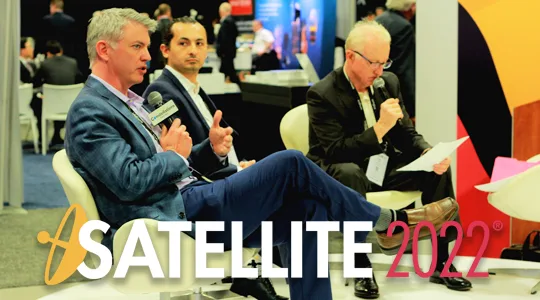
John Gilroy: Welcome to Constellations, the podcast from Kratos. My name Is John Gilroy, and I’ll be your moderator. Today we’ll be interviewing Chris Badgett, Vice President of Technology from Kratos, and Araz Feyzi, Co-Founder and CTO of Kayhan Space. We recorded this interview live on the floor of the Satellite conference in Washington, D.C. The purpose of this discussion is to look at space technologies being used for both civil and military purposes. The number of commercial firms intending to or already engaged in space activities are only continuing to grow, and commercial firms could be a force multiplier. Let me start off with a question for Araz, can you give me a short synopsis of what Kayhan does for Space Domain Awareness?
Araz Feyzi: Let’s talk about the problem first, since the dawn of the space age, we have launched a little over 10,000 satellites total. In the next decade, we’re planning on launching 10x that, a hundred thousand satellites. So, let’s remember that 10 times more satellites in one decade. There are estimated to be a million pieces of debris larger than one centimeter in diameter orbiting the earth. Why is that number important? Because traveling at 17,000 miles an hour, a small piece of debris, the size of a painting or larger, can destroy a satellite. It’s a threat at that point and we need to care about it. We’re tracking about 30,000 of them, and there’s about a million estimated and in-orbit. And also, conjunctions, which are collisions between two objects in orbit, that’s changing. We have a lot more operational satellites that are becoming closer to one another.
Araz Feyzi: So, in general, that’s been causing a ton of trouble for satellite operators, and they can no longer operate as they used to. So at Kayhan Space we have developed and coordinated an autonomous satellite collision avoidance service. We ingest data from various data sources, such as government or commercial sources, and we ingest data from our owner operators. And when we detect a conjunction or a collision that needs an operators attention, we send them notifications and also provide them with optimal maneuver plans that are designed with operators constraints in mind. So, physics space, non-physics space, and then we basically automate their collision avoidance efforts.
John Gilroy: Chris, Kratos is a big company. What specifically do they do in relation to Space Domain Awareness?
Chris Badgett: Yeah, so for Kratos, a big company, they have several different divisions that span anywhere from UAVs to microwave electronics. The one I’m personally familiar with is the one I work in, Kratos Space. We cover a lot of different mission areas and different customers from RF monitoring, to Earth Observation, to COMMS, to space superiority. We’re one of the companies that have a global sensor network around the world, looking for RF interference in the global SatCom belt. So six different sites around the world, couple hundred apertures, looking for events happening in the GEO belt from what could be owner operators to tracking maneuvering objects if they’re admitting. So that’s a commercial service that we actually offer through our own on-prem infrastructure.
John Gilroy: There seems to be a need for transparency and space as dual-use technologies are apparent. For example, SpaceX turned on Starlink for Ukraine. So the real question is, and people in the audience may have this question as well, how do you manage this dual usage? Do you just have one baseball hat for one and one baseball hat for another? It’s kind of tough. Araz, let’s start with you. Your company, Kayhan Space, provides a cloud-based collision avoidance service, you just mentioned it. So how do you manage your technology for military or commercial applications? How do you juggle that?
Araz Feyzi: Yeah, honestly, it’s actually even more complicated than that. It’s not just, “hey, we have government and we have commercial.” Our services rely on different pieces of data, we have algorithms that combine the services together, and then we provide these services to customers. Now, each one of these components, when you look at them, you might have different access levels for different commercial operators, government operators, or international customers. So, as you can see, it can become extremely difficult extremely quick, it’s very complex. So, for example, you won’t be able to, because of restrictions, use this particular data source with that algorithm for that customer.
Araz Feyzi: So, yeah, it’s the restrictions we have, they’re necessary for obvious reasons. So the way we deal with that is by actually defining different access levels for the different parts or different components of our services. And when we decide, okay, so who’s going to get access to certain services? We can put it through our logic and make sure that the right person has access to the right data through the algorithms. And again, when you go international, it gets even more complicated because no two countries are created equal when it comes to national security.
John Gilroy: Chris, my wife is an assistant principal at a high school, and she does a lot of conflict resolution and conflict management. You mentioned it earlier, your company works in the commercial and defense space, how do you deconflict?
Chris Badgett: Great question. So similar answers, it all starts with the customer. Depending upon the customer and the type of service they’re looking for, that really drives the data that we’re collecting. So we not only look at it from the standpoint of where the customer is going and what data sets they’re looking for, but we also have to back that up through the life cycle of our products and how we’re building them. Because, in some cases, some algorithms may be specific to the U.S., and we have to consider ITAR or EAR. But again, it really starts with the customer and the particular service that they’re looking for.
Chris Badgett: I mentioned a little bit about how we can look at RF monitoring from any emitter, that’s really just trying to characterize spectrum and seeing what’s going on. Maybe there’s intentional interference, or unintentional interference. Well, for that object in space that’s emitting, we can add things like geolocation to it, or actually, let’s say spatial location to it through TDOA and FDOA analysis so we can actually pinpoint where that transmitter or that emitter is in orbit and actually detect maneuvers and different kinds of change algorithms that you can put on it to give you situational awareness.
John Gilroy: As we’ve continued our discussion at this satellite show, there seems to be a need for transparency and space as dual-use technologies become prevalent, technologies that can be used for military or commercial uses. For example, SpaceX turning on Starlink for Ukraine. How do you manage dual use? Araz, let’s start with you. Your company, Kayhan Space, provides a cloud-based collision avoidance system. How do you manage your technology for military or commercial applications? Is there a way?
Araz Feyzi: Yeah, so the term SDA, Space Domain Awareness, kind of originated in the government and military, because we need to understand what every asset is doing, what the intention is, what the declared intention is, what the actual intention is, and how it’s different from what we are observing. So, we need to be able to identify imminent threats or potential threats. The awareness from that perspective makes a lot of sense and obviously, it is a necessity. From a commercial customer point of view, basically our commercial customers say “I don’t necessarily think Space Domain Awareness is relevant to space operators.” Mostly because what they really care about is traffic management. They really want to know what to do when there’s an upcoming conjunction. They want to know, in the trajectory that they have, if there are any threats in front of them, or, if they’re launching a new mission, what orbital regime they want to end up in because they want to understand what the current situation is. So, in our opinion, STM, space traffic management, applies more to the commercial customers of our services, but for us, on the SDA side, we need to make sure that we have a clear understanding of the intent, especially with the way things are going. Imagine having a hundred thousand satellites in low earth orbit, now imagine trying to figure out what the anomaly is, right? It’s going to be extremely difficult. And we have some projects that we’re working on with the U.S. Government to assist in that world.
John Gilroy: Chris, I’ve got a question for you. If you read today’s literature, there’s a phrase called ‘existential threat.’ So, one man’s traffic management is another man’s existential threat, isn’t it? I mean, it all depends on how we define this, right Chris?
Chris Badgett: Absolutely. So that existential threat, it’s really if you’re going to proliferate and take advantage of the different orbital regimes, then you have to understand some of the consequences from an orbit phenomenology or kinematics situation. So, the problem not only is kinematics in a spatial sense, now you overlay that with emissions and RF interference, because all those things could be emitting or interfering with other gateways on the ground, they could be interfering with co-orbital objects, could be interfering with things above them, say in MEO or GEO. So the problem is not only an existential threat, but it becomes an exponential existential threat because now you’re trying to solve these problems across lots of different domains, not only MEO, GEO, or LEO, but in the EW spectral space as well.
John Gilroy: Araz, here we are in Washington, D.C. at the Washington Convention Center. There are all kinds of people and government agencies near here, I’ve been in many of them and talked to a lot of the CIOs. So, from your perspective, what does the SDA need from governments or other entities in town, to achieve its full potential? What does it need from governments for Space Domain Awareness to reach its full potential?
Araz Feyzi: That’s a good question. So, my answer would’ve been different six months ago, but today’s a bit different. From a national security perspective, we’ve always had to keep track of objects in orbit. The systems that we developed, the Space Domain Awareness network, which was developed a long time ago, to prevent ICBMs and other threats coming our way, and as a byproduct of that, we’re tracking all of these objects. One parallel I see here is traffic management for air travel. There are radars that are owned and operated by the government, and the data that’s collected, is provided to all operators because it’s in everyone’s best interest. It has the best interest of the commercial industry, the best interest for national security, and the government.
Araz Feyzi: Now, we believe that this data plays an extremely important role in deciding how fast we can innovate in space. There are government data sources that are paid by taxpayers, developed by taxes, and built and operated by them, and they should be provided to everyone as much as possible to keep space flight safer. However, there are commercial providers that have also invested and then generate a lot of data that’s very useful. We also believe that the commercial and government industries can work hand in hand. This is a great opportunity for private and public core collaboration, where we can ingest data, bring all the services, and provide it to everyone.
Araz Feyzi: For example, some nations have taken different approaches. Europe has a controversial approach where they have started providing certain services that make the world a little bit less competitive for European companies and I know a lot of European companies are not very happy about that. We really think that what the U.S. Government has done so far, and the efforts that are in progress today, both in the department of commerce, Mil Law, and DoD, are going to help us improve the safety of flight for all satellite operators.
John Gilroy: Araz, I’m going to state the obvious here, I’m an old guy and you’re a young guy. When I was a young man, satellites were the size of refrigerators, now they’re the size of cubesats, maybe ice cubes in the refrigerators, kind of small. And so, it’s one thing to track a refrigerator, but another thing to track a cubesat. So, how can you quickly identify different cubesats and launch simultaneously?
Araz Feyzi: That’s a great question. So, I remember talking to a company that were talking about deploying thousands of picosats, even smaller than what we are capable of tracking today, and that’s obviously very dangerous. There are different ways and there are different companies that have different solutions that make it easy. For example, tags, or reflective surfaces that make it easier for ground trackers to track these objects. As a company, we’re not involved in that process. So we use the data and we continue to work on algorithms that help with what’s called IOD or initial over determination.
Araz Feyzi: Identifying those small objects that look alike and come out of space at the same time, from a policy perspective, we need to make sure that we’re good neighbors to each other. So, if you’re an operator, even if there is no guidance, even if there’s no regulation that is forcing you to identify by yourself or cooperate with your neighbors. I think as an industry, we need to collaborate with each other, tell everybody where we are now, GPS is very feasible for, even one use. And when we talk about transparency, we believe that there needs to be transparency in terms of sharing some basic data that’s already available out there. So, I don’t know if that directly answers your question, but yeah, that’s our vision, that we need more transparency. We need more people to share their data.
Chris Badgett: Yeah, just to add on to that, in the situations where it’s cubesats, or any vehicle in particular, different phenomenology’s can be applied from Space Domain Awareness. You can use optical radar, we typically are the RF experts there. So, we’ll take the signals that are already coming off the satellite and be able to use that to differentiate from a location perspective. So, to address some of the possible cross haggling and small volumes for cubesats, you can use some of those signals to your advantage, and actually do TDOA or FDOA analysis so you can resolve those objects in a cubesat hard problem there.
John Gilroy: Got a football question for you, Chris. About a month ago, there was a super bowl and it’s one thing to hit someone with a football when they’re stationary, a whole lot different when they’re running and someone’s chasing after them, a moving target. How do you maintain RF situational awareness with moving emitters and still ensure comms? I mean, that’s the moving target, isn’t it?
Chris Badgett: Yeah, that’s a fun problem. So, Space has changed over time and as we’ve proliferated LEO, the physics have changed a little bit more, right? GEO objects or geosynchronous, tend not to move too much, MEOs, and then we’re getting to LEOs, and you have to take those things into account. You experience a lot more Doppler shift, you have to have better pointing, better tracking antennas. But there’s really a lot of interesting things that you can do from understanding and tracking those transmitters as unique identifiers, and then track those things and keep custody of them in a catalog that can be presented. So, that way, you are actually keeping track of those moving objects in LEO. So, it’s a little bit harder problem, but it’s not an insurmountable problem.
John Gilroy: Well, Araz, I’ve got another Washington D.C. question, right in the thick of things here. We have a lot of intelligence agencies around town. They get attacked a whole lot, and some share information on cyber-attacks while others are very wary, for a lot of different reasons, all kinds of ethical and moral questions here. So, let’s take this to the world of satellites. How do you share data internationally and across organizations? I mean, how much is the good stuff and how much is fair to share?
Araz Feyzi: Yeah, I’m just going to go back to my answer to one of the first questions where I was talking about how different types of data that we have access to and receive have different access permissions or levels for different consumers. So, we always abide by those access permissions, we track them properly, we tag them properly, and every time a data is provided to a certain customer, we make sure that it’s checking all the boxes. One example I’ll give you is that it doesn’t matter where you are from, you can always go to space tracker, create an account, and get access to the TLE catalog, it’s public information. So, we can use TLE’s data for anybody, pretty much, whereas we access to more proprietary data or protected data where we can only use it in certain cases, for certain projects. So it is very, very important, for any service provider, or any company, to pay attention and make sure that the right data is always right for the right people.
John Gilroy: Question for Chris here, I guess there’s room for a commercial based aggregator with Space Domain Awareness information. Do you have any examples of this today, or is this limited to the intelligence or commercial community?
Chris Badgett: No, you actually brought it up from an intelligence community. There are some examples where NGA continues to buy commercial imagery data, so that’s a great model that you can actually apply from an SDA perspective. There are lots of commercial operators out there that you can actually pull in from their sensors, and from their infrastructure, into a larger aggregator. The unified data library is another good example of where people are actually putting their data, depending upon the sensor time. So, a couple different examples, but yeah, I think it’s a great model, and space force is actually going through from a commercial engagement strategy and actually building an office around some of these opportunities for aggregation.
John Gilroy: Let’s talk about space sustainability, Araz. I have a couple of daughters that are very interested in sustainability because they’re going to be around a few more years than I am, and so people talk about space sustainability. What does that mean to you, space sustainability?
Araz Feyzi: So I’ll ask a question, is space the same today as it was 60 years ago? No, it’s not. Is it going to be the same in 60 years from now? No, it’s not. Research came out, I think it was UT Austin, but they estimated that 95% of the caring capacity of lower earth orbit is already 95% taken up by space junk. And that was before they began rushing sat test, so you can only imagine. So, the way we’ve operated so far in space hasn’t really been, I guess, sustainable. We’ve created a lot of debris, intentionally or unintentionally, and that has made it a lot harder for operators that are coming online today to operate. Hopefully, we’re not doing most of the things that we were doing years ago.
Araz Feyzi: But, if you continue to down the same path, low earth orbit will be unusable. And, let’s remember, lower earth orbit is not just for satellite operators. If you want to go to moon, you have to pass through it. If you want to perform any kind of inter mission, you have to pass through cloud debris. And it can get to a point where it makes it very, very difficult for anybody to do any innovation in space. So, in my opinion, sustainability in space is that we should consider every generation and company that is coming out and want to innovate in space, and make sure that they have all the resources that they need, that what was provided to us is also provided to them. So, if you can make it better, even by short term, let’s not make it worse.
John Gilroy: Chris, now from your perspective. How would you define space sustainability?
Chris Badgett: So, very similar, from a object and traffic management standpoint, but even to build on that, it becomes sustainable from an emission standpoint. I mean, FCC understands this, spectrum contention is not going to go away. All we can really do at this point is continue to grow, we’re going to probably move up into newer bands as other things have contention. We need to get smarter from a dynamic spectral awareness standpoint, be able to reuse spectrum in different locations. But, all of that implies a much larger management scheme. That’s actually dynamic instead of where it’s actually fixed, and you actually have a license to operate in this orbit regime. There are probably techniques that we could to use, but that would actually involve a much larger scale solution that crosses organizations and governments on how to be dynamic and how to reuse spectrum.
John Gilroy: Araz, I want to go back to my wife, the high school system principal. You get a bunch of teenagers together and there are all kinds of unexpected events. I mean, car crashes and things happen, and fist fights, and all kinds of things. And so, part of space sustainability must be expecting the unexpected. There are going to be events that are going to happen and they have to be controlled. So, this is going to have to mean cooperation between civilian and military organizations, and you may sit in the seat here coordinating, is that right?
Araz Feyzi: Yeah, absolutely. So, I mean, we deal with it today, we do a little bit on a daily basis. When a mission is launching, you usually have discussed or mentioned the intention of that mission. We see it on daily basis that a lot of times, the data they collect from a physics perspective on these assets, whether it’s the capabilities they have, or their mass, or the orbit that they’re going to, or the RF activity that they have, it doesn’t really work. It doesn’t really jive with what the intent of that asset has been. So, in space, there are a lot of times we are surprised, well, maybe not surprised, but we find cases where it’s unexpected. The behavior’s unexpected, the activity’s unexpected, and the list goes on, there are many of them.
Araz Feyzi: So, as an industry, we need to make sure that we are, first of all, transparent, as much as we can be, and, for obvious reasons, you can’t always be 100% transparent, but at least try to make sure that we have a safe orbital environment, and a safe environment to operate in. We have to build and develop technologies where we can identify the unexpected behavior and deal with it in a timely manner. And, that’s one of the reasons that we keep talking about autonomy, because when you have a human in the loop, you have error.
Araz Feyzi: You have human error, you have delays, and at orbital speeds, at the pace that things happen in space, and we’re getting to a place where humans can no longer be in your loop. In many cases, whether it’s responding to an unexpected event, or detecting something unexpected, you cannot rely on human eyes to do it anymore, the volume is so high that the speed is too fast. So, we believe that autonomy is the only way we will be able to operate efficiently and safely in orbit going forward, and that includes detecting anything unexpected.
John Gilroy: Araz and Chris, we’ve looked at both sides of Space Domain Awareness, and a lot of insights here. I’d like to thank you, gentlemen, for opening up the eyes of our listeners to the possibilities of commercial world, helping improve Space Domain Awareness. I’d like to thank our guests, Chris Badgett, Vice President of Technology at Kratos, and Araz Feyzi, co-founder and CTO at Kayhan.
Araz Feyzi: Thank you for having me.
Chris Badgett: Thank you.