Transcript:
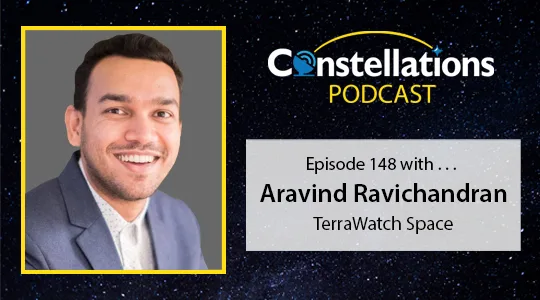
John Gilroy: Welcome to Constellations, the podcast from Kratos. My name is John Gilroy and I’ll be your moderator. Today we will discuss sovereign Earth observation along with emerging business and technology trends in Earth observation. We welcome Aravind Ravichandran, founder of TerraWatch Space, a company devoted to providing insight to satellite Earth observation. Aravind will discuss new business models for EO, Earth observation, including space-as-a-service and satellite-as-a-service models. We’ll also touch on some technology advances affecting EO such as data fusion and onboard computing. Sounds like a busy podcast, Aravind. Let’s jump right in here. Here we go. So this industry, the Earth observation or the EO industry, is projected to reach 11.3 billion by 2031, growing at a rate of 7.2% from 2022 to 2031. Is this growth sustainable or will it begin to kind of plateau around 2031?
Aravind Ravichandran: Hi, John. Thanks for having me on the podcast. Yes, on the market, I believe that it’s probably going to be the farmer, where the industry is going to continue to grow simply because we are collecting more data than we’ve ever collected in the history of humanity. We are knowing more about our planet, our activities on the planet, and the relationship between the two. The more we know about it, the more industries will start to use it and in 10 years’ time or eight years’ time, by 2030s, Earth observation data is going to become fundamental to a lot of products across a lot of industries. People are also already going to forget that they’re using Earth observation data, and the biggest example of that is weather. We don’t even realize that it’s coming from satellites, satellite data. That’s what’s processed and giving us that energy, or that number that we see on our mobile phone. That’s an example of what will happen for the Earth observation situation industry. Yeah, it is going to continue to grow.
John Gilroy: I never plug in a lamp and go, “Now I’m going to plug a lamp into the electrical network and the generator through.” No, you just plug it in. Same thing, I think with Earth observation. It’s going to be assumed, isn’t it? In a recent paper you wrote you talked about sovereign Earth observation. Now, I’m not familiar with that term. Could you explain it to our listeners and why is it important for them to understand?
Aravind Ravichandran: Well, especially if you’re working in the space industry, but also if you’re just the general public, sovereign Earth observation is essentially the strategy of national governments. Different countries in the world have Earth observation programs, and historically, there has been only a dozen or so countries with Earth observation programs, a dozen or probably a couple of dozen at the maximum. But now we’ve seen that a lot more countries are starting to become interested in launching their own Earth observation satellites or creating their own Earth observation programs. It’s a function for national security reasons. I think the evolving geopolitics require that each country becomes independent and not be dependent on another country for sharing data, because observation data is typically shared between allies. That’s one of the reasons driving that trend for creating those programs in countries. The second one is the environmental reason and what’s happening with climate and the fact that countries want to monitor their own regions and their own assets using their own satellites again, instead of depending on external sources and data from other countries. That’s what’s deriving the trend for sovereign Earth observation.
John Gilroy: Selflessly, I think military leaders talk about resilience, and it’s always better to have a heterogeneous environment than a monoculture. I think this is even great for having different resiliencies and military people talk about it all the time. In your paper, you reference space-as-a-service and satellite-as-a-service business models. What differentiates the two and where does this EO stuff fit in?
Aravind Ravichandran: Space-as-a-service essentially is a term pretty much restricted to the space industry, where space-as-a-service allows companies to launch their payloads into space. So when people talk about space-as-a-service, it just means that people can outsource the space component, which is essentially integrating the payload onto the satellite, performing the testing, taking it into the launch, performing the testing there, and then launching the satellite right? All of those things that are part of the space industry that someone who is just developing a sensor for, I don’t know, measuring rainfall or for tracking wildfires, that’s not their area of expertise. Space-as-a-service model allows anyone who’s developing new sensor to launch their instrument into space. Satellite-as-a-service on the other hand, is more relevant for users. If you take a country as an example, not every country needs to launch their own satellite. When a country wants to own satellite, there are satellite-as-a-service models today. You can go to a company and that company can now lease the satellite that it already has on orbit and provide capacity to this country. It seems like this country has a satellite in space, but they didn’t launch it. They’re just taking advantage of satellite-as-a-service.
John Gilroy: It’s a perfect solution. It’s economical and both parties win. I think it’s a very easy business plan that you can talk about. In this paper, you also talk about space strategy and then data strategy. So what are these two and how are they different?
Aravind Ravichandran: Yeah. This is more related to organizations that are starting to use Earth observation data. So Earth observation data can be used in essentially two kind of ways. One is a data strategy, which means that companies can just make use of data that is already available. Maybe it’s already helpful to solve their problems. But then, there can be cases where the data that they want is either not available or they want to own that part of the value chain. Right? There are companies. They don’t want every competitor of theirs to also use the same sort of source of data. So what they want to do is launch their own satellites, which is the space strategy. Not everyone will probably go in that direction because we have already hundreds of satellites in space that are providing data. So not every organization will go in that direction, but I can already see that some companies, especially the ones with the pockets and with strategic interest, can potentially go into that direction. We’ve already started to see that happen.
John Gilroy: We talk about different strategies here, space strategy and data strategy. We have these two concepts, and then one of the ways that it can be delivered is a service model. I was lucky enough to meet one of the founders of Salesforce, which is a classic as a service. I mean, they used to have this big no software sign on their website, and it’s kind of a classic as a service. Are they different as a service model or are they incorporated, or where does it fit in?
Aravind Ravichandran: Yeah. As a service, essentially is starting to come up in Earth observation. So it’s starting with data. So people can buy subscriptions to data. You know? Instead of going and picking data every week or every month, they can just subscribe to a company that is collecting data today. That’s data-as-a-service. But then there are also two other kind of as a service models that are evolving. The second is analytics-as-a-service, so instead of providing data to customers, you can already do the pre-processing yourself, for example, start to detect objects. Instead of customers writing an algorithm for detecting a tree or a building, they can already start providing this as a service. You know what? You just want to know where the buildings are in this part of the world. Here’s my software that can tell you that already. So that’s analytics as a service. Then there’s a third category, which is specific to Earth observation. I don’t think it’ll fit into Earth observation anymore because I call it insights as a service. Usually, it is not only from Earth observation data, so it’s insights that are derived from Earth observation, but also combined with other sources. If you are predicting the yield and providing that to a customer, you are using satellite data, but you’re also combining that with other types of data in order to provide an insight that is essentially solving a problem for the customer. That’s the third category, insights as a service.
John Gilroy: So Aravind in software development, they talk about the software development life cycle and everything else. I think maybe we can come up with a term just you and I here maybe the data life cycle of, okay, we got to the point where we’re collecting all this data. It’s very hard to get to that point. Well, great. Well now what? Now, you have to get insights on that data. And it’s one big hurdle to go over and just get the satellites up there and get the Earth observation data here. Now, where do we process it? How do we? What do we look for? What do we include? What do we not include? What’s the most efficient? What do we prioritize? So that insight thing is really where the tip of the spear is in the battle. That’s really the important, especially with decisions that have to be made very, very quickly,
Aravind Ravichandran: 100%. There’s also one more step after that, which is usually forgotten, but then what people do with that. But that’s not under our purview, but we forget about it. But then, weather forecast again is a very good example of that. People get a weather forecast or governments get a weather forecast. Do they take the decision of evacuating a city or not? That’s almost like a different science, but we won’t get into that here.
John Gilroy: When you look at your business in kind of a wider perspective, it sure looks like the traditional business model is transitioning towards an industry focused model. For example, maybe optimizing an instrument’s accuracy for a specific application and acceptable, there is a priority, an acceptable error margin, and sacrificing some resolution for a much higher revisit rate. It seems like this is a trend. Is this the right observation?
Aravind Ravichandran: Yeah, no. 100%. Again, people are not just launching satellites for a specific technological reason. Usually, they used to launch. You know what? I’m going to cover this area every 30 minutes. And they have not made the link of what actually the customer needs. Maybe the customer does not really need every 30 minutes. Even every two hours is fine. But then what they need is they want to look at a wide area. Right? Satellites are becoming smaller, which means that they can only see a smaller area, and it’s called the swath. Right? And the swath has been going down over time, but if you go to a customer and say, “I will give it to you in pieces and you need to stitch it together,” they might be like, “Can you just give me the whole thing? Can you give me a big swath?” You know? I think they are going towards more of a use case driven approach where the industry is starting to see more applications, and then deriving the requirements based on what the use case asks them, right? They’re not just saying, “We are going to launch a wide swath sensor.” Now, they have a reason for it because the customer wants it and they want to look at one piece of image at the same time. You know? That’s how the strategies are evolving.
John Gilroy: Aravind, I go to LA about twice a year. The street vendor markets, the trucks, used to be real popular. They’re coming back. What’s fascinating about LA is you can go to the best tamales in town. It can be from a street vendor in LA. We know that. They have these fusion things. So you can get a Korean taco. It’s food fusion. And then I look at everything we’ve been discussing today, the satellites the space, the space-as-a-service. It looks like it’s something to do with data or data fusion. You know? I think I understand a little bit about this data fusion, but maybe you can expand on data fusion and how it’ll affect this whole concept of EO.
Aravind Ravichandran: Yeah. Data fusion, again, is already becoming the next big thing in Earth observation, because there’s only so much you can do with one sensor. You know? The easiest example is optical imagery, and they can’t see through clouds. So if you were to need continuous monitoring over an area in, let’s say, the Northern Hemisphere, you’re not going to get you that, right? You have to be very lucky to have a non-cloudy day. But if you need continuous monitoring, you need to combine the optical data with SAR. Again, I’m sure we’ll talk about SAR. SAR is essentially a synthetic aperture radar, which can see through clouds. You need to combine optical data with SAR data. Right? That’s just the easiest example that I always give, is that data fusion needs to happen. If not, customers are not going to get anything for six months of the year, which is not a great service. Right? If you’re developing a product, you kind of need to do it together, combining different sensors, different types of data, and it not just applies to only in space. It also applies combining with institute data. You may have sensors on ground that are taking the measurements of soil moisture, but then you also have satellites that are doing it over a wide area. Right? Essentially, you can combine those two data sets and that can give you a better result. That’s an example of data fusion.
John Gilroy: Aravind, the Constellations Podcast was launched back in 2017. It was a small step for man, but a giant leap for podcasting. For the first time, you got to listen to leaders who focused on innovations in satellite and space networks. Today, thousands of people from all over the world listen to Constellations and thanks to you, we’ve grown into more than just a podcast. Now, you can sign up for the Constellations Newsletter to receive articles on current industry issues, podcast summaries and contributed blog posts at constellationspodcast.com.
John Gilroy: We’ve done a few podcasts on the topic of onboard computing or computers in space where vast volumes of imaging data no longer need to be downloaded. The analysis and extraction can be done in the satellite so is this the future of EO, where satellites not only gather the data, but they also process it?
Aravind Ravichandran: Yeah, again, it’s an emerging trend. It’s still in quite an early phase. We are not processing everything in orbit. There have been some demonstrations of processing data in orbit. What I think is probably going to be the future is we will do very repetitive tasks on orbit. If you have to look at the same part of the farm and you have to detect the same crop to determine what the yield is going to be, whatever the crop, you can kind of push the repetitive tasks to orbit so that you don’t downlink, or more importantly, you don’t waste time doing it on ground. I feel like there are some tasks that are going to be perfectly suited for that. There are some, just also from a technological point of view. You don’t have a lot of infrastructure up there. You don’t have access to cloud capacity. Well, you’re in space.
John Gilroy: Yeah.
Aravind Ravichandran: You’re further away, to push the pun. You don’t have the infrastructure that you need. Also, there are engineering problems that’ll come in. The satellite or the power system starts getting heated up, so you probably need to generate a lot more power in order to use the processing capacity. Even if processing was available, I think there are other problems that need to be fixed. It’s not to say that it’s not going to be fixed, but I think it’s going to be a combination of the two.
John Gilroy: Well, as long as you’re talking about trending topics, and edge computing certainly is trending, another trending topic is SAR. S-A-R. In the last couple of years, there’s been a lot of buzz about synthetic aperture radio radar, which is SAR, and its impact on your field on EO. So that said, some people are still reluctant to use SAR because the imagery just isn’t as understandable as the more traditional optical ones are. Can you quickly explain for our audience some of the difference between SAR and traditional optic images? And tell us where do you think SAR’s going to play in EO?
Aravind Ravichandran: Yeah, so I think, fundamentally. It’s a different type of sensor because optical sensor is a passive sensor, which means that it just passes over an area and then almost takes a picture. A camera is a very good example. It can take it in different spectrum, but essentially it is a passive sensor because it can only look at what’s there. If there’s a cloud, it cannot do anything about it. It will take a picture of just the cloud and nothing underneath it. But SAR, on the other hand, is an active sensor. What it does is essentially it generates a signal with which passes through the cloud and it hits the atmosphere and you get the reflection back, reflected signal back, or it hits the land. It’s a building, it’s a tree, whatever it is. It hits it and it gets back, which means that it can traverse through the cloud. Essentially, what that bottom line is, you can keep monitoring it all the time, whether it’s raining, whether there is a flood. Even in geopolitical war situations that we are seeing, SAR is a very, very important sensor in that category, because again, if there are clouds, you may not be able to do monitoring, but then, SAR on the other hand, can help you do that monitoring. Just fundamentally, that’s the big difference between the two sensors.
John Gilroy: Boy, I’ve heard a lot of people talk about SAR, but you kind of distilled it in two words. Active, passive. Simple to understand. Very clear. That’s a wonderful explanation. If we talk about the explosive growth of EO constellations, I think we have to talk about the ground systems that support them. I think that’s part of the discussion. I would think that the traditional geo ground system would need to undergo aggressive modernization to manage the hundreds of EO constellations and the terabytes of data they’ll be sending to the ground. Am I looking at this correctly?
Aravind Ravichandran: 100%. I think people don’t pay enough attention to this part of the industry almost. It is the forgotten part of the space industry, to be honest, because people just assume it works. There are a lot of things that need to be worked on, especially with all the data that’s coming down. Like I said, we are not going to process everything on orbit. You still need to downlink every information that you’re collecting from orbit. The ground system is going to play a fundamental part, and we are already starting to see that happen. Whether it’s in just the placement of stations around the world, the distribution of the ground stations, that is the easiest problem to fix, because you just need to have the infrastructure set up in every part of the world so that you can capture or have the line of sight for the satellites to get the data down. That’s just the first part. The second part is how are people commanding it from a software point of view? Do people have the power to task a satellite when they want? Can the infrastructure or the software system available today, is it scalable so that users can use it in a way to send command to their satellite? Let’s assume a future of in-orbit computing. The people who want to send code up and down, because they have first cloud detection algorithm, the next day they want to have a tree detection algorithm. The next day they want to have a ship detection algorithm. You also need to have the ability to send cloud command and code up and down, which means that you need to have a system that is safe, that is secure, that is scalable. All of that needs to happen. It is happening again in phases, but I don’t think we are talking about it a lot.
John Gilroy: Earlier, we were talking about data-as-a-service and space-as-a-service models. Let’s go from space, get back down to the ground here. So how do these models relate to this ground service, ground station-as-a-service concept, I guess, if that’s the word, huh?
Aravind Ravichandran: Yeah. Well, I think there are two emerging trends there. I think there’s a small differentiation between the two. The first one is ground station-as-a-service, which is essentially taking the capacity of a ground station that is not in use and using that to downlink the data, so that the user who’s just a user, downloading satellite data, does not know the difference of which provider’s used. For him, it’s almost like the Uber model, where you know, have a car that’s passing by that’s free. You book it and you can take it instead of waiting for 20 minutes. The same way for ground station. If you have a ground station that is not under capacity and the satellite is passing over, you just downlink it. There’s this ground station-as-a-service model that’s evolving, but then there’s also ground software-as-a-service, which is where I talked about before.
Aravind Ravichandran: The ground software is more about giving the users the power to operate the satellite, command, and send signals back and forth, and having a software interface for that, which is a little different for that. But then there are companies also working on ground software-as-a-service as well.
John Gilroy: You know, I think there are thousands of satellites all over the Earth right now. We know that. There’s also thousands of podcasts, and I think you folks have a podcast. What’s the name of your podcast, Aravind?
Aravind Ravichandran: Yeah, it’s called TerraWatch Space Podcast. It’s about all things Earth observation. Talking about satellite data and all its applications, what’s going on in Earth observation? What are we doing with all the data? What is it used for? Who’s using it? What are the challenges in processing the data? What are the problems that we need to be solving? What are the problems it can solve? Because again, awareness is something that people don’t have as much about satellite data. Again, like the weather example that I mentioned, people have no idea how it works, but then, we are reaching a point where all of them, or at least people who are interested, need to know what’s happening, what the use cases are, what it’s being used for. We talk a lot about climate. We talk a about emissions and all of that have applications for our applications of Earth observation, but people don’t know much about it. Part of the effort is also talk about it from a commercial point, but also spread the awareness of what Earth observation can do.
John Gilroy: True confessions here. When I drove over here to the studio, I took out my phone and I wanted see if it’s raining. I didn’t think of, “oh, wait does the cloud detection algorithms”, I never think about that. I just found out if it’s raining.
John Gilroy: And I think exactly that’s what you folks can do and say, “Look, it just doesn’t happen. You have to have an algorithm that’s going to determine in your specific it spot what the clouds are, if it’s raining or not,” so I think it’s just maybe pulling back the curtains and showing people what’s going on.
Aravind Ravichandran: Yeah.
John Gilroy: Well, Aravind, I’m going to have you put on your prognosticator hat here. We’ve done so many as a service in the last 20 minutes. I’m getting confused myself. So what do you think EO will look like five years from now?
Aravind Ravichandran: Well, it’s a good question. I think it’s going to be a lot of companies that are focusing on developing products with the data that we have been collecting, because in the last five to seven years, there have been several companies that have been founded to launch hundreds of satellites, of constellations, with different sensor capabilities. But then the next five years are going to be about what are we going to do with all that data? Because, like I said, we are going to collect, or we are already collecting more data than we ever collected before, but now, we are going to have to make use of that. For that, we also need to involve the users who will use that data, whether it’s an agriculture or insurance or banks or anybody we can think of, or governments. We need to involve them and then educate them about what the satellite data can do because we can’t develop an application. Because as the industry, we won’t know what people want it for. We won’t know how they want it so we need to involve them. Essentially, how I call it is build it together for the users, but with the users so that you develop it properly. I think that’s kind of what’s going to happen in the next five years. We will build applications for the users, but with the users.
John Gilroy: Aravind, after this interview, I’m sure our listeners will have a better handle on sovereign Earth observation and this whole concept of as a service. By the way, they have a new podcast to listen to, it’s called the TerraWatch Space podcast and get all kinds of information about EO. I’d like to thank our guest, Aravind Ravichandran, the founder of TerraWatch Space.