Transcript:
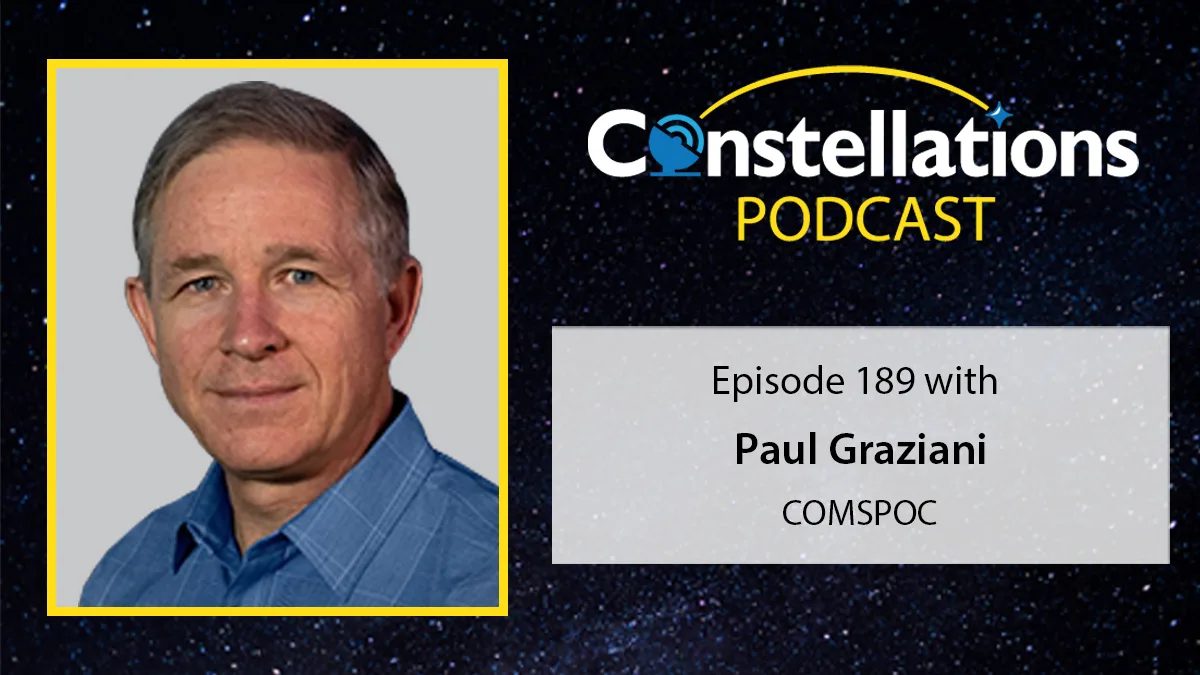
John Gilroy: Welcome to Constellations, the podcast from Kratos. My name is John Gilroy, and I’ll be your moderator. Our guest today is Paul Graziani, the CEO of COMSPOC. He is here to discuss Space Situational Awareness, or SSA, and the value of data fusion to enhance SSA by integrating multiple data sources to produce more consistent, accurate and useful information. Data fusion is one of the processes that assists in reducing vast amounts of data into more usable information that supports insight for Space Situational Awareness. Paul, thank you for being on the podcast to talk about this technique, which seems to be improving every day. Now, Paul, we’re going to jump right in here. What sorts of data and visualization are needed for good SSA?
Paul Graziani: Well, John, first off, I have to say great setup there. I think you identified a bunch of the key points that’ll make an interesting conversation here. But yeah, I think there’s all sorts of different data, and maybe we should start by just defining what we mean, because that word could mean almost anything – it’s very generic, as you know – and maybe the same thing on visualization. So for our purposes here, I think a great definition of data is really what we’re talking about is metric observation data that’s input to the SSA process. So that’s the data we’re talking about, it’s kind of input at the beginning of the process. Visualization, as you mentioned here, that’s something that happens after data gets processed in a way and a human can take a look at it and then understand more about it. So I just wanted to give that definition of terms. I would say there are few other areas that are very relevant too. So we should talk about once that data comes in, it gets processed, those metric observations get processed into orbits. Another section is looking at that data and looking for maneuvers, for instance, characterizing maneuvers. And then you propagate forward. And from that forward look of ephemeris propagated forward, we’ll take a look at that data and look for things like conjunctions or predictive maneuvers or predictive reentry. But so back to your question, with that definition of what I’m talking about on data, I’d say there are so many different data sources right now for Space Situational Awareness. They vary in what’s called, the term is phenomenologies, so that would be, it could be optical data that generally comes from telescopes, it could be RF data that comes from listening to, passive RF data, I should say, that comes from listening to signals that satellites transmit. It could be radar, where the signal’s actually being transmitted from the ground or from some transmitter, it could be in space or in the air, back down to the ground. So all of that data is an important part of this element, the data. So I think it’s those types of data, focused in different orbit regimes as well, so anything from low earth orbit, even very low earth orbit, up to the mid orbits where navigation satellites generally are, and then all the way through to geosynchronous and beyond now, we’re talking about a system there. So I hope to kind of paint the boundaries of the data that we’re talking about there and where visualization comes to play.
John Gilroy: Well, I wrote down propagate forward. I’ll have to write that instead of predict. Different terminology means different things here. So we’ve got this data coming in, and you can call it metric data, but let’s call it data for the purposes of argument here. So how do you vet incoming SSA data to ensure it’s accurate and reliable to begin with? I mean, how reliable are your sources? Sounds like a Washington Post investigative reporter. “Show me your sources! Show me your work!”
Paul Graziani: Exactly, yeah. An important topic, and again, with so few words into a comment, such a complicated area. There’s a lot of different ways you could interpret that. So some people might look at that and think you’re talking about data security, for instance. So hey, I created data to sensor, that sensor’s out in the field, that data has to be transmitted, and that data could be compromised somewhere along the way. So that’s one way that you kind of get the data. I think relative to the way I think about this, and we think about it, we think more of the problem of taking data from different sensors on the same object that could, and you’ve got different metric observations coming in on that same object, and that data may show different results. So now you have to take a look at it and say, hey, why are those results different on those two different sensors? It could have been those sensors may not have been detecting the object at the same time, and it may have actually maneuvered at some particular time. That information could be wrong. We actually had an incident, one of our data partners, what happened, they had a telescope that was set up on a balcony of a hotel. And literally, the cleaning crew came in, and when they cleaned, they knocked out the plug in a GPS that was being used for timing and the clock started drifting. So all these things contribute to errors, and many more that we don’t have time to go into. But what we do in our focus on the data integrity, is we put this into a Kalman filter, and so people that use that type of algorithm for their orbit determination, and the Kalman filters are fantastic. As a matter of fact, our technical people, they use the term, “It’s a lie detector.” So when one sensor’s lying about that object, it kind of pops out very clearly, and then you can go and you can dig into it, and you can find out, hey, your clock is drifting, what’s going on? You can find out that your GPS got knocked out, or you can find out that your sensor was miscalibrated. So that’s how we think about vetting the incoming data. It’s making sure that the data coming in on one object, data coming in from multiple sensors, that those sensors are accurate and are not lying about the object.
John Gilroy: Okay, I’ve got a book title here. I’m going to write this book. It’s called Sherlock
Holmes: The Case of the Unplugged Clock.
Paul Graziani: There you go.
John Gilroy: So let’s delve into this. So Paul has presented with the case of the unplugged clock. So let’s say there are gaps in coverage, okay, let’s say that. So we’ve got a gap in coverage somehow, who knows, so how can they be addressed?
Paul Graziani: Sure. So I think to us, the obvious answer there is lots of sensors, so that’s more sensors that are distributed, and they are different types of sensors, and this plugs the various kinds of gaps that you could have. So for instance, let’s take an observation of geosynchronous satellites. The most common means to do that is with optical, with telescopes. Telescopes generally don’t work very well when the telescope itself is in light, right, so you have a gap. When the telescope’s in the daytime, there’s a gap there. So an obvious way to fill that is with RF, for instance. So if it’s a transmitting satellite, you could listen to the signals being transmitted from that satellite. That fills that daytime gap. Same thing if you have radar. And it’s hard, but there are radars that go out to geosynchronous. Generally, radars are usually used for satellites that are down closer, but not always, so radar is another way to fill that daytime gap. Other gaps are more geographic. So when you’re talking about lower-orbiting satellites, the location of your sensor, which could be a radar, generally can only see a certain area in the sky above it, and it can’t see kind of a third, let’s say, of the sky, because the satellites are down so close. So there, you need to fill that gap by having different sensors in different areas of the globe, but so I think it’s different phenomenologies and different geographic locations, is the short answer to your question.
John Gilroy: Okay, let’s maybe take the next logical leap here. We tried to collect data, we realized there may be some problems, we patched it, we cleaned it up. Okay, now we have a nice little clean data set to hand to a data scientist somewhere. Okay, so that’s fine and dandy, but there seems to be a need to transform data into actionable information. So what kind of analytics contribute to good SSA?
Paul Graziani: Yep, yep. Boy, okay, again, a wide area. It’s funny, I think that many people would be listening to this conversation and they might say, “Wow, these guys are so narrow.” And of course, when we’re in the business, it appears to be so wide, because it’s close to us. So to me, this question seems wide. So let me, again, maybe divide up the answer here in a few ways. So maybe if we work backwards, so what actions might we perform, and then we can go backwards to how do we get to that actionable data, that’s one way to think about it. So one very common thing, I think, it’s kind of a first-order problem, are things like conjunctions that you have, where two objects in space are getting too close to each other, too close for comfort, and there, usually, if one or both of those objects are capable of maneuvering, you want to maneuver one of those. So if we work backwards, the action we want to take is a conjunction avoidance maneuver. Then we’d look back, what do you need to know? How do you transform the data from a raw observation into the actionable information you would need for that conjunction assessment? So there, I would say the key things are you need to have trending information, so you need to have a consistency of observation, so you can watch that conjunction over time, because what’ll happen is, sometimes what appears to be a conjunction, maybe a few days in the future, ends up not happening. So that’s one thing that you have to do, so you have to trend it over time. Another thing you need to do is to make sure that you understand the accuracy of the data, because this is an imperfect science. You actually pretty much never have perfect information. There’s always something that’s impacting your information. And so there, what you want to make sure you know is what is the uncertainty of that data that you have? So the term is covariance, so you understand how noisy that data is, and you want to have as good an understanding of how well you know that object’s position. So that’s how you get your way to knowing better conjunctions. But I’ll give maybe another example might be a national security example, where you might have some sort of defensive space control maneuver that you might have to do because you’re feeling that your national security asset is somehow threatened. So there, the actionable information you need is what is that object? So you need to have an understanding of what that object is. That’s something you have to gain over a long period of time by observing it and using other sources of information. The other thing you need to know is patterns of life. It could be, for instance, let’s use an analogy on the water. So you could have a warship on the water that’s maybe approaching another nation’s ship, and if it’s approaching it in a reasonable way, then there’s not really a threat. However, there are other ways that that ship might be approaching that is more threatening. Same thing holds in space. You really want to be able to understand the patterns of life, what represents a normal maneuver. Maybe that satellite’s just going to fly by you, or maybe that satellite is an approach to cause some harm to you in some way. So that’s how I would say you need to transform that data that you have, the raw observations we’re talking about here now, metric data, into actionable information.
John Gilroy: Paul, I know you’ve been to LA, and in LA they have all these food trucks, every type of nationality and LA’s crazy with all this, and they have food trucks that they call them food fusion like a Korean taco. And I want to take this word fusion and incorporate it into our discussion today, because you mix different things together, you never know what you’re going to get. It could be good, could be bad.
Paul Graziani: Right.
John Gilroy: So tell us about data fusion. So what does it mean? Is it critical to ensuring SSA systems are tracking the right objects? Do you need that data fusion?
Paul Graziani: Yes, absolutely. In our world, everything is so complex now that’s going on in space. It’s just crazy. There’s a huge number of objects that are in orbit right now, some of them are live, some of them are dead debris objects. There are a lot of objects out there now that maneuver all the time, so that’s another big problem. And then on top of that, you have bad actors out there that are doing some things like maneuvering their spacecraft very close to other spacecraft. So with all that going on, fusion is one of the main ways that you can deal with this problem. Basically, that means get as much information as you can from as many different sensors that have different phenomenologies, they have different times they’re looking at objects, they have different geographic locations to looking at objects, and fuse all that together. So I think that’s critical. And in this case, the way I’m defining fusion is it’s, again, taking those metric observations and fusing that information together to form better orbits. Now, other people can use that term fusion in different ways, but that’s the way, when I’m talking about fusing metric observations together, to give you the best orbits you can.
John Gilroy: So we have a lot of objects out there, you implied that, we know we do, so how well do current data fusion approaches address this ability to track the right objects?
Paul Graziani: Yeah. Well, it depends where you’re looking at and which approaches you’re talking about. I would say, and I think most of us that live in the commercial Space Situational Awareness world, would tell you that there are some terrific commercial capabilities that can fuse data and really help you figure out what is what. I would say for the governments, the governments are really pretty far behind, and I think that’s very clear, it’s very objective. I think the government officials all recognize it, the government, and I’m talking US as well as international. But what’s happening, and this is the frustration of pretty much the entire commercial SSA community, is that the commercial team have a bunch of great answers here, but the government teams are just so focused on trying to develop, and it’s actually basically reinvent, what the commercial people have already done, that it’s very frustrating. So I wanted to give that foundation. I would say that in the commercial world, and a great example of this, you could take right now there’s a lot of great commercial optical providers that are looking at geosynchronous space. There are also a lot of, fewer but good number of, RF providers out there that are listening to signals coming down from space. Fusing those two together, for instance, let’s just take the example of a constellation. So sometimes a geosynchronous space, there’s limited geosynchronous space and so some commercial owner-operators that have allocated a particular slot in geosynchronous will fly several satellites in the same orbital slot. Well, that’s a dicey situation, because they’re flying close to each other, and if you were to only use optical, which optical is very nice, it gives you really nice angles you can get, and that’s a nice part of the solution, the RF, however, gives you two real benefits on top of that. So one, it has a range measurement in there, and so fusing together the angles from the telescopes and the range from the RF systems is really fantastic, gives you a much tighter solution. So one way to think about that, so a telescope, which doesn’t have range but great angles, the error that you have in that would result in a cigar-shaped, if you imagine and use your mind to think of a telescope on the ground pointing up to a geosynchronous, and if it doesn’t know range, there could be this long, kind of cylindrical space that that object might be in, because you don’t know exactly how far away it is. Well, the RF has the opposite. The RF has great range, so it knows exactly where it is, but it doesn’t have good angles, so that results in a pancake-type shape. Well, when you fuse those two together, you take the pancake that’s pierced by the cigar shape or pencil shape, and now you know that object is just in the intersection of those two, which is a much smaller area, so that’s beautiful. Then the other thing that I mentioned earlier, the RF also has a unique signature, because it knows the signature of the satellite that’s transmitting, so you can actually get an object ID based on that. So that is just one example of what commercial companies are doing. Now, the governments aren’t doing this, because they don’t have the ability. All the government’s software is just very old and just not up to date with what the commercial teams are doing.
John Gilroy: Well, Paul, I’m taking notes here. I’ve got pancakes, I’ve got pencils.
Paul Graziani: There we go.
John Gilroy: And I’m drawing this thing on the piece of paper I’ve got here. Now, does this data fusion introduce latency?
Paul Graziani: No.
John Gilroy: And if it does, how does that impact SSA?
Paul Graziani: Yeah. I would say no, so and again, it needs some definitions here. So the question probably is formed based on the assumption that you’re waiting for some additional data to fuse in. So if that were to happen, then yeah, there could be some latency that’s introduced. I would say, however, the way we think about that problem, that you wouldn’t think of it this way. You would think about the additional data that you’re going to fuse in is just additional information. So you have whatever information you have from, let’s call it sensor one, then augmented, and when data’s available from sensor two, it gets fused in. And so you only get better data. You’re never actually introducing additional latency when you fuse that data together. So that’s the way I think about that, so it doesn’t actually introduce latency, it actually only helps. Actually, one of our technical guys who are really good at equations, maybe not so good at English, said, “More data is more better.”
John Gilroy: I like more better. I like gooder too, it’s gooder than that. So you’re kind company’s called COMSPOC, we know that, and I think there’s a big conference out in Hawaii called AMOS, A-M-O-S, and you folks are going to be at AMOS where you will be demonstrating a commercial SSA ecosystem. So what’s meant by an SSA ecosystem, how does it work, and why should other folks even participate in your little adventure?
Paul Graziani: Yep, yep, absolutely. So there are many, many companies in SSA right now, commercial companies. So some of us have been in the commercial game for a long time, others are new. So our view, and this is something that, by our experience, and there could be other experiences, a bunch of commercial companies started talking about coming together and forming a complete solution for our customers, and it’s really broad and actually even goes outside of corporations. So by this, what we mean is, there are many different aspects of Space Situational Awareness. So we’ve talked about a bunch of them now. You need data sources for raw observations. You need to be able to transport that data in a secure way to get it to a particular source. You then need to start processing those raw observations, and there’s a whole bunch of breakdown of various different types of processing that you do, to take those raw observations and turn them into orbits, to analyze maneuvers inside of that, to understand new observations. If you suddenly see something new in space, where’d that come from? What is that? You’ve got to figure that out, called uncorrelated tracks. There’s database work that has to be done. It’s very substantial, but there’s a large number of objects with a lot of data. Then after that data gets into a database, you’ve got to process that and look for things like conjunctions we mentioned earlier, or there might be future rendezvous going on, might be a friendly rendezvous, might be a not-so-friendly rendezvous, so you’ve got to look at that. There could be analysis on that of reentries happening, things that are getting so low that the atmosphere is going to pull it back in. Then you kind of go into a human analysis, so you mentioned visualization at the beginning of that. Now, that’s just the operational system. So now you think about other parts of the ecosystem, there’s going to be, if you think of a timeline, there’s got to be really early science and technology research going on. That’s typically the domain of labs, so labs need to be out there doing the early science and technology. Then you have another area you’ve got, like maybe a little bit later than the early science and technology, you’ve got the applying that into systems. So that’s later stage, where there might be, let’s say, some government contractors that are doing that. Actually I forgot one I should have named at the beginning, DARPA. So like DARPA, they’re supposed to be like 20 years out of things that seem like fantasy at the moment. So DARPA, then you’ve got the labs, then you might have academia kicking in, where they’re doing different research with professors or PhD students. Then the next realm I go into is government contracts, where there isn’t a commercially viable solution yet, but government contractors can be there, paid by the government, the risk is being born by the taxpayers, not by any one corporation, and they could spend great sums of money that have to be spent to be able to get through those risky areas. Okay. Then, after that, comes the commercial companies, because now once the government contractors have burned down the risk and maybe a market is formed, you get the commercial companies coming in there. And then lastly, you have the commercial users coming in there. So to me, that was what I would describe as the ecosystem there, all those different players. And what we’re really keen to do, and there’s a bunch of other commercial companies are keen to do this as well, is to create that ecosystem where, at the end of the day, all those piece parts can come together to serve the mission at the end of the day. The mission is we need to have a space domain where everything is detected first, protected, characterized and managed, and even what’s the other one, coordination going on. All of those things have to go on. And there are so many different pieces of that, companies and government contractors and labs and academics, and so that is the ecosystem that we’re talking about here. And if the commercial companies can come together and formulate this, and this is, again, what we’re doing, these conversations, then we’re going to end up collectively serving that mission that much better.
John Gilroy: I think you articulated this whole concept of an ecosystem, and you went line by line by line. And what I noticed, because I’m so perceptive, is that many of these organizations are comprised of humans. And when you get this word collaborate and humans, and I’ve seen many things happen over the years with humans and Montecrop, and so we have a wide variety of people here. So what’s this all going to look like for the satellite industry? Some people are going to play within the line, some people aren’t, or what’s it going to look like?
Paul Graziani: Exactly. And you’re kind of seeing that to some degree, right? Whenever humans are involved, it gets messy real quick with humans. So I think what we’re seeing in this, and again, I’ll parse some words here, so the satellite industry itself, I would use that term to be the folks that are flying satellites that could benefit from Space Situational Awareness, so for them, they’re looking at all this, and in their worlds, for the most part, they’ve got the economics of their companies that they’re worried about, and generally there are not great economics in the satellite business. If you look at, you can see this in the news now, the commercial geosynchronous communication satellite business. There are companies there, have tremendous investments, and they’re hoping to get those investments paid back, but that’s a lot of money and the marketplace isn’t that great. Same thing’s happening in commercial remote sensing right now. So commercial remote sensing, these satellites are very expensive to build, very expensive to launch, very expensive to operate, and the economics are not great there. So none of those industries in space really want to pay a lot for their various services, and they really want to rely on governments. So in my view, what it looks like to the satellite industry is that the satellite industry is turning to the governments. US and Europe are the countries that we deal with, primarily. US, Europe, and Asia are all kind of looking to governments providing the Space Situational Awareness for them. That’s the way I think this is really going to roll out.
John Gilroy: Well, I think you’ve given our listeners a real deep and thorough understanding of this whole issue of SSA and how it’s going to change, and we’ll have to keep an eye on this because there’s so much going on in this whole area. I would like to thank our guest, Paul Graziani, CEO of COMSPOC. Thanks, Paul.
Paul Graziani: Thank you, John.