Transcript:
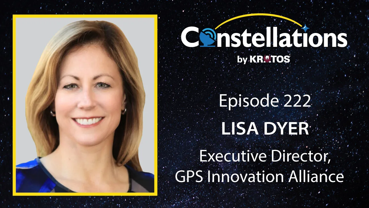
Jason Myers: Welcome to Constellations, the podcast from Kratos. I’m Jason Myers, and I’ll be your moderator today while our host, John Gilroy, is away. Our first episode of the year addresses the future of GPS and global navigation systems. As reliance on positioning navigation and timing continues to grow across defense and commercial sectors, questions of resilience, interoperability, and global cooperation are becoming increasingly important. Joining us today is Lisa Dyer, executive director of the GPS Innovation Alliance. She brings deep experience in navigation systems and space policy, and we’ll discuss where GPS fits today, how GNSS is evolving, and what organizations should be considering as these systems become more critical and more complex. Lisa, welcome to Constellations.
Lisa Dyer: Thank you. Thank you for having me.
Jason Myers: Absolutely. So you spent decades at the intersection of public policy, space technology, and national security. What initially drew you to focus on positioning navigation and timing systems in particular?
Lisa Dyer: GPS just has an incredible brand name. It is the default name for any sort of position navigation and timing systems, though it is its own unique system itself. But really what fascinated me is how it is used in every single sector, public, emergency services, commercial, scientific, as well as nearly every industry. And I couldn’t resist the opportunity to get to learn more about each one of those sectors. And then really, I’m privileged to be able to delve into each one of these markets and get to learn a little bit more about each one of them and how they’re using not just GPS, but all sorts of technologies to bring value to the end user, no matter what kind of end user, a military end user, a commercial end user, and especially the public services sector. That’s really fascinating to me.
Jason Myers: So for many of our listeners, GPS and GNSS are interchangeable terms, but fundamentally GNSS is broader than GPS alone. Could you please explain what’s meant by GNSS and why having multiple constellations operating globally is important for both civilian and defense users?
Lisa Dyer: Absolutely. So GNSS stands for global navigation satellite systems. And historically, those have been limited to those that have been designed, built, launched, and operated by governments, whether it’s the United States with GPS, Galileo by the European Union and its member countries. Russia’s GLONASS has been around not nearly as long as GPS, but soon after GPS. And then China’s the newest entrance with an entirely global system with its BeiDou system. More and more, GNSS is being used to describe satellite-based PNT systems that are going to be providing global coverage, or those that already do. For instance, Iridium already provides a commercial PNT system that is globally available. And soon you’ll have new systems like TrustPoint coming along that’ll be providing a commercial PNT system. It’ll be transmitting in a different part of the electromagnetic spectrum than what GPS and the historical GNSS systems do, they’ll be in C-band, but they will be providing that global coverage that so many companies and militaries and people around the world really depend on and need to make their technologies work.
Jason Myers: In the coming year, 2026, as we entered the new year, what do you see as some of the biggest challenges and the biggest opportunities for positioning and navigation satellite systems?
Lisa Dyer: So many great opportunities. I think there’s so much room still for innovation in position navigation and timing, whether coming along in the commercial market. I am really excited about TrustPoint and this C- band signal that they’ll be transmitting. Since all of the other systems are in L-band, it provides that diversity of signal that is really unique and very helpful as many people are starting to figure out how do you exploit or stop these signals from being transmitted, particularly in conflict areas, but especially outside of conflict areas now that are impacting commercial services as well as public safety services that are understandably dependent on GPS. You should be able to depend on a signal that you’re integrating into your system, for instance, right? But now we’re seeing this use coming out of there. And I think that conversely, that then leads me to the challenges. Getting new signals integrated into the different user equipment is something, it’s one thing to build the satellite system. It’s to get those signals integrated into the user equipment that you and I rely on every day, or to get it integrated into weapon systems, for instance, that the military relies on, and it is part of their operational plans. That is one of the biggest challenges that I see for the emerging commercial market is getting those signals integrated. Conversely, I think that this idea that there were reports in a major newspaper that the US government jammed GPS, it intentionally jammed its own system. And that blows my mind, that we are intentionally degrading our own system. It’s like cutting the internet for a particular region of the world. I am just stunned that we’re doing this, and I hope that this is not a long-term solution for the military. I think we can be much more innovative in the ways that we protect our systems, our people, and make sure that GPS remains available to everybody operating in a particular region.
Jason Myers: You mentioned jamming, and there’s been discussion about threats like jamming that affect GNSS signals. From your view, how should both government and industry be thinking about critical infrastructure that depends on accurate PNT?
Lisa Dyer: A lot of companies have already integrated redundant systems or multiple systems to try to back them up. Ran did a study in 2021 that talked about the different ways that, for instance, the financial sector has been integrating ground-based timing systems to provide a backup to GPS signals. Really unique thing about GPS is that you need to see a minimum of four satellites in view before you can figure out, okay, here’s where I am. And then the system that has integrated those signals can start telling you where you want to go, where you’re at, and provide all of those different services that you and I rely on every day. We hail a car sharing service, right? We can use that system when there are four satellites in view. So there are 32 satellites up on orbit today. So as long as you’re not blocking out all of the satellites in view, you can get access to your positioning signal pretty reliably. But some companies have said, “You know what? For our peace of mind, for our commercial reputation, we are going to integrate other signals into there depending upon the uses, the public safety uses, for instance.” And they’ve already started making a lot of that redundancy and resiliency available to their customers.
Jason Myers: So you mentioned earlier China’s BeiDou system, which is now a fully global GNSS. Some see alternatives as a geopolitical risk, others as added resilience. How should we understand BeiDou as a threat, compliment, or something more nuanced than that?
Lisa Dyer: I’ll go with a nuanced side of the equation there. There are some people that see everything that China does as a risk, as a threat, as a potential adversary. I don’t see it that way. I think China has put BeiDou in its economic plan. They’ve seen that the United States and US companies and companies around the world have realized incredible innovation and economic benefits. And the United States alone NIST estimated that GPS had contributed $1.4 trillion to the US economy from all of the different spinoffs and innovations that have come along. And if I were China, I’d say, “Wow, that’s pretty innovative itself.” I think BeiDou is more of an illustrative example for the United States though. They launched their third generation of their BeiDou satellites in three years. The United States started launching its third generation of GPS satellites in 2016, and a decade later, we still do not have our full constellation of third generation GPS satellites on board. It’s illustrative of our industrial base writ large that we cannot undertake these big ideas, these big plans, whether it’s high speed trains in California or otherwise, and rapidly innovate and deliver capabilities for people. I don’t see us being able to do that in any part of the space sector whatsoever. And that to me is the bigger concern that we can’t actually do that. It’s not that China has done it. It’s more reflective on what the United States is or is not capable of.
Jason Myers: So as you mentioned, GPS keeps improving, but other GNSS constellations like BeiDou are rapidly maturing. From a user standpoint, what does multi-constellation integration actually deliver in terms of accuracy, resilience, and redundancy?
Lisa Dyer: From a user standpoint they probably don’t know how many different constellations their device is accessing to give them resiliency and redundancy. In the highly regulated industries such as aircraft, they are relying primarily on GPS and alone. But for many of the commercial uses, 96% of the commercial devices and receivers out there are using multi GNSS systems. So that allows them to be assured that they will be able to grab that signal that tells them where they’re located. Some of these systems are in slightly different inclinations, different types of orbits, different altitudes of orbits that give them more insights into where they are. For instance, if you’re in Tokyo and you can access Japan’s QZSS, which is focused on the Asia region, you’re going to have a better ability to get access to those signals in some of the urban areas that you may not be able to get from GPS and other medium earth orbit systems that are in slightly different inclined orbits than that. So there are some benefits to having access to those constellations. Hopefully the user doesn’t see that they’re doing that, that they just turn on their device or their receiver, if they’re a farmer in a field, they get what they need and they start being able to do what they want. They don’t have to make any configuration changes to the device. They just keep going. And that’s one of the main innovations that I think we all have learned to rely on, appreciate.
Jason Myers: Those commercial sectors that you’ve touched on are increasingly relying on precise PNT from autonomous systems to financial networks. How are industry and policy needing to adapt to ensure these systems are robust and trusted?
Lisa Dyer: That’s a really great question. One of the joys of where I sit and get to see all of these different applications and uses of industry, sometimes I can see where the government is operating in one way and planning to operate in one way and where they’re undercutting their own ambitions in a different area. And I will say in autonomous systems is one area where I see that coming, particularly in the drone space. Beyond visual line of sight drones is a Trump administration priority that those rules get put into place, that the Department of Transportation move rapidly to put those rules into place. Drones that are within sight already rely on GPS to transmit where they are every few seconds per FAA regulations to say, “I’m here. I’m here. I’m here,” so that people know where they are. But as we start implementing more beyond visual line of sight technologies, knowing where those drones are, knowing that the drones know where they are and can navigate safely in these beyond visual line of sight scenarios is vitally important. And they’re relying on GPS as one of their main sources of navigation for that. Conversely, there are a lot of counter drone initiatives out there that are among the different technologies that people are looking at is jamming those same signals for counter drone capabilities that they’re going to be relying on in the beyond visual line of sight. So on the one hand, the FAA Reauthorization Act of 2024 and the Trump administration have said, “We want to get these rules in place to really unleash this beyond visual line of sight capability for Amazon deliveries and other types of deliveries.” On the other hand, they’re saying, “Oh, we’re worried about these counter-drones, and so we’re going to do something about it.” And I see a potential coalition course coming up in the policy arena.
Jason Myers: Speaking of policy and the regulatory and standard sphere, what progress have you started to see toward global cooperation on GNSS signal integrity and availability? And is there a path toward universally accepted resilience standards that you see?
Lisa Dyer: I don’t see universally accepted resilience standards as an achievable goal right now. I think this administration is much more inward looking. And so these kind of international cooperative activities are one of this administration’s top priorities. I will say my former Department of State colleagues deserve a lot of credit. They and a number of the federal departments and agencies that have worked to make signals interoperable between the foreign government GNSS systems for years, they’ve been working on this for decades and they’re really realizing some of the same signals that are being transmitted by a Galileo are being transmitted on the same exact frequency as GPS, as BeiDous, so that there could be interoperability among these standards so that these systems could rely on each other in a commercial standpoint and another standpoint. So they’ve been working on this for many, many years and really proud of the work that they’ve done and we’re starting to realize the benefits of those commercials as well as government wise.
Jason Myers: So looking ahead, how do you see emerging technologies like low earth orbit augmentation, quantum timing, or terrestrial backup systems changing the landscape of PNT over the next decade?
Lisa Dyer: I am very, very excited to see where the low earth orbit systems go. I mentioned TrustPoint earlier and Iridium earlier as well. From where I stand, many companies are looking for that global availability of signals and you get that uniquely from space. There are a lot of opportunities for terrestrial signals to continue to provide kind of a localized solution, but they just don’t have that widespread availability that the satellite-based solution offers, for instance. Not only that, but the terrestrial capabilities, as we saw with the Maui wildfires, the California wildfires, and recently Hurricanes Helene and Milton, terrestrial systems get wiped out by natural disasters. And for instance, in Hurricane Helene and Milton, what folks were able to do was to take these … Either they had a Garmin inReach device that a lot of climbers and outdoors people carry with them as backup systems for emergency purposes, or they were able to take their iPhone and they were able to hit a button and say, “I need to make an emergency call.” And they hit that button, their location based on the device was transmitted up to a satellite, which sent that signal down to first responders who were working around the clock 24/7 to answer those calls. They were able to direct emergency services personnel to people who were stranded in the middle of nowhere during Hurricanes Helene and Milton. That’s remarkable, an incredible capability and invaluable if that’s you or your family member or someone you love who’s in that situation.
Jason Myers: All right. So some have proposed hybrid architectures that integrate GNSS with other sensors or ground systems for resilience, as you touched on. Is a diversified PNT architecture something you think we’ll see as operational in 2026?
Lisa Dyer: I think commercial companies already have a diversified PNT architecture, to be honest. Let’s talk about precision agriculture, for instance. That is a very diversified PNT structure. You’re a farmer in a field, you’re operating some sort of farming equipment, a tractor, harvester, planter, whatever. They are taking in remote sensing information from satellites, drones, aircraft that has mapped out their particular piece of property. They have these GNSS receivers that are taking in information from all these global navigation satellite systems we’ve discussed. They’re also taking in ground-based terrestrial architectures, information from those signals that have refined those GNSS signals down to one to two centimeters accuracy. And they’re doing this by taking out some of the atmospheric distortion that naturally occurs from every satellite signal that’s transmitted to earth that allows that GNSS position accuracy down to one to two centimeters. And then they’re integrating a form of artificial intelligence called computer vision in some of those applications. For instance, as they’re taking a look at how do we weed these massive fields of soybeans or weed or whatever, they’re able to distinguish between a particular plant as being a weed or a healthy plant. And they’re focusing herbicides or pesticides on the bad stuff in the field and leaving alone that healthy plant. And so all of these different systems working together are providing an incredible end use for the farmer. And the farmer doesn’t need to know that it’s taking in inputs from these eight or nine, 10 different sensors and signals together. They just need to know that they’re saving money on water, they’re saving money on seeds that they’re planting. They’re saving money on the herbicide and pesticide, and they’re saving time by using mostly autonomous systems in those fields.
Jason Myers: That’s very interesting. Are there any other particular use cases that you’re finding especially exciting or surprising?
Lisa Dyer: Really exciting public safety application. First instance of Garmin’s Autoland capability took place over the weekend of December 20th, 21. Garmin has, in certain aircraft, they’ve integrated this capability called Autoland that kicks in should something go wrong in the aircraft in general aviation. So private planes, smaller aircraft that hobbyists like my uncle use, for instance, they have this capability installed in their aircraft. It can be a lifesaving capability. And that first occurred over that weekend of December 20th, 21st. An aircraft was flying from Aspen into Rocky Mountain Regional Airport and rapid drop in air cabin pressurization. Auto land kicked in. And what Autoland does is it takes the GPS satellite signals to figure out where it is. It sends emergency alerts to the air traffic controllers and say, “This aircraft is having an emergency.” It notifies the people in the cabin. For instance, if the pilot’s been incapacitated in some way, it notifies people in the cabin, “We’ve got the plane, we’re going to take care of you. We’re going to get you to the ground.” And this aircraft worked hand in hand with air traffic control, Autoland systems, and got those folks safely to the ground. What an exciting capability that can, I think, just revolutionize the general aviation market. And I’ll be interested to see if it gets transitioned into other aviation types of capabilities, especially as we move more towards autonomous.
Jason Myers: That is very exciting. Well, thank you very much, Lisa. One last question. If you could name one shift, policy, technical or economic that would most improve global navigation systems in the next year, what would that be and why?
Lisa Dyer: I would say that resist the urge to jam GPS and other global navigation satellite systems. That is an important policy decision that I think is important for governments to do. I would say this because, one, we are smarter, more capable of coming up with better ways to protect our people and our property and still conduct military operations wherever we need to. That to me is, we are smarter and better than this. But two, the more that people talk about jamming and spoofing of GPS and global navigation satellite systems, more harmful that is for their reputation. And there are tremendous investments that governments have made, commercial companies have made, public safety capabilities have made, and that are in the pipeline between the government Autoland capability, as you mentioned, these autonomous capabilities, whether in vehicles or drones or other aircraft that are coming down the line that are going to be cost savings, efficiency savings, time savings. So let’s move into something, let’s be more innovative and resist the urge to jam our own systems that we invented and we create and we continue to operate today.
Jason Myers: Well, Lisa, you’ve given our listeners a great perspective on GPS innovation. And I’d like to thank our guests, Lisa Dyer, executive director of the GPS Innovation Alliance. Lisa, thanks very much for joining us.
Lisa Dyer: Thanks, Jason. I really appreciate this opportunity. Happy New Year.
Jason Myers: Happy New Year to you.