Transcript:
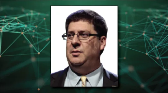
John Gilroy: Welcome to Constellations, the podcast from Kratos. My name is John Gilroy, and I’ll be your moderator. The focus of today’s interview is unleashing the power of geospatial intelligence. Our guest is Keith Masback, leading international authority on geospatial intelligence with over 30 years of experience. Keith is the owner and principal consultant at Plum Run, and provides advisory and consulting services to leading edge companies working in geospatial intelligence and related fields.
John Gilroy: Prior to founding Plum Run, he spent over a decade as the president CEO of the United States Geospatial Intelligence Foundation. Keith will discuss harnessing the power of geospatial intelligence or GEOINT, by moving beyond data silos into integrating, fusing, and analyzing data horizontally to deliver new insights. We will review GEOINTs historical roots, the evolution today across industries, and look to the future.
John Gilroy: With more remote sensing satellites, more rapid revisits and global coverage, an enormous volume of data is being created every day. This is a daunting challenge in terms of archiving, processing, and analyzing all that data and turning it into insights. As the founder and early adopter of the concept of GEOINT, the government has been on the frontlines for over a decade. What lessons can be learned from the government’s efforts that can be applied to today’s new technologies and providers in the commercial sector to maximize the full value of geospatial intelligence?
John Gilroy: Keith, here’s your first question. Geospatial intelligence, GEOINT, it was initially a project by the U.S. military, and is now also used by academia and commercial enterprises to solve geographic problems. What has caused the dramatic growth in the use of this approach?
Keith Masback: Well, first of all, thanks so much, John, and Kratos for the opportunity to join you today. The Constellations Podcast series has caught on quite quickly in our community and it’s very popular. So I’m humbled to be a guest as part of this series.
Keith Masback: I’m a student of history, and so I find it very interesting to think about sometimes when we talk about geospatial intelligence in the context of the United States and the military and the government, we go back to the first GEOINTer, George Washington, who was a surveyor. And we can trace that lineage all the way through Lewis and Clark, who were paid to be doing an intelligence mission. Up through cameras and balloons, cameras strapped to rockets up to the YouTube of the Corona spacecraft commercial imaging. And then of course, everything we have today, plus Google Earth and things that we do on the ground. And while all those technologies were changing, so was the government’s approach to geospatial intelligence.
Keith Masback: It was inevitable that mapping and imaging, remote sensing would come together because the maps are created from those images. And I’d like to take a moment to define geospatial intelligence for the purposes of the discussion, John, if I could. Just to make sure we’re on the same sheet and with the listeners as well. So when I look at geospatial intelligence, I think of it as remote sensing from phones to drones, to space, plus geospatial information data of all types and layers, plus data analytics to make sense of it, plus data visualization, to create an output that allows somebody to make a decision, to take action towards some end. So the intersection of those four things is GEOINT.
Keith Masback: And I think as you look around the technologies that are available to us today, the explosion of remote sensing, the ubiquity of precision location data, powerful software. Increasing powerful processing capabilities available, things like GPUs, data analytics, the mobile revolution, the Internet of Things, XR, all those things come together and create this vision into a reality.
Keith Masback: We talked about GEOINT for a long time, we worked towards getting there. We saw the opportunity, but it wasn’t until all these technologies matured that we were able to come together and actually make it happen.
John Gilroy: I did show prep this morning for this interview, but I never thought I’d go down Lewis and Clark and the federal government geography, but exactly right. I mean, they were doing what 100, 200 years ago, what we’re doing now, only with satellites. That’s a obvious connection there. Now, you were one of the early folks with GEOINT. What were the challenges that you government encountered during these collecting, integrating and analyzing geospatial intelligence data?
Keith Masback: Look, it’s a question that I worry about to this day, John, the thing that hangs over my head, when I think about those of us who came together to make up this term from whole cloth, is were we right?
Keith Masback: Can you take the expert imagery analyst and the deep expertise of people in the geospatial fields, things like geodesy, understanding the magnetic fields of the earth. Human geography, political geography, physical geography, and can you take all those experts and meld them into a single person who understands how to take the power of all of it and apply it to a problem, be it a disaster response or hunting a terrorist, or outside of the national security context, doing something in retail or marketing or agriculture, right? And so we continue to try to do this. And now we find that we take an imagery analyst and a geospatial analyst and put them together and try and give them the opportunity to be one overarching analyst. And we recognize the data problem we’ve presented them. So now we want to sometimes put a data scientist next to them.
Keith Masback: And so I think, well now is that data science part of that also going to be rolled into the role? Are they all going to have to understand, to be data enabled, to do this larger job that we’ve asked them to do while still maintaining some very discrete expertise in a number of those fields? So we don’t lose that. So I think that that remains the challenge. Did we ask people to do too much? Did we set up a system that by definition was going to be a little too challenging for us?
Keith Masback: Or were we right? Were we prescient? Did we see the future and have we paved the way? And over time, the vision that we had, will it continue to mature and do the things we thought it would?
John Gilroy: You mentioned being data enabled, and now maybe 10 or 15 years ago, you could put that on a line item and not have too much concern about it, but remote sensing satellites, rapid revisits, global coverage. I mean, we get pounded with data now. When I was sitting down with Robert Cardillo, we talked about 11 terabytes of data every single day. So how is the challenge of archiving, processing, and analyzing all that data overcome? Do you just throw up your arms and walk away?
Keith Masback: Yeah John, I think some might be inclined to do so. In the national security community obviously we don’t have the luxury to do that.
John Gilroy: That’s not an option.
Keith Masback: And I’d point out, even perhaps more interestingly and lesser known to our community, it is going gangbusters outside of the national security space. We are incented by protecting the nation. We have a sacred responsibility, the national security sector, to master geospatial intelligence to keep the nation secure. In the commercial world, it is about capitalism. It is about being more efficient, being more effective than one’s competitor, looking for a differentiator in the commercial marketplace.
Keith Masback: So that is driving a ton of innovation in this field that can be rolled back into what we’re doing in the national security world. So not only do we not see people throwing up their arms and saying, “No mas, this is too much for me.” But rather we see phenomenal technical innovation towards being able to ingest more quickly, make sense of it and get it to someone who can make a decision in time to be impactful.
Keith Masback: So I think it’s computer vision, it’s processing power. Again, I talked about the GPUs. It’s understanding that volume now is a friend and not an enemy. Volume isn’t something that scares us or overwhelms us. Volume is something that we thirst for and understand that this is something now that can… the secrets, the unknowns are in that volume of data. And that’s how do we go in and get it? And understanding the temporal value of geospatial intelligence information.
Keith Masback: We’ve always been very focused on the spatial resolution. What is the resolution of that picture from a drone or from space, but there’s a real awakening now about the value of temporal. How many times can I see this point on the earth per day? And there’s a growing interest in spectral diversity. In what parts of the spectrum can I view things that are of interest to me? And now even in the commercial world, the ability to do radio frequency spectrum from space, or signals intelligence, SIGINT from space, in a way that I don’t think anybody had anticipated.
Keith Masback: So this creates this wonderful opportunity. We will only be able to take advantage of it when we can integrate it all and make sense of it again in time to support a decision or support somebody taking action.
John Gilroy: Keith, I am deeply embedded in information technology for the federal government here in Washington D.C. and consistently what the federal leaders say, they want to learn from the commercial world and apply that to the federal government. Let’s flip that. So what lessons from the government can best be applied to the commercial sector to unlock the full power of this geospatial intelligence?
Keith Masback: Yeah, John, one of the things I like to say when I lead an organization, when I have that first meeting with the workforce, I encourage them to make mistakes. I give them permission to make mistakes. And I say, “Look, I want you to lean forward. I’m absolutely tolerant of mistakes. The thing where I don’t have a lot of tolerance or patience is to make the same old mistakes.” As I like to say, “I’d like you to have new, imaginative mistakes, but just not the same ones.” And so, the commercial opportunity here is to learn from the government’s struggles. The government struggled to understand how to develop people that could manage across all these fields.
Keith Masback: The government struggles, internal stove pipes, external stove pipes, to put things horizontal. And to do that integration, achieve the type of integration that the government gets in its own way of doing with bureaucracy and with parochialism and with security, and the commercial world has an opportunity to blow right past that. Understand the barriers that the government created for itself and inherited from old ways of doing business, and actually look to do things differently.
Keith Masback: I’m reminded of the term, “Let’s not pave the cow paths,” right? We have this wonderful new opportunity of technologies and data and processing. So let’s look for new ways of doing business, not just doing the old ways of business faster. Because there’s a lot of that going on in the government, despite heroic efforts, in some cases to break paradigms and to change approaches.
Keith Masback: But if commercial industry folks fall into that trap of just trying to do the old things faster, then it will sub-optimize the investment that’s been made in these technologies and these opportunities.
John Gilroy: Keith, you just mentioned some of the barriers that governments have, in far as geospace intelligence goes, so what are the biggest hurdles that are there today to unlock the full potential of geospatial intelligence? People, processes, technology, so where are the biggest hurdles in all the story?
Keith Masback: Yeah. So I like to think of it in people, process, and technology, and I’ve been persuaded by people who would also suggest that there’s a fourth one, which is data, right? So people is the tough one. So a little foreshadowing here, I think I’ll probably come back and tell you that people’s the number one challenge. It’s keeping up with new skills. It’s that depth of expertise that I mentioned. It’s how do you learn while still being productive every day? We can’t take people out of the workforce constantly to learn at the pace of change, but rather understanding that learning is going to be continuous and there has to be a desire. And there has to be incentives built in across the workforce for people to be keeping up skills and learning new languages, and not being intimidated by the new technologies and things that come online.
Keith Masback: That leads into processing a little bit. I talked about not paving the cow paths, but organizations having to be agile, learning, adaptive. These are not things that are often ascribed to bureaucracies, John, and yet, certainly internal to the government, that’s going to be key to success. And that’s a place where I think commercial can lead and teach and help the government.
Keith Masback: In terms of technology, I think it comes down to something really important that we skip over sometimes, which is what are the machines going to do well? And what are the humans going to do well? What is the best role for each and how will they interact? We need to sort that out and just stop talking about it, but really begin to understand it on a deep level. And then as we get to data and data is just not sexy. And people like to skip by data, because if you skip past data, you can get to intelligence and knowledge and wisdom. And if we were comparing that to Maslov’s hierarchy, that’s a wonderful place you want to be somewhere up in the highfalutin area, but you know what? If you skip past data and you don’t condition it and prep it and have metadata and have standards and have training data to train your machines, you never get to those other things.
Keith Masback: So we skip past data and we find the unsexy subject of data, despite talking about data analytics all the time, no one wants to get down and dirty in the eaches of data. And we skip that step very much at our own peril.
John Gilroy: Keith, thousands of people from all of the world have listened to this podcast. If you’re listening now, you can go to Google and type in Constellations Podcast, get to our show notes page. There you can get all 70 interviews, transcripts for all of them. Also, you can sign up for free email notifications for future podcasts with guys with a voice this good. Keith, you sound like a radio personality, don’t you? Wow. You sound great.
Keith Masback: Very kind of you, John.
John Gilroy: We talked about machine language and training data, and this is a whole new field by the way, training data before it’s even submitted to artificial intelligence. So if we overcome some of these challenges related to geospatial intelligence, so what new and innovative applications and problems can be solved if we achieve some of these goals?
Keith Masback: So I think one thing that I’m really intrigued with is thinking differently about space and time. How we depict it, how we understand it. The army recently let a contract for something called One World Terrain. Now, when I was a leader on the army staff, in the Pentagon in the nineties, we had this vision of being able to train, rehearse, and fight on the same data set. If we have an idea that we’re going to fight in some part of the world, then we can train there routinely. When we load the vehicles onto aircraft, we can have interconnectivity and be rehearsing in flight. And then roll off that ramp out of that C-17, into that terrain and the soldiers will have seen it before. They will have acted in it before, they will have seen the consequences of decisions. They will understand the weather affects on that terrain. Because they’ve been there, done that.
Keith Masback: So there’s no reason in 2020 that we should send people into places, either as individuals or as units, when they haven’t had the ability to be immersed in it already. And they haven’t been able to toggle, just like the types of things we do with pilots in their very, very realistic simulations, right? They are in those simulators and engines go off and engine suck in birds and things in the aircraft fail, and all of that they experience in a very realistic, very heart pounding situation. So that if it ever happens in the air, they are prepared. And I think that our new technologies, I think the interactive immersive opportunity is at hand finally. Again, lots of technology coming out of the gaming industry, the power of processors and displays to make it happen. I think we’re really on the precipice of something super exciting here.
John Gilroy: Yeah. You mentioned GPU earlier, started with all the gamers that’s for sure. Well, here it is 2020, Keith, and it’s mandatory that we have to talk about COVID. It’s just expected. And so I’ve been doing some reading and I’ve read that geospatial intelligence is being used in the fight against COVID-19. Give me some details on this. How can it do that?
Keith Masback: Well, COVID is the center of every conversation; it seems we’ve had for many months now.
John Gilroy: Whether you like it or not.
Keith Masback: Personal, professional, and otherwise. And very proudly, I’d like to say that this is ultimately, it’s a spacial problem. There’s certainly a biological dynamic to it. But I like to say that geospatial intelligence puts the pan in pandemic, right? So it’s about where. Imagine if the director of the CDC stood up to warn us about something going on, but didn’t tell us where. It just seems like it would be rather unsatisfying. So the ability to understand quarantine compliance, right? The ability to understand and conduct contact tracing is all a fundamentally geospatial intelligence related issue.
Keith Masback: So there are companies like SafeGraph and X-Mode and Skyhook, who have been selling data to marketers and retailers and other sorts of commercial folks. But now we understand, and in some cases for people, for the first time, what our cell phone data is revealing about our habits, and where we are, and when we are there. And what we are doing, and where we are lingering, and who we are near, and what our habits are over time.
Keith Masback: And so when you take the type of analytics software and you add it to remotely sensed information, now you can really create a picture. So you’ve got a company like Orbital Insight taking a look at remote sensing data, plus this data from the ground, and really describing activity over time that can inform the governor of New York or the chancellor of Germany in terms of decisions about unlocking or increasing vigilance, bio surveillance, right?
Keith Masback: A company like OmniSci, that can do billions of records in sub-second return, which suddenly makes all this data as I talked about earlier, where volume isn’t scary. Volume becomes a friend. The last thing I’d say on this topic, John, is it’s also raised some significant privacy concerns. I don’t think that people have really appreciated while we’ve nipped at the edges of it with some discussions and every once in a while, it pierces the darkness into public awareness and Google and Apple working on a contact tracing application and assuring that that data isn’t going to leave our phones, but rather inform us. The privacy issues surrounding commercial collection of location data and activity data is really serious.
Keith Masback: And one of the most important things that come out of a post COVID world is a better understanding of our vulnerability, and perhaps lead to things like legislation. As the former CEO of Foursquare called, he said, “I don’t want to be in this business anymore. I don’t want to provide this type of data until we can regulate it. And if we have to self-regulate as an industry, we’ll do it, but we also need to lead the government into regulating these sorts of things.”
John Gilroy: You talk about COVID, sooner or later people talk about PPP. I want to talk about a different type of PPP. This is public private partnerships, information technology it’s replayed in whole kinds conversations in there. So how can the government and the commercial sector work together to continue to the advance geospatial intelligence efforts?
Keith Masback: This is so vitally important, John, I appreciate that question. We are very familiar, those of us who’ve worked in and around the government, on cooperative research and development agreements, right? These are no costs relationships between industry and government. Industry normally gets to access IP from the government that it would be illegal for them to share. And in return, the government has insight and access to the technology and the things that are going on inside the company. These things have worked better or worse over time, but we’ve really got to get past that.
Keith Masback: We’ve got to find a way for industry and government to team in the truest sense of the word. And we can’t let the lawyers be the impediments to this happening. When government and industry comes together, and they’re able to communicate in an unfettered way. I’m not blind to conflicts of interest or blind to competitive advantage, and making sure that we are abiding by ethical guidelines, but let’s not be so cautious as we have tended to be that we keep organizations like INSA, AFCEA and The Global SOF and American Geospatial Society and USGIF, and allow them under their umbrellas, as nonprofits to create safe spaces if you will, for industry and government to collaborate.
Keith Masback: So that, and there’s been some limited success. I think the army was a leader in this, in taking mid-grade acquisition officers and having them go out into industry and then come back into government. Let’s exchange hostages. Let’s get government seniors out into the commercial world for six months or a year. And vice versa.
Keith Masback: We have such a tremendous advantage here in the United States, given what’s going on in industry. If we can harness that by true partnership between industry and government, to learn from one another, to share best practices, everyone comes out ahead, everyone comes out more prepared, and the nation comes out more secure.
John Gilroy: Keith, we began the conversation talking about Lewis and Clark 200 years ago, and what’s happened today. So what’s going to happen in just not 200 years, the next five to seven years. How do you see GEOINT evolving any way?
Keith Masback: Well, I think we’re going to get something that looks more predictive and less reactive, something more anticipatory and less forensic. As I’ve described often in talking about geospatial intelligence, and especially during the heat of things going on in Iraq and Afghanistan, at the point where an IED goes off, we’ve failed. And that was all the push to get to the left of boom as we used to call it, let’s trace the chemicals. Let’s trace the training, let’s get way far up that chain. So that those soldiers are never impacted by that IED. Because it never gets planted, because it never gets manufactured.
Keith Masback: And I think that taking geospatial intelligence in that different immersive way of thinking that we talked about a few minutes ago, and disrupting the way we thought about things and being more predictive, being able to model, being able to be out front on any number of things, be they national security issues or things in any vertical sector of the economy. I think there’s a tremendous opportunity at hand, and melding that data science and that data analytics into these geo and remote sensing enabled people, and allow them to use the tools at hand. I’m just very excited about what the future holds.
John Gilroy: Well, Keith, thanks for sharing your analysis of geospatial intelligence with our listeners.
John Gilroy: I’d like to thank our guest, Keith Masback, owner and principal consultant at Plum Run. Thank you, Keith.
Keith Masback: Thanks so much, John, and thanks again Kratos.