
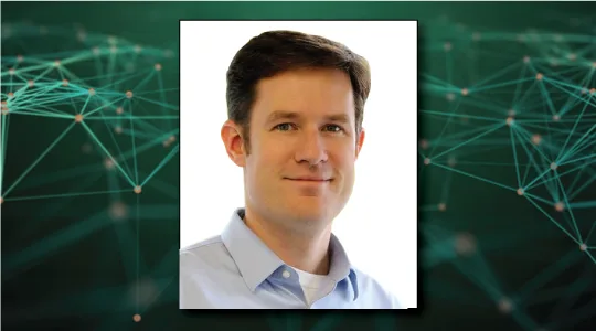
Podcast Episode #79: July 15, 2020
Radar Tracking, Orbital Debris and a Safer Space
Daniel explains his goal to track the 12,000 known debris objects in low earth orbit.



Space is a Network.
Constellations is Your Connection.

Transcript:
John Gilroy: Welcome to constellations the podcast from Kratos. My name is John Gilroy, and I’ll be your moderator. Our guest today is Daniel Ceperley, CEO and Co- Founder of LeoLabs Space. Today we’ll talk conjunctions. No, not the reason you failed high school English. We’ll talk about how to apply innovation to solving the problem of space debris. Orbital debris is a serious issue that will only get worse, but dealing with it is as much an opportunity as a challenge.
John Gilroy: This is an area well known to LeoLabs as they building a set of advanced radars dedicated to tracking the 12,000 known debris objects in low earth orbit or LEO. LeoLab’s core technology includes a patent pending global phased array radar network, which tracks debris and satellites in LEO. Observations generated from this network inform the LeoLab’s platform with timely and accurate orbital and situational data.
John Gilroy: Currently, LeoLabs offers 10 times the precision at one time the cost of traditional methods. Dan, that sounds like the very definition of innovation. Doesn’t it?
Daniel Ceperley: Yes, I completely agree. We’re in the business now because we’re bringing in innovative new technology to market. So we’re building out a global network of phased array radars, keep an eye on all that new activity, all those new satellites going into space and also all the debris. And we’re going to be tracking a lot of the small stuff that’s never been tracked before.
Daniel Ceperley: Absolutely, I think we’re doing something very disruptive on the technology side, but also on the business side we’re carrying a new business model with this technology and, specifically, that’s the software as a service model. So you can actually subscribe to information about your satellites, or subscribe to debris information, to make your satellites more safe and that’s never been done before, so we’re really excited to be pursuing.
John Gilroy: There’s a guy named Kevin O’Connell. You’ve probably heard about him. He’s the Director of the Office of Space Commerce. He said in testimony before the Committee on Commerce, Science and Transportation downtown here, United States Senate, that this year alone there may be over a thousand new satellites launched into low earth orbit, increasing the number of active satellites by almost 50%. What type of technology’s out there to track all these satellites, Dan?
Daniel Ceperley: Yeah, so it’s a really exciting time in the space industry. People talk about it as a gold rush. The price to build a satellite, the price to launch a satellite, the ease of getting these satellites up there, it just means there’s a whole lot of new activity and there’s a lot of new companies pursuing business models based on satellites.
Daniel Ceperley: It provides a method of accessing the entire globe, getting real time information anywhere in the world or from anywhere in the world. And it’s attracted the notice of a lot of investors, so they’re putting a lot of money into it, so that number is going up dramatically. I think three years ago, the number of active satellites in low earth orbit was about 500 and, right now, I think we’re at about 1800, so that’s three X higher in just a few years and it’s still continuing to grow.
Daniel Ceperley: I think the space industry’s just going to keep growing and growing because these satellite applications are quite transformative. That, of course, means we have to really take a hard look at how do you keep all this stuff safe? If there’s more satellites going in up there and there’s already a lot of manmade debris, how do you make sure there aren’t more collisions, there aren’t more mishaps, or even just how to organize it more intelligently, and the foundation for all of that work is data.
Daniel Ceperley: So data on where’s the satellite, where’s the debris and that’s something that really hasn’t been available before. So the primary way of tracking most of these objects has been radars and telescopes run by defense organizations and the US Air Force, now the US Space Force, was really the leader and has been for a number of years in publishing data, providing a foundation for safe navigation, safety of flight.
Daniel Ceperley: But even they are not allowed to disclose the full range of their data, the full precision, because they’re a military organization that’s got to protect their secrets. And so that’s why we got into the business. There was a big need for more data, better data and, on top of that, really services, interactive services. And so we’re now in the business of getting those customized services out there for specific operators, specific mission, and really broadening the reach of these sorts of services.
Daniel Ceperley: So if you rewind about 10 years, the primary use for tracking satellite tracking debris was for defense. But now that there’s a huge number of commercial operators in LEO, all these commercial operators need precise information. And because there’s a lot of new commercial satellites, the regulators need a lot of information about what’s going on.
Daniel Ceperley: Ultimately, we think the insurance industry is going to need a lot of information about what is the risks that their portfolios face? And so there’s this need for a commercial source of data that is able to be disseminated very broadly and used in all sorts of new applications.
John Gilroy: Now, we can talk about the number of satellites and we’re just doing it verbally in a podcast. Sometimes you have this visual image that really punches through. And this morning I was at platform.leolabs.space/visualization. Wow. It’s just overwhelms you the number of orbits and satellites out there. It really brings home the point, doesn’t it?
Daniel Ceperley: Oh yeah, absolutely. We very early on got that visualization up on the web so people can see the latest 24 hours in lower earth orbit. So yeah, I encourage anybody go to that website. There’s actually a little search bar in the upper left where you can pull out individual satellites like the space station, or you can pull out satellite constellations like Planet, it’s got a big one, SpaceX and Starlink has got a big one. Or you can zoom in on some of the debris items too, rocket bodies, debris left over from other activities.
Daniel Ceperley: To give you a sense of the numbers, I mentioned a moment ago, there’s about 1800 active satellites in lower earth orbit. Well, there’s about 14,000, a bit more now, pieces of debris and satellites tracked. So 14,000 manmade objects that are tracked in low earth orbits in those are the objects that are about four inches or 10 centimeters in size. That’s kind of the industry standard right now. So there’s way more debris than there are active satellites, unfortunately, and that debris is going to be up there for a long time, decades, even centuries.
Daniel Ceperley: On top of that, there’s a lot of small stuff that we really have to be careful of. It turns out that even down to two centimeters in size, an object has so much energy, it’s moving so fast that if it hits your satellite, it’s got the energy of the hand grenade. So it’ll shatter your satellite and create a new cloud of debris, and then that debris is up there threatening your other satellite, other people’s satellites. And so that small stuff, there’s about 250,000 pieces of it. That’s the best estimates right now. So 20 times more small stuff, that’s not even tracked, as there is tracked stuff today.
Daniel Ceperley: So if you’re going to get hit, it’s going to be by a piece of small debris. And so that’s one of the big things that LeoLabs we’re doing, is rolling out a new generation of radars that can track all that small stuff.
John Gilroy: Well, Dan, I’m asking a Joe Sixpack question here. Two centimeters, you can’t put a license plate on two centimeters. I mean, how can you identify uniquely each one of these objects? Is there a way to do it?
Daniel Ceperley: Yeah. When it comes to the small debris, it’s all about tracking it frequently. So you see it going over one radar and you can pretty precisely tell where it’s going to be for the next couple of days. So when we track something we know to better than 100 meters, or better than the size of a football field, where that object is going to be at all time. That enables us to say, when we see that object again, with a lot of confidence say, “This is the same object. It’s not a different piece of debris,” and so being able to check in on a daily, or even many times per day, is really critical.
Daniel Ceperley: That enables you to keep up with it and not get confused about whether it’s one object or the other. And that’s actually something that’s really not been available before. There’s a need for just a lot more sensors, a lot more radars to keep track of everything. So, one of the big things we’re doing is rolling out those radars. In fact, we’re the only organization that’s demonstrated being able to build one of these radars in less than a year. We’ve actually built two in less than a year.
Daniel Ceperley: So we did it in Texas and we did it in New Zealand, and we’re going to continue and roll out at least three more of these radars. But to your point about identification, there’s also another challenge of identifying newly launched satellites. And those things, they’re a lot larger, but these days they tend to be kind of launched together. While from the radar you can’t precisely say, “Hey, this is that satellite. This is satellite A, this is satellite B.”
Daniel Ceperley: You can get a size, so you can say, “Hey, here are the large satellites, here are the smaller satellites,” and you can also keep close track of it so that you don’t start switching satellites and say, “Oh, it was this satellite today. I’m not sure if it’s another satellite tomorrow,” keeping close track of things enables us to avoid any confusion.
John Gilroy: When I introduced you to this podcast, I used the phrase, phased array radar. It sounded like Star Trek or something, what a phrase. What do you mean by phased array radar? Is it different from the traditional radar dishes or what is it anyway?
Daniel Ceperley: Yeah, it’s actually really critical. The phased array part is what enables us to do our job. So by phased array, we mean there’s no moving parts. It’s all electronically steered. Quite often if you, say, watched the movie Contact, they’ve got these big dishes and the dishes slowly move around. Those dishes are one way to do a radar. The big challenge you have there is you’ll lose a lot of time when you’re moving that dish around, so you go and track one satellite and it can take a few minutes to move that dish and then go track another satellite or another piece of debris.
Daniel Ceperley: We don’t have that amount that much time, because it turns out there’s thousands of objects going over each radar every hour. So every millisecond you have to switch from one object to another, piece of debris, satellite, piece of debris and back. And that’s what the phased array lets us do. So when we build a phased array radar, we have a few hundred identical electronic units or electronic modules, and they all act as kind of their own compact radar.
Daniel Ceperley: By carefully timing them all so that they’re all working together, we can actually have the radar say, look to the East and then a millisecond later look to the West, and it’s all that steering is done electronically, so we can very rapidly switch between the object and keep up with that heavy amount of traffic going overhead.
Daniel Ceperley: It’s also important to note that radar’s quite critical. When we’re talking about low earth orbit, which is where most of the activity is, all the new satellites, all the astronauts and the like, you have to be tracking around the clock. Satellites are going over in the middle of the day. They’re going over during the dead of night.
Daniel Ceperley: They’re going over when there’s bad weather, when there’s rain or clouds or snow, and you have to keep tracking during that time, radar can do that. Radar is not affected by sunlight. It’s not effected by clouds and that’s why we’ve chosen radars and that’s why we’ve chosen phased array radars for this particular task.
John Gilroy: Dan, there are a number of shared ride launches these days. I think everyone knows that. Trade publications talk about it. Is it possible to track multiple objects being launched in the sky at the same time? I mean, you see dozens of satellites going out there. It seems like it’d be confusing, wouldn’t it?
Daniel Ceperley: That is actually one of the biggest challenges right now in the industry is you get these rideshare launches where there’s a bunch of satellites on them. They deliver a whole bunch of satellites all at once into space. And then there’s a few week time where a satellite operators have to find their satellite, get in touch with their satellite and basically turn it on. And many times, if they don’t boot the satellite up in a few days, the batteries are dead and it’s game over.
Daniel Ceperley: I think the statistics are pretty bad for these really small satellites, the CubeSats, that something like 25% of them are, in effect, dead on arrival because it’s in a large part, it’s hard to find them and get in touch with them. That’s where the precision of the tracking data, it becomes quite important. You need to know precisely which satellite is which, when is it going to go over my ground station? How do I get in touch with it?
Daniel Ceperley: And so that’s a big area that we’re focused on and yes, we can absolutely track all those satellites as they come off the launch. We’ve done this with a number of rideshare launches and actually, just recently on June 13th, we worked with our friends at Planet who put three of their SkySats on top of a SpaceX Starlink mission, delivered those satellites to space, and a couple hours after they were dropped off, we tracked them and delivered that tracking data to Planet.
Daniel Ceperley: One of the big benefits we have is we directly control our radars, so we can actually set aside a fair amount of time to make sure we’re tracking these new launches. So we stare at the point of the sky where those satellites are going to fly over our radar and we start watching a little bit early, a couple of minutes early, keep watching until it’s a few minutes late, after the pass, just to make sure that we see all of those objects. Then we fit the orbits to them and we can predict where those satellites are going.
Daniel Ceperley: And again, we can also see their sizes, so we can tell you, “Oh, there’s the big satellite. Those are the main payloads.” And, “There’s the small satellites, those are the CubeSats,” and there’s a few in-between. Those are the small sats. With that kind of precise information and that comprehensive picture of what’s been delivered in space, we can cut down a lot of the confusion.
John Gilroy: When you talked about cube satellites being lost I thought about a new application for the phrase, “Lost in space.” It’s the undergraduate satellites that are lost in space and Professor Dan’s got to help them out, find it somehow, huh?
Daniel Ceperley: Yes, absolutely. We want to make the lost in space thing a thing of the past, so the new norm is simply sign up for the service. As soon as your satellite gets dropped off in space, we track it. You know where it is. In that visualization you talked about on the web, where you see all the debris and all the satellites, we have a version of that that actually shows only the satellites operated by a specific company.
Daniel Ceperley: So in fact, it’s now even an off-the-shelf service to just have this dashboard, just, “Where are my satellites now?” And we even have some companies that have it on their webpage, that show, “Hey, here’s our fleet. Here’s where they are and this is the latest tracking information from the LeoLabs verifying that they’re in their orbits. And if you need to know when they’re going to go overhead, here’s the data,
John Gilroy: Daniel, thousands of people from all over the world have listened to this podcast. If you’re listening now, you can go to Google and type in Constellations podcast to get our show notes page. Here you can get transcripts from all 78 interviews. Also, you can up for free email notifications for future podcasts, where we talk about lost in space. Maybe that’ll be a theme of the show or not lost in space. That would be the theme of your company.
John Gilroy: How many people are keeping an eye on this? How many people are looking at the space traffic? Anyone? Just you?
Daniel Ceperley: Yeah, so in a way it really is the wild West. Companies, they launch their satellites and then, by and large, they’re each tracking their own satellites. The US Air Force keeps a pretty comprehensive eye, or the US Space Force now, keeps a pretty comprehensive eye on the satellite and the debris, and they share some information as well.
Daniel Ceperley: But one of the big changes we’re seeing is there’s a lot more discussion about what should the rules of the road be? How should space traffic safety be defined and what should be reported on, what should be monitored? And I think there’s two opportunities here. Certainly there’s an opportunity for LeoLabs and companies like LeoLab to be this tracking service provider, to rollout more sensors, rollout advanced services, to provide very detailed information about satellites and the activities in space.
Daniel Ceperley: But there’s also a need for a government regulatory body to kind of step into a new role, and that is to really define what it means to be safe in space, to monitor what is going on in space and in the beginning, simply report on it. What activities look completely safe, especially the new ones? Hey, which new ones are actually going really well? We should do more of that. We should license for these satellites.
Daniel Ceperley: And maybe which ones look a little risky? They’re not going as we planned, they look like they’re creating some risk. We need to go back to the drawing board and update them. Right now there’s just not that much certainty around, “Hey, how is space traffic safety defined? If I’m building a satellite constellation or designing a new satellite, what should I take into account?”
Daniel Ceperley: And so that’s a new need for an agency that does this and it really has just come up in the last few years because of this rise of a lot of new companies that are delivering satellites to space, or that are providing launches and rides to space. I kind of think about it a little bit like almost the stock market and the public markets, that there’s a need for somebody kind of like the SEC, the Securities and Exchange Commission, somebody who’s setting the rules and talking about what activities are in compliance and which ones aren’t.
Daniel Ceperley: And then those day-to-day operations, steering the satellites, driving the satellites, planning satellite operations, leave that to the private sector and the companies who are flying the satellites, and services like LeoLabs that are providing the information going into that process.
John Gilroy: In my world, they toss around this phrase, predictive analytics. It sounds pretty impressive. And I would think that with all this mathematical information you have now, you’d be able to forecast something out. Is it a matter of days, matter of months, or can you forecast these potential collisions?
Daniel Ceperley: Yeah. So very good question and actually very timely because in early May, we launched our newest service, our collision avoidance services. That actually, that sends out alerts to satellite operators about potential collision, and it sends them out up to a week in advance because it turns out the way these satellite operators work, they want the first inklings, the first information that there’s a risk about a week in advance. And then they watch the situation develop for a few days. In about two to three days before the collision, or before what they call the time of closest approach, they make a decision about whether they’re going to maneuver or not.
Daniel Ceperley: In part, that they don’t need to maneuver before then there’s plenty of time, two to three days out, but also in part, because the predictions, it’s a little hard to make a prediction seven days in the future, because it turns out there’s a little bit of atmosphere in space. Just the trace amounts of air push the satellites and the debris around just enough that if you’re looking seven days out or even further, you don’t precisely know, “Hey, is there really going to be a collision or is there not going to be a collision?”
Daniel Ceperley: But about two to three days out, you’re confident enough that, “Hey, this is going to be too close for comfort,” or, “This is going to be completely harmless. It’s going to pass very far away.” And so our CA service, our collision avoidance service, sends them those alerts in advance. Then actually, in the days leading up to the close approach, it sends them a few more updates every single day. Every time we get some new radar data, they get an update.
Daniel Ceperley: The service also has a feature where they’re able to send us essentially a maneuver plan. “Hey, if I maneuver my satellite here, if I put it on a slightly different orbit, am I going to get rid of the risk?” And our service immediately responds with updated risk information so that the people who are planning these maneuvers, planning the satellite operations, when they’re in a meeting, they can just be hitting us with multiple maneuver plans and getting answers back. Oh, look. This one’s safe. This one’s not,” and you can get to a final answer.
Daniel Ceperley: The challenge has been in the industry in the past, this sort of service has been on a very fixed schedule that you can submit a request and about eight hours later, you get a response. You say, “Oh, if you follow this plan, here’s the new risks you might face.”
Daniel Ceperley: So we’ve changed that we’ve made this a modern response of service. You get an answer back within seconds. And so that means you can actually start to play out, pregame the situation, try different plans and find one that works.
John Gilroy: Dan, you can see I have a whiteboard behind me. You’re in this room here and you’re drawing this. This is a potential collision. You’re happy. I’m happy. What happens when they run out of gas? Well, there’s no fuel to avoid the collision. I mean, just sit here and enjoy it, or that can possibly happen, couldn’t it?
Daniel Ceperley: Yeah, so you touch on a very interesting point and it generally comes up in the topic of derelict satellites. So one of the sort of rules of the road right now is that when your satellite’s end of mission, which can be hey, maybe some of the solar are failing, or it could be it’s out of gas, the satellites essentially retired, but it’s left in space. The rules right now say you have to set it up so that the satellite leaves space, it burns up in the atmosphere within 25 years. But that’s a pretty long time.
Daniel Ceperley: That means there’s a lot of derelicts and satellites in space. Those satellites can run into other satellites during that time, or they could get hit by debris, other pieces of debris, and themselves get turned into a cloud of debris and pose risk to other satellites.
Daniel Ceperley: So there’s some notion that maybe that requirement needs to be changed. Maybe these satellites need to be moved out of space faster, or if you’re at certain altitudes, or you’re deploying certain numbers of satellites, you need to get them out of space more quickly. But I don’t think there’s consensus yet. And that’s actually where some direction from some of these regulatory agencies could be quite useful.
Daniel Ceperley: We saw an example of this in late January. We actually tweeted out that there was a near miss between two satellites. Two old US satellites, one from the 1960s and one from the 1980s and they passed within 50 meters of one another. They are very large satellites, so if they hit, there would have been thousands of new pieces of debris. There would have been a substantial increase in the collision risk in low earth orbit.
Daniel Ceperley: Those satellites, luckily they missed. We didn’t have a collision situation. It was a big relief, but those sorts of situations happen every week. These old defunct satellites and old defunct rocket bodies are passing close to one another. So with our data, we’re working to quantify, “Hey, just how much risk is this? What is the riskiest kind of orbits to be in? What are the riskiest satellites and what do we do about it?”
Daniel Ceperley: So you can certainly update the regulations so that future satellites pose less of a risk, but you also want to get into a situation where maybe you start removing those satellites. You start reducing the risks. And that’s an area of the space industry I’m really interested in, so active debris removal. And there’s some companies that have been started that aim to provide that service. Go up, grab a piece of debris, drag it down to the atmosphere and burn it up.
Daniel Ceperley: I think for the health of the space industry, we’re going to need to get to the point where that’s routine, that that sort of service is routine and I hope our data can really help them close their business case, that we can provide the actuarial information that they can use to justify the cost of the mission.
John Gilroy: Dan, earlier in the interview, you talked about software as a service. In my tech world, that’s used all the time. In order to coin a phrase here, so we’re talking about here is maybe orbital debris tracking as a service, is that what we’re talking about then?
Daniel Ceperley: Yeah, that’s exactly right. So we present ourselves as a staff company, software as a service company, and so the way you access our services is a subscription, a monthly subscription or an annual subscription. You sign up for the specific satellites you need to track, your fleet of satellites, and you sign up for the specific services you need.
Daniel Ceperley: So maybe it’s precise tracking information, maybe it’s these collision alerts, and then you access it over the internet. We have a application program interface, so your software engineers can make very small modifications to the software you use to connect to our data feed and just pull our information over the internet in real time.
Daniel Ceperley: We also have a set of online dashboards, so you can log into our website and get these displays. We have a team that’s making some really great 3D displays that, in the example of a collision, showed that two objects coming together and just how close the potential collision or the conjunction’s going to be.
Daniel Ceperley: And more importantly, give you reporting tools. We have what we think is the first kind of modern reporting tool for space traffic safety. You can get these reports and these displays that you can share with other stakeholders, like company management, or the investors or other satellite operators who might be in the vicinity. The information’s presented in this way that’s easy to digest, so people can get to precisely what they need.
Daniel Ceperley: So, we’re a SAAS company, but we also happen to be backed by a network of radars. So we were rolling out this infrastructure that produces all this data, but people access it through a subscription. So our users, they don’t have to become radar experts. They don’t have to worry about, say, maintaining a radar or building a radar, or even processing a lot of the data.
Daniel Ceperley: They just get that end product that they need, that alert, or that report or that dashboard, and then you just go on with their daily lives. We’re in the background worrying about those radars, and adding more radars and adding more advanced analytics to the mix.
John Gilroy: Dan, let me put you behind the steering wheel of a car. You’re driving down the street and a watermelon falls off a truck in front of you. You veer out of the way and you hit the car coming at you. And so I can see this happening in space. Your LeoLab says, “Look, you got a potential collision, good luck.” I mean, there’s got to be some kind of a, “Here’s some options for avoidance, maybe some simulations of what if I did this.” You touched on this earlier. It seems to me an important part of the whole story here.
Daniel Ceperley: Yeah, absolutely. You’re right. In terms of collision avoidance, we’re a critical piece of preventing the collision, but we’re not the end story because ultimately the satellite operator has to decide when they’re going to maneuver, and if they’re going to maneuver, and how they’re going to do it. And it turns out actually the satellite operators don’t want to hand over control of the steering wheel to us, to LeoLab, because when they make a decision to maneuver, they’re not only avoiding a collision, but they’re also impacting their schedule.
Daniel Ceperley: They’ve got a schedule for, “When do I get to collect more data?” Maybe it’s images of the ground. “I’ve got a set of images I’ve got to collect over the next day.” They’ve also got a schedule for when can they down link data? “I’ve got to download all this data I collected and I’m only going to be over the teleports during this time.” And so they’ve got all these considerations they have to take into the mix. And then our information is a critical piece of that.
Daniel Ceperley: But we try to make the job as easy as possible. So rather than simply providing them this kind of static information that, “Oh, you’ve got a potential collision coming up. You’ve got that watermelon, it’s sitting in the road ahead of you. You’ve got to maneuver around it.” We’ve got this interactive service where they can say, “All right. What if I swerve at this time? But what if I swerve at this other time? What if I go down the side street?”
Daniel Ceperley: They can send us all those what ifs and we’ll run them against the entire data set, against every single satellite and every single piece of debris we’re tracking, and tell them if they’re not only avoiding the watermelon, but avoiding everything else, avoiding that other satellite coming down in the oncoming lane of traffic, avoiding something else that’s sitting on a side road.
Daniel Ceperley: So when we say we’re doing maneuver screening, it’s not just against that watermelon, that one object, it’s against everything we’re seeing in LEO. And it’s spent a lot of work on our side, and our software engineering team, to really make that happen, to make it so you can get an answer back about the entire set of stuff in LEO in only a few seconds. It’s not trivial, but with cloud computing and with the algorithm development we’ve done, we’re very proud to say that we can get you those answers quickly.
John Gilroy: Sit down with your brainiac staff and say, “The goal of this company is to make sure things aren’t lost in space and how to avoid the watermelon.” Kind of both ways on both ends of the collision, huh?
Daniel Ceperley: I like it. I like it. Yeah. I haven’t heard about the watermelon in space yet, but I guess there was the cheese wheel that SpaceX put up a while ago. So we’ve got some precedent.
John Gilroy: Yeah, yeah. Well, Daniel, I loved hearing about this from someone from the University of Virginia. I’d like to thank our guest, Dan Ceperley, CEO, and Co- Founder of LeoLabs Space.
Daniel Ceperley: John, it’s been an absolute pleasure and I really appreciate the time. Thank you so much.
