
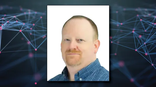
Podcast Episode #4: November 15, 2017
RF Analytics, SmallSats and Dark Ships
Rob Rainhart shares his thoughts on the technology, applications and future potential of space based RF mapping and analytics.



Space is a Network.
Constellations is Your Connection.
Transcript:
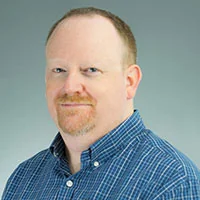
John Gilroy: Welcome to the Kratos podcast. My name is John Gilroy and I’ll be your moderator today, and our guest is Rob Rainhart, Senior Vice President of Engineering at HawkEye 360. Rob, how are you?
Rob Rainhart: I’m fantastic. I’m excited to be here to talk about HawkEye 360, what we’re doing, SmallSat industry and all the things associated with that, so it’s an exciting time for us and got a lot going on.
John Gilroy: Wow! You’ve got great background, electrical engineering, systems engineering. I have kids, they say EE, that’s the smart ones, huh?
Rob Rainhart: Yeah, it’s kind of funny. I grew up a EE and did a lot of design work, and then moved into systems engineering and have since been doing technical leadership for probably the last five to eight years of my life, and a number of different roles over those times. I love solving problems and creativity and finding ways to innovate new product lines.
John Gilroy: So let’s say you were cutting the grass and your neighbor comes over and says, “Well geez, HawkEye 360, what business problem does your company solve?”
Rob Rainhart: Yeah, it’s a great question and it’s one that’s kind of interesting because when you look at the website and you look at who we are, you think SmallSat space company. The reality is we’re an RF Analytics company and we’ve just decided that the best way to create those analytics is to collect a unique data source and that’s what we’ve set out to do, so we started doing that by building a set of satellites that allow us to collect a unique data source, independent geo- location of different emitting signals on the surface of the Earth and with that you can create a lot of interesting data sets that can be used to help solve problems and create unique use cases and that’s the intent of where we’re headed.
John Gilroy: So if you have three satellites up in the sky, it’ll be a constellation, is that right?
Rob Rainhart: Yes, so the constellation is we have three satellites that fly in a cluster of three. The constellation will be a number of clusters, so we say somewhere around six to ten clusters full constellation size.
John Gilroy: If you Google ‘small satellite market’ you’ll come up with an interesting number. In 2017 it’s estimated to be about $2.9 billion market and go up from there, so where do you fit in in this big market?
Rob Rainhart: Yeah, it’s interesting. I would say that because we’re in RF Analytics we fit into the SmallSat market in a couple different ways. One, we’re leveraging the technology of SmallSats to be able to get on orbit quickly, efficiently and then be able to iterate on that design over time and that’s what the cost point of SmallSat technology allows you to do. So we fit into it because we’re a user of the technology to get to a data set as quickly and as rapidly as we possibly can. I think in the end we end up pushing that technology because we have needs that we want to see the technology be able to meet, and so in the end we end up pushing the technology and helping advance those different, the ecosystem of providers that are out there.
John Gilroy: I went to your website and I saw the phrase ‘transportation activity’ so I think that’s one of the focuses, maritime and land-based transportation, is that correct?
Rob Rainhart: That is correct. I’d say it’s maybe one step higher in that you know we don’t intend to track everything, we intend to track interesting things. So when we look at how we process data and what our satellites will look at, we look at ways to do that in a very targeted fashion in a very specific way. So we would look at a particular area of interest or a particular behavior of interest using other data sources to augment the decisions that we use for our own satellites.
John Gilroy: I’m an old fellow, obvious, and when I look at satellites over the last few years, it seems like your small company handling a pretty big problem where five or six years ago it would have been too big a problem for you to handle.
Rob Rainhart: Yeah, I think that’s true. I think technology’s advanced significantly that’s made some of these constellations possible today. I think you see an approach that has a lot of little sensors versus a handful of much bigger sensors or much bigger satellites, and so there’s just this momentum that builds towards that and we’re riding that wave and using it to solve some very specific problems in that.
John Gilroy: Are there other companies that do geo-location and RF processing now?
Rob Rainhart: There’s absolutely other companies that do RF processing. I don’t know that there’s anybody out there that does geo-location using a three-ship cluster like we are. That’s our unique claim and that’s our unique feature of how we’re planning to fly these.
John Gilroy: And so how many have gone in orbit so far?
Rob Rainhart: The first three are under construction now. They are going through tests as we speak and our first launch comes up in February of 2018, so the first three Pathfinder mission, which is our first, goes up in February of 2018.
John Gilroy: We began the conversation by talking about engineers and classically engineers solve problems. You know that they love solving problems.
Rob Rainhart: Yup.
John Gilroy: Any kind of puzzle they love it. And so what are the problems that a small satellite company has in this industry?
Rob Rainhart: Yeah, so in this particular industry we look at what’s being done within maritime domain awareness and we look at what’s being done within tracking, tagging and locating and we look at what’s being done within the communications industry. Our satellites are really geared towards helping to refine the data products in those industries and bring a new layer to that. So an example of that would be looking at dark ships and illegal fishing, and looking for ways to better track those assets in scenarios where they may not be doing exactly what they’re supposed to be doing. And so we have a tool set that allows us to inform users of that data, an informed user who would be interested in that data, to be able to help them identify the behaviors that are actually going on, track those behaviors and then decide what to do about that long-term whether it be an interdiction or something along those lines.
John Gilroy: So what sparked those ideas, I mean?
Rob Rainhart: You know, I think a lot of it boils back to me building and delivering a product to market is all about understanding gaps in the current technology, gaps in the current solutions, understanding the user needs, meeting with customers, understanding those needs, and then folding that back into an architecture that allows you to meet those needs. HawkEye 360 began as an idea that turned into looking for users of that data, looking for problems to solve, and then fold that back into the architecture of how do we build this in a way that gives us the flexibility to solve lots of different problems and adapt as we go. Within systems engineering, there’s a pretty interesting design concept called Design Thinking where you rapidly iterate on releases and capability, push that to market, get feedback and that’s what we intend to do on the satellite side and on the processing side, and on the analytics side is find ways to push new functionality and new features either to the satellites or the ground, and certainly the pace at which the SmallSat industry can launch and build vehicles makes that a very appealing proposition.
John Gilroy: When it comes to maritime domain awareness, it would seem to me there’s ways to do that now, right?
Rob Rainhart: There are. What we focus on is the gaps. We focus on the areas where the ways to do maritime domain awareness today aren’t as successful. Cases where someone might be on purpose trying to not let their location be known and that’s where we would come in and be able to find them through a number of different means and capabilities, and that’s what we focus on because it’s in the gaps where folks are either losing data or it’s in the gaps where folks are trying to get a better operational efficiency for themselves and that’s what we focus on.
John Gilroy: So would your target customer be the law enforcement community?
Rob Rainhart: That could be one. A target customer could be insurance providers. Target customers could be commercial companies looking to protect their interests or their investment in either operations or shipments and those are all applicable users of it.
John Gilroy: If I got a little map of the world and had my own push-pins and tried to mark every single ship in the world, by the time I got done I’d have to remove it and that’s got nothing to do with the trucks and everything else. I mean, this is more of a big data problem than anything else, isn’t it?
Rob Rainhart: Absolutely, and that’s why we call ourselves an RF Analytics company. I mean, at the end of the day we’re an RF Analytics company that looks to collect a unique data set and so, you know there’s a huge piece of this that relates to being able to collect the data source, task the data source and process that in an efficient way, and then get those records out to the customers in a number of different ways.
John Gilroy: With all this information floating around, it seems like there may be a limit to even an electrical engineer’s ability to understand it. Maybe you have to go artificial and use artificial intelligence. Is this where AI fits in?
Rob Rainhart: It is. AI fits in in a number of different ways. If you think about it, AI is really about processing and to looking at data sets in a different way. Rather than using a logical algorithm, using a data science method to look at those and make sense of the data that’s there, and so AI fits in in terms of being able to analyze the data sets, use that to predict certain behaviors, predict ship locations. It also fits in on the operations side from a SmallSat industry perspective. What do we look at, when and why? That can be an AI piece as well, helping us discern what to look at, so that there’s not operators in the loop. That the decisions being made or the decisions are being recommended by the system in terms of how you operate and what you look at.
John Gilroy: People talk about start-ups and they say, “Oh that start-up, that’s just a PowerPoint company.” When I look at a lot of artificial intelligence, I look at PowerPoint presentations and go “Well, you’re really kind of pushing it.” It’s not really AI but you’re kind of applying it because it’s trendy.
Rob Rainhart: Sure. Yeah, so AI and the data science algorithms is a huge, huge bucket of capabilities in terms of what you can do. So there are certain things like regression analysis that have been proven and used in a lot of different cases and those are more mainstream than maybe some more of the advanced algorithms that you look at. But they have history and so they have a proven track record and they really are becoming mainstream in terms of helping figure out how to make decisions and solve those problems, and what behaviors are you trying to track and what behaviors are you trying to predict and certainly the Internet of things, the financial industry has driven a lot of that for their own interests.
John Gilroy: I don’t want to do any inside baseball talk here. But in doing research on your specific company, I came up on a phrase that really was kind of interesting. I never heard, it’s called tipping and cueing. John Gilroy: So what exactly does that mean in your world?
Rob Rainhart: Yeah, so it really goes back to that what you look at, when and why. In the satellite industry particularly from an electro-optical Earth sensing mission, there’s the concept that you take pictures of everything you can and you vacuum clean up data. What we’re focused on is really finding a way to create a data set that allows people to know when to look at a certain spot. So that might be HawkEye 360 provides a tip or a cue to another constellation of an interesting data set or an interesting behavior that’s happening so that they could go take a picture of it. Find ways so that those assets can be used in a much more efficient way and then that allows them to focus on the higher occurring events or the more interesting areas. So tip and cue’s really a relationship about tipping other collectors, other sensors about what might be going on as well as accepting those inputs from other sensors. You might have an EO vehicle that detects change detection in an area and they say, “Gosh, we ought to really take a look at what this means from a spectral communications perspective,” and that’s where we would come in. So that would be that tip and cue relationship, and that keeps us from having and necessarily collect all the data. At the end of the day, part of putting AI to use is finding ways to decimate the data much closer to the sensor and getting comfortable with that decimation and so that tip and cue relationship allows us to do that.
John Gilroy: Interesting. You know, when I think of small satellite companies, it’s almost becoming a crowded marketplace. If you look at the Silicon Valley, lots and lots of people including our friend Jeff Bezos and everyone’s talking about satellites and small satellites, it seems like there’s a lot of sharp elbows in here, a lot of people positioning for the same type of area.
Rob Rainhart: Yeah, so there’s a lot of momentum in the satellite industry and there’s a lot of small satellite start-ups. Every week there’s a new one. A lot of them are, you know, you see a lot of star start-ups these days. A year or two ago, it was all the EO start-ups. There absolutely is a lot of momentum but I think it really sets out that the SmallSat industry has established a platform and a technology that can meet the needs, and do it at a price point that makes it efficient to get up and running very quickly. And so that allows you to iterate on your design and your architecture, and prove out how you’re solving those problems. So absolutely, a percentage of them will eventually fall by the wayside, but that’s the part of innovation is fun is at the beginning of that funnel developing a new product or a new capability, pushing it out there, finding users and then iterating on that. That’s the exciting part so it’s always crowded at the input.
John Gilroy: Yeah, back when the hurricanes were hitting the United States, there was a lot of excitement around survival in Florida and in Texas. Let’s just project in time five years from now, let’s say you’re all up and running. How would a company like HawkEye 360 help in a disaster situation like Texas or Florida?
Rob Rainhart: Sure, so there’s a number of different ways. One of the first signals that we’re processing right now is emergency personal locator beacons and those are the distress signals that are put on boats. Those are the distress signals that are put on folks who have a maritime basis but not always. We can track those and we can geo-locate an emergency event very, very accurately, much more accurately than in past, and so we can provide a level of response there. Communication networks. Communication networks get damaged in these events. We’ll be able to provide before-and-after scans of general spectrum use, spectrum mapping capabilities that will allow a very broad brush of trying to figure out what’s damaged, what’s not damaged, where are the areas that I might need to apply my resources. Those are just two simple examples.
John Gilroy: I’m trying to think like an engineer so it’s going to be hard for me, but from my little hat on as an engineer, so what you’re trying to do is just help folks visualize the radiofrequency and then how it’s utilized. So there’s a radio frequency, limited amount of frequency there, it’s just a different way to take and interpret that information.
Rob Rainhart: Yes, exactly, and I think you have to think of these signals as representative of a set of behaviors and representative of a set of scenarios that are happening that’s what we interpret, is we look at the exterior of those signals and we process those, and we look at those and translate that into events that are occurring on the ground. And those events might be this communications in this area is down or those events might be there’s a particular ship that has a distress signal. Those events could be a lot of different things.
John Gilroy: I think the term in the maritime industry is ‘exchanging paint.’
Rob Rainhart: Yes, exactly.
John Gilroy: That’s the term. You don’t want to exchange paint in the Chesapeake Bay, do you?
Rob Rainhart: Yeah, you do not want to do that.
John Gilroy: Especially if you’re doing something illegal, bad things can happen as well and every time we talk about big data and security and analysis, we have to talk about cybersecurity. Small satellites more secure, more vulnerable?
Rob Rainhart: I think small satellites, they serve two roles. I think it comes at it from both angles. I think small satellites have to continue to embrace the needs and the requirements of their customers, so they have to find ways to incorporate additional encryption modules and cybersecurity into them and that’s an area that is continuing growing and there’s a healthy interest in. They also support it from the perspective of the cost of these sensors is pretty small, so the loss of one or two sensors as long as you have ways to protect your overall system, is not detrimental. So there’s other resiliency aspects about small satellites that are kind of interesting, right, because now you can let sensors die and replace them very quickly and rapidly, and that brings in the level of your ability to react to change, rather than have to try to build a system that meets all the potential threats at day one. So it’s a little bit of both. I think SmallSat industry’s got to continue to embrace cybersecurity techniques and there are certainly lots of folks working on that.
John Gilroy: And the advances in small satellite technology have enabled you to be able to accomplish, even think about doing this.
Rob Rainhart: Yeah, I mean the cost point and the price point of where we’re at, the advances of technology, the size of systems on a chip, the frequency, agility, capability of RF front-ends, have made a mission like this possible at a price point that’s very doable.
John Gilroy: Rob, I know we’re in the Washington, DC area. Some people have two-hour commutes, a lot of congestion on the roads around here. But if you get your telescope out, I think you’ll see a lot of congestion up in the sky too. So these companies have dozens of satellites, thousands of constellations. It seems like space debris is going to be a major issue for you, I would think.
Rob Rainhart: Yeah, it’s interesting. It will and it won’t. I think there’s plenty of space with adequate planning and preparation, and certainly you can plan for all those events. I think we have to continue to be careful. We have to continue to support the different tracking agencies and even the commercial side of tracking to be able to provide data on where all the assets are at what point to augment those. I think the SmallSat industry also has to play a role in terms of having the right de-orbit plans and we certainly do. As an example, we have an on-board propulsion and that gives us the ability to handle end of life in a reasonable way. So I think the SmallSat industry continues to embrace a number of different techniques and ways to be able to mitigate that and if you certainly think of, I think space has always been this land where we send things and we think about they go and that’s where they go and they’re there for 10 or 15 or 20 years and they never come up, and they’re there. Certainly in the LEO belt, the SmallSat approach is very, very dynamic so you look at getting satellites up and back down. Some of the satellites at lower altitudes have less than a year of life, and so it’s a very dynamic environment and we need to think about it as a continuous dynamic environment.
John Gilroy: When I think of the hurricane season, we all remember you can go on television, see this little map of the eye and a lot of companies out there deal with images but really that’s not your skill set there at all, no. What you’re looking at is a whole different world when it comes to satellites.
Rob Rainhart: Yeah, so what we would say is we would look for ways to enhance that image with an additional layer either information about a ship that might be in it or radio frequency spectrum that’s overlaying that image, or there’s things in that image that help us understand what’s going on there. I think there’s been this collect everything and data sets have grown very large, and what we look to do is to find ways to push the information and the collection closer to the sensors so that you disseminate the data before you collect everything.
John Gilroy: Earlier in the show I put on my engineer hat. Now I’m going to put on my software developer hat. It’s possible you talk to one of your neighbors and describe your company, and he scratches his head and goes, “You know, I don’t know. It sounds like you’re more of a big data company that the data you want to collect just happens to be from satellites.” So it’s hard to really describe, well really, it could be interpreted that way, couldn’t it?
Rob Rainhart: It absolutely could, but I’ll tell you we’re looking at terrestrial sources of data. We’ve got a partnership with Kratos right now where we’re looking at terrestrial sources of data that is RF-centric that helps make our data set better from a data science and communications perspective. So our data sources will not just be satellite-based, they’ll be terrestrial and a lot of different sources and I think that’s how most analytics companies look at it.
John Gilroy: We’re going to switch hats now. I’m going to put the prediction hat on your head and I’m going to ask you to predict and we’ll put it in granite. Take a look five to 10 years down the road here. Where do you see this whole business evolving to?
Rob Rainhart: Yeah, great question. I think you’re going to see, you know, there is a number of things that could happen over the time. I think you could see, you could continue to see some vertical alignment. So in the past there’s been satellite operators, small satellite companies coming together, certainly Terra Bella and Planet coming together as an example of that. So I think there will be some consolidation of sensor providers over time, but I also think that there’s going to be this explosion on how to use the data. I don’t know that we’ve really gotten to how all the different ways that you can use these unique different data sources, so there’s going to be an explosion on the back end there. I think there will be a number of different consolidations and alignments because of that. You might find some folks who look at diverse sensor sets and trying to consolidate all those in. You might look at folks who just focus on the space side. It’s going to be really interesting to watch the dynamics of how things shake out.
John Gilroy: If today we can identify a ship within three or four kilometers, and your system may be able to get within 500 meters, would it be a prediction to say even more accurate than that down the road with using your technology?
Rob Rainhart: Yeah, I mean I think it’s possible to say that you can get more accurate than that. Obviously as the technology advances, what we can do with it gets better, and that certainly is within the realm of possible.
John Gilroy: So a lot of positives going on. So you have one satellite in the air and two more coming up in the next two years?
Rob Rainhart: No, so we don’t have any launched yet. The first three launches are in February of 2018 and that’s our Pathfinder mission. Everything we’ve done to date we’ve done doing airborne demonstrations. We’ve done a number of different airborne demonstrations with ships and things of that nature.
John Gilroy: Wonderful. Well unfortunately we’re running out of time here. I’d like to thank my guest today, Rob Rainhart. He’s the Senior Vice President of Engineering at a company called HawkEye 360. Thanks Rob.
Rob Rainhart: Thank you for having me. It was a great time.
John Gilroy: And thanks for listening to the Kratos podcast. If you like this, please subscribe and give us a review on iTunes if you can.
