Transcript:
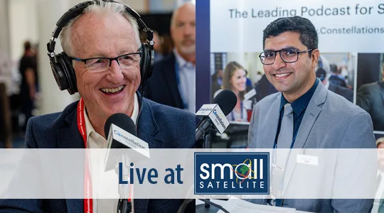
John Gilroy: Welcome to Constellations, the podcast from Kratos. My name is John Gilroy, and I will be your moderator. Today, we are recording this from the floor of the SmallSat conference in lovely downtown Logan, Utah. Our guest is Dr. Rachit Bhatia, Space Safety Analytics and Research Lead at a company called LeoLabs. Well, at Constellations here, we will be talking about space domain awareness and the changing face of space sustainability, but if I look at your LinkedIn background, I see a PhD, a school and we are here at Utah State University. So this must be your homecoming. Is that right?
Rachit Bhatia: Indeed, it is. It is lovely to be back home, and I spent five good years doing a PhD here. I just love this place.
John Gilroy: So were you one of those skinny starving graduate students looking for snacks at these shows? Just looking for food, talking around, and seeing what’s going on, huh?
Rachit Bhatia: Yes.
John Gilroy: Well, you’re like a homegrown expert. We love that. Well, we’re going to jump right in here. First of all, I know your company does surveillance of low Earth orbit with ground-based radar. So why radar? What’s so special about that?
Rachit Bhatia: Radars are best suited for low Earth orbit monitoring, because they have large field of view, and we can track these dynamic objects moving at very fast speeds relative to each other, and get all of these observations very quickly, because when these objects are passing over radar, we are just getting measurements and we are operating these radars 24/7. No interference because of weather, no problem, whether it is day or night, and these operate just in such remote places and autonomously. So the best example is we deployed our QV space radar just before the pandemic, and it was working throughout the pandemic. We got all these measurements coming in from that radar without any human operating the radar on the ground, so that is the beauty of the sensor. The objects in low Earth orbit are moving very fast. They’re moving at 12 kilometers per second, relative to each other. So optical sensors and other types of sensors, like passive RF, etc., they can be great follow up, but radars are very good for tracking and tracking these chains of objects that are being launched these days, because there are these mega launch vehicles available. That is why radars are best suited for low Earth orbit.
John Gilroy: Rachit, it’s almost like you work hand in glove. Your technology at your company fit perfectly, where they had to have something autonomous, and it was right there, wasn’t it? And I think that’s the goal for all these people spitting out artificial intelligence. The real goal is to have something autonomous, because there’s too much to handle manually.
Rachit Bhatia: That is correct. LeoLabs has built this radar technology over decades. This is a technology perfected by our founders when they were working for the parent company, SRI. So this technology is not something that has sprung up over the last few years. Even though LeoLabs has existed since 2016, the technology was perfected over decades. It was primarily being used to study auroras in the polar regions, and that is when they found that they can track satellites, which were noise then when they were trying to do their scientific research, but it was signal when you’re trying to do space situational awareness. That is how they started working on this project, and that is how LeoLabs was born.
John Gilroy: So it’s not just in the Arctic anymore. It’s all over the world. If I understand your company correctly, your building radars all over the world so they can map the objects in low Earth orbit and maintain a dynamic map of what orbits are. So how does this dynamic map work?
Rachit Bhatia: That is a great question. It is not easy to map the entire low Earth orbit, because one of the major criteria here is that when some object is in low Earth orbit, say 400 kilometers, the outer tier of the international space station, the orbital period is just 90 minutes. That means they’re completing a lap around the earth in 90 minutes. If you are not tracking them regularly enough, then the uncertainty on this track can grow, and the information will become not actionable or useful. Now with the growth in population in resident space objects, as we call it in technical terms, the growth in population in all these satellites and debris, specifically, that we are seeing in low Earth orbit, it becomes imperative to have regular tracking. That is exactly what LeoLabs is trying to do. We are trying to fill in gaps where there are no sensors right now around the world. The Southern Hemisphere was not very well covered, so we have put two radar sites, one in Western Australia and one in New Zealand, to track the objects passing over the Southern Hemisphere, and then put more radars out there so that we can get more frequent tracking on all of these objects.
John Gilroy: Yeah. I’m trying to coin a phrase here, but tracking the LEO is kind of like an onion. There’s a lot of layers, huh?
Rachit Bhatia: Yes, that’s true.
John Gilroy: Maybe you can explain that to your class when you start teaching here in a few years. Novices to this world may not understand what a conjunction is. They think that’s something to do with grammar, but in the satellite and space community, it means a collision, right? And so people just casually refer to conjunctions, I want to talk about that now. This risk of a satellite conjunction is evolving. Tell us about those changes and what this drive means?
Rachit Bhatia: So this is a very, very basic misunderstanding that people have. There’s a difference between conjunction and collision. A conjunction is when the two objects are approaching each other and can collide or can just whiz past each other. That can happen. So conjunction is when we are monitoring them, we are trying to make sure whether they will collide. What is the probability of collision? And then collision is when it actually happens, so up until now, according to NASA, there are only 235, approximately 235 collision events that have happened since the age of space began in 1957. So that is where we are. The conjunctions are happening right now, and many of those are low risk. Many of those are high risk. And the way we define that is when the probability of collision is past a given threshold, generally the criteria that we follow is one in a million chance of the objects colliding is when we start monitoring them as high-risk conjunctions, and there’s a risk reduction maneuver needed to make sure that everyone stays safe and the objects don’t collide. So having noted the difference between conjunction and collision now, the major part of risk that is coming for low Earth orbit objects is from the debris and derelict objects, because these objects just can’t maneuver. There are a lot of questions about the constellations being launched, but these have been very responsible objects in orbit up until now, as they have made sure that they act and that they have the required amount of onboard resources to maneuver and stay safe.
Rachit Bhatia: But there are a lot of objects which have been left over decades since the space era began, like rocket bodies, and the derelict objects that were created, non- operational payloads, and the debris that were generated from some of the anti-satellite discs, which are actually the problem and drive most of the risk to these neighborhoods, as we call them. So there are some altitude regimes which are very bad neighborhoods. They’re not so good, not so safe for your satellite, and hence, one should think about the risk that will be posed to their satellite when they’re trying to put that satellite up there.
John Gilroy: So Rachit, do you think this is due to an increase in the number of satellites in orbit, is our behavior changing too? What’s really the cause of all this?
Rachit Bhatia: Yes, the behavior is changing over time. There is a lot of focus on having a very robust approach for space situational awareness. There’s a lot of awareness among the customers and a lot more that can be done. The primary change in behavior that we see is most of the large constellation companies are trying to make these operations autonomous, and they are trying to put relevant checks and bounds so that they can keep maneuvering and making sure that their satellite stays safe and they have very good thresholds to monitor them and the teams that interact with commercial SSA companies, like LeoLabs, throughout the time of events, such that these can be mitigated effectively. There’s a lot of focus coming in from government as well, where there are new agencies and new roles assigned. The DOC, Department of Commerce, spearheading some projects, which will be influential in creating a new SSA environment for the country which will be very effective. In that sense, yes, the behavior is changing, but the geopolitical impact is definitely there, and there are more things that can be done. One of the things that we have noted, as we generate a lot of data, the insights that we get are that there is a huge debt from the Cold War era that is impacting the operations right now. When we do top 50 most risky objects in low Earth orbit right now, 78% of them are from the Cold War era, because these are rocket bodies that were left at that time, thinking that they would not be imposing any harm, but they are up there, and they are tumbling rocket bodies we cannot maneuver. If you are in the neighborhood, you have to save yourself, so that is where the risk is.
John Gilroy: Rachit, your company is using data from radar for space traffic management, safety of flights, and to monitor what is happening in terms of irresponsible actions or, let’s say, potential threats. So is there any kind of new technology helping you to assess conjunctions earlier than you already are?
Rachit Bhatia: Yes. My primary role at LeoLabs is to do mathematical modeling of the events that we are seeing, do conjunction assessment modeling, and assess the statistical risk that we are seeing as it evolves over time, and how to mitigate it in terms of the change in environment that is needed. What kind of objects can be removed once the ADR, Active Debris Removal, technology becomes available. So what we are seeing is we are using our real intelligence and artificial intelligence to help solve this problem. Yes, artificial intelligence is very useful, and we deploy it at relevant projects, and we have used it for object characterization and improving some of our already existing algorithms, and we do data fusion with all our radars, different radar sites. We are bringing in all the data, and we are fusing the data to create near real time insights and alerts for our customers, so those are the technologies that we are already using. Then, we are also using real intelligence, in terms of the decades of knowledge that our experts bring to the table, and they provide context and they provide how to interpret the data so that we can understand the pattern that we are observing, and use it to frame a story and use it to have a robust policy and mitigative guidelines.
John Gilroy: The Constellations Podcast was launched back in 2017. It was a small step for man, but a giant leap for podcasting. Today, thousands of people from all over the world listen to Constellations, and thanks to you, we’ve grown into more than just a podcast. Sign up for the Constellations newsletter to receive articles on current industry issues, podcast summaries, and contributed blog posts at constellationspodcast.com. So Rachit, how does your company manage and process these huge volumes of data that you guys collect every day? I mean, how do you do it?
Rachit Bhatia: We have been monitoring all of this data, and we are generating measurements and tracking all of these conjunctions over time. What we have seen is the top 15 debris clouds in low Earth orbit right now contribute to 15% of fragments that are still up there in the orbit. And this is after decades of them being there and having decayed over time, so that is the kind of insight that you can get. 45% of conjunctions being generated are because of these debris clouds, which could have been avoided in the first place. All of these insights are powered by the data that we are generating, and your question is how are we managing this data? The best thing that our team has done is to architect the overall system in a manner where they anticipated that such a requirement will come where the scalability will be needed. That is where we differentiate from legacy systems. As we are a commercial company, we anticipated that scalability, transparency, traceability of our solution is needed, and we built our system, designed our system around it. We do use Amazon Web Services and other, again, new technologies to manage and store our data, but we are also using our architecture to improve the screening processes. One of the best things that I’ve seen while I’ve been at LeoLabs is, when we actually get an update on an object, a position, velocity, state vector update on an object, we screen it against all other objects in the catalog to determine whether a conjunction will be happening or not, and guess what? We do it within two minutes, even sometimes in a minute, which is very different from a legacy system, which can take hours, which used to take hours to screen, just to know whether there will be a conjunction or not, so that is the kind of scale that we are operating at and making sure that we keep our customers informed.
John Gilroy: In pro football, they call it the two-minute drill, huh? I’ve been taking notes here. I’m familiar with the public cloud, the private cloud, the hybrid cloud, and I get a new one here, the debris cloud. I guess this is a breakthrough in this interview, huh? Different applications here, but it’s fun with clouds. So there are people at Utah State University, and they may have heard of LeoLabs, and I think some of them refer to your company as the Google Maps for space, but a real time map, and you just use that word, a “real time” map is always changing in low Earth orbit, as it is a very dynamic, open environment. So I don’t think Google updates their maps very quickly, especially the overhead views. When something new appears in space, how do you determine what it is and how it should be cataloged?
Rachit Bhatia: This is directly related to our radar network, a global radar network. So this is a great question in terms of how are we monitoring continuously, and that is why we are not content yet with all of our six radar sites. We want to put more radar sites out there, because we know it’ll be needed to make sure that we update our maps more frequently, so that we get a much more actionable insight on all the objects and it can be maintained that way for a longer period of time. There are a lot of factors there. There’s atmospheric drag, which decays the object. So again, there are these perturbations that act when someone is operating in the low Earth orbit environment, and this can be challenging because all of these perturbations actually perturb the orbit just a little bit that the uncertainty grows, and this uncertainty can become pretty big over time if your measurement was taken a while back. The best way to keep the map dynamic is to have more sensors and get frequent measurements.
John Gilroy: I want to expand on that measurement concept a little bit. One month ago I did an interview with a gentleman who talked about geo referencing, and I’m wondering, do you cross-reference your data measurements with other measurement types as well?
Rachit Bhatia: Yes. All of our radars, the way the architecture has been built, all of our radars operate independently, and they are putting the data into the main system. And so we should rethink of all of our radars as individual sensors. So one cross- reference is happening within the system, where we are getting data from all of our radars. The other kind of cross-referencing is happening from operator side, where we are ingesting their ephemeris, because no one knows where the satellite is better than the operator, so they have GPS on board, many of our customers. They share their ephemeris, and we use them to help them get better results and screen it better so that they can get actionable insights on conjunctions. So we have radars, which are helping us cross-reference. We have operators, which are sending their ephemeris, and these are regularly being compared to the updates that we are generating from our radars. So there is cross-referencing there, and then the third layer is, of course, the public catalog, which is very important and the huge amount of work that is being done by 18 Space Defense Quadrant and now 19 Space Defense Quadrant, who are maintaining this public catalog for so long and so effectively, that we use them, that data, to make sure that we are tracking all the objects and all the conjunctions correctly.
John Gilroy: Rachit, I bet when you were studying here, all the physics majors had a real need for speed. In fact, look around this room. We see military types. They have a need for speed, and I think we can all conclude that satellites in LEO travel incredibly fast. Well, that’s good, but if you were to anticipate a conjunction, how much time would you have to contact the satellite operator and theoretically move a satellite in a different path? I mean, it’s all kinds of questions here. There are layers upon layers. What about fuel? Will this information build up over the course of passes? Do you think, in general, you have enough information ahead of time to alter the situation? Action. Take action, Rachit?
Rachit Bhatia: Yes, so this is something that I actually presented yesterday and was one of the main focuses of my study. As I dwell upon the different requirements for different satellites, there are satellites which have very good onboard resources. Big satellites, they have thrusters; they can maneuver very quickly, and they will still have some lag time, but there are such satellites. Then, there are small satellites. Since we are at small satellite conference, the focus was on small satellites and how they have limited onboard resources, and they need much earlier advanced notice so that they can mitigate the risk effectively. So having taken all of it, and then there’s also the approach, which different operators take because these mitigative strategies vary from operator to operator. As they take into consideration their mission requirements, they take into consideration their onboard resources and, based on that, they decide whether they want to go for just-in-time collision, like some of the operators do, which monitor these high risk conjunction events up to 12 hours before the time of closest approach, and then they maneuver so that they’re both safe and save on fuel, because their idea is that they have the sufficient capability and they’re waiting for the most recent best specification on the other object, lowest uncertainty to act upon. So it is like going all the way close to the wall and making sure, “Okay. There’s the wall. Now I can deflect just enough so that I can miss it.” It’s a great strategy, and they do it every time, and that has worked phenomenally, but then there are other objects which do not have that much capability. So they act up to 24 to 36 hours before, and all of these maneuvers, risk reduction maneuvers, as we call them, they take quite a long time, because all of these Delta-vs are on the order of a few centimeters per second and only sometimes meters per second because of the type of thrusters they have.
John Gilroy: Most conversations at lunch, I’m sure, if they talk about diplomacy, global diplomacy, they’re pretty negative; however, we seem to be developing a more global diplomacy here regarding sustainability in space, so how do commercial SDA providers enable transparency among each other? Is there some common database or catalog they can reference?
Rachit Bhatia: Yes. One of the things that LeoLabs does is we are collaborating. We are ready to collaborate, and we partner with a lot of these operators who are operating in space. We work with national agencies and make sure that we are providing our insights to them about relevant events and sharing our data at regular intervals of time. The other thing that we do is make sure that the policymakers and regulators are informed by building dedicated tools for them, because that is very important. When we do that, we are providing insights to them, and because we are sharing our data and we are regularly publishing at conferences like these, we are getting validated and peer reviewed by other agencies, which is great because that is how the system should work. Regarding the governance and the defense, one of the things that we have seen is, with the rise of commercial space, there’s a faint boundary between military space and the commercial space, and that is exactly what makes it much riskier. Having a comprehensive space behavior awareness helps in making sure that everyone is aware of where they are, and everyone is under surveillance so that the behavior can be noted, there are no surprises, and make sure that the military and commercial stays.
John Gilroy: I live in the Washington DC area. Everyone pontificates about this policy and that policy, and it’s wonderful. I mean, it makes for great lunch conversation, but the how has to come in somehow. How can commercial and government stakeholders work together to minimize risk of this collision space? This is the how part, Rachit. That’s the hard part, isn’t it?
Rachit Bhatia: Yes, it is. The commercial and government can work amazingly well, because there’s a need for commercial to bring in the innovation. Just like LeoLabs is building these radars really quickly, and providing this data at a competitive cost and at the requirements that meet the operators, the government is focused on making sure that this data is available to everyone and making sure that everyone stays safe. So there is a national system required, which is augmented by the commercial system, and that is what our approach has been. We want to work with the national system to make sure, and the global system, because global tracking that we are providing with our global radar network will help in monitoring the objects in low Earth orbit, which is very important and cannot be done by a single or few sites located at a very limited geographical region.
John Gilroy: I’ve talked to many DevSecOps people and network administrators. They all love the word transparency. It’s probably important you know? So let’s talk about transparency in your situation. So how can transparency in space enable the responsible deployment of dual use capabilities on orbit?
Rachit Bhatia: This, again, comes back to making sure that the military, the defense, and commercial systems stay segmented, and that is the best way to maintain safety for everyone, and also making sure that the commercial viability of the environment is maintained and the effective use can still happen. To do that, transparency is very important, because many of the objects in low Earth orbit, which can maneuver, if they’re sharing that they are going to maneuver, and they’re sharing their ephemeris, the position and velocity, well in advance, and making sure that everyone knows where they are, and using a good SSA system or service. Then, they will be able to make sure that everyone knows and stays safe. The traceability of the solution comes into play from Leo Lab’s side by sharing our metrics about which radar is performing, and most of our radars are 24/7, but all of the statistics are available to our customers 24/7 as well. The biases, the noise value on these measurements are available so that the operator who is ingesting our state vector can know whether this is an outlier measurement or this is a regular, accurate measurement and depend their actions based on that.
John Gilroy: We’re running out of time here. I’m going to ask a quick question here too. The obvious thing is that there are companies in countries in the world that have their own systems, huh? And now we have LeoLabs, and so commercial tracking capabilities expand. How do you see the usage of those capabilities versus these indigenous national systems?
Rachit Bhatia: We believe that LeoLab’s system will augment the national system. The national system will be focused on the national requirements, and LeoLabs will bring the global perspective into it by sharing the data from the global radar network. The low Earth orbit objects cannot be completely tracked by a few sites, a few sensors, in a limited geographical location, so a global cooperation is needed and a global sensor network is needed, and that is exactly what LeoLabs is trying to achieve.
John Gilroy: Earlier in the interview, I mentioned the two-minute drill, Aaron Rogers and all that. I’m giving you the two-minute drill here. In two minutes here, real quick question here; as commercial satellites are openly threatened by other countries, how do you see the SDA environment having to change?
Rachit Bhatia: The Space Domain Awareness environment is changing by accepting the traceability and transparency in the system, especially from the commercial actors. The commercial actors are embracing this. They’re putting out their ephemeris regularly. They’re putting out the events that they’re facing, and they are making sure that the commercial SSA services are validating their claims, and doing that, they’re making sure that there’s a differentiation between the defense and commercial operators, and everyone knows who is operating in a particular environment and there are no surprises. So that is how the environment is changing, and they’re also preparing for the future events by taking responsible action and making sure their behavior is responsible and safe for everyone in the neighborhood.
John Gilroy: That’s great.
Rachit Bhatia: One of the other things that we have noted is that considerable cooperation and continuous communication is needed between satellite operators and SSA service providers, like LeoLabs. We have published a report today where we actually did this experiment and helped university students find the satellite they had launched recently. Many of the operators are unaware of how difficult it is to catalog an object immediately after launch, and how quickly the data becomes obsolete. That is where LeoLabs comes in, and we are able to track these satellites and provide up-to-date information to the operators so that they can get early signal acquisition, and they can mitigate the conjunction risk immediately as they get on orbit instead of waiting for them to get cataloged and prolonging their conjunction risk.
John Gilroy: Rachit, I have to say, you have helped our listeners understand the complex world of space safety. I’d like to thank our guest, Rachit Bhatia, Space Safety Analytics and Research Lead at LeoLabs. Thank you.
Rachit Bhatia: Thank you. It has been a pleasure.